
Arizona Trail - Cienega Corridor Segment
The Cienega Corridor is one of the last unfinished segments of the cross-state Arizona Trail. Volunteers from the greater Tucson area are coming together as part of a remarkable effort to complete the trail.
For more information on the project and to sign on for future work dates, see aztrail-build.org
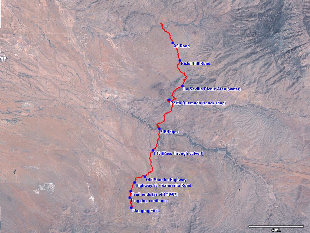
TopoFusion software was used to map, plan and flag the trail. The most current GPS data can be found on this page. At present the GPS file starts 3 miles south of Sahuarita Road and ends at the Saguaro National Park boundary, a total distance of 21.6 miles.
GPS data for the Cienega Corridor
Click Here for the data in .GPX format. [last updated 01/18/2007]
NOTE: You may need to right click and select Save As... also, your browser may (for some strange reason) add the .xml extension to the files. The correct extension for the files is .gpx
Thanks to Jerry Quesnel, Tim McCabe and Lee Blackwell for help with data collection.
How to access the trail
(thanks to Mark Flint)Note to equestrians: Currently the trail south of Colossal Cave Mountain Park to Interstate 10 is not accessible to horses. Gates need to be installed, a horse route under I-10 adopted, gated and signed, and a safety issue north of Three Bridges needs to be resolved. Check here for updates.
Sahuarita Road
The trail can easily be accessed at four points. From the south, the trail crosses the Sonoita Highway (Hwy 83) at Sahuarita Road. The northbound trail is directly east of the highway at Sahuarita Road and southbound trail is approximately 100 feet west of the cattle guard on Sahuarita Road.
Three Bridges
The next access point is at Three Bridges. Northbound trail is on the north side of the road bridge, just west of the trestle and within a few feet of the north edge of the Cienega Creek embankment.
The southbound trail follows an old right of way road that ends near the south end of the road bridge. Follow the right of way south until you come to the trail on your left before you get to the top of the hill (almost directly across from the Cienega Creek Trail parking lot).
Colossal Cave Mountain Park
A link trail near the Cowboy Parking Lot is the southernmost access point inside the park. The parking lot is at the beginning of the one-way loop road at La Posta Quemada Ranch (near the group picnic area). The trail begins at an aluminum gate just west of the parking lot.
The trail also can be accessed at the La Selvilla picnic area at the north end of the park. It can be found west of the restrooms and parking area
Pistol Hill Road
The trail crosses Pistol Hill Road approximately 1.5 miles northeast of Old Spanish Trail. From Old Spanish Trail drive downhill on Pistol Hill, a well-maintained dirt road, to a cattle guard. There is room for parking above and below the cattle guard. The northbound trail begins at a gate in the fence north of the cattle guard. It goes to Rincon Creek, approximately 3.5 miles.
The southbound trail is approximately 200 feet west (uphill) of the cattle guard, heading southwest about 50 feet in from Pistol Hill Road. Both of these trails have carsonite signposts, but the southbound signpost is not visible from the road.
Below is a progression map of the first season of work events in the Rincon Valley:
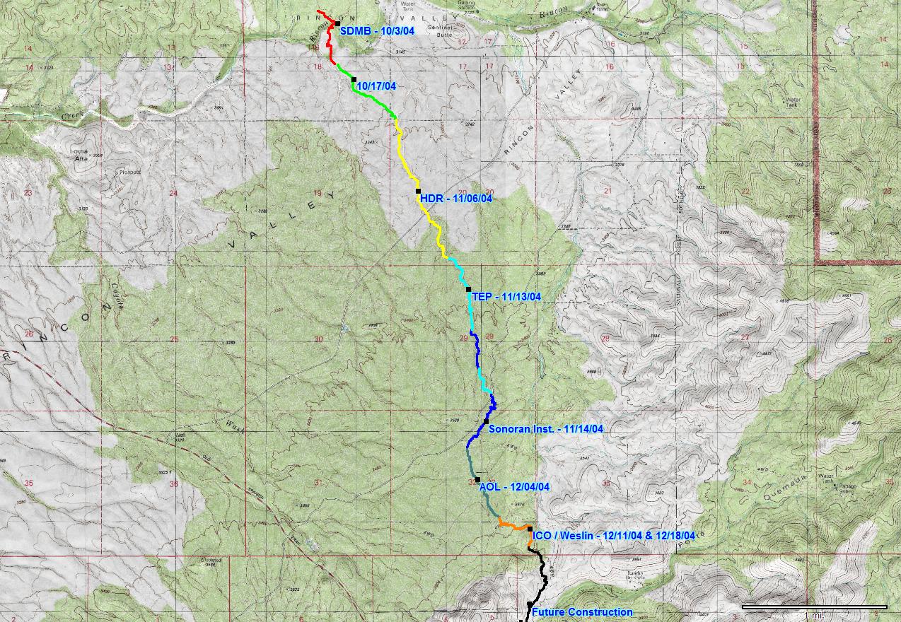 CLICK on map for larger version