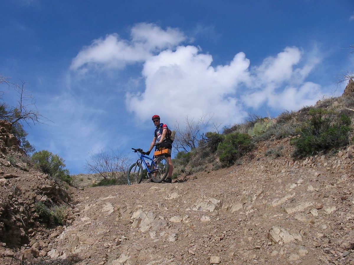
The ride began on familiar ground. At 9:30 Lee Blackwell and I pedaled away from the pickup to begin climbing Copper Creek Rd. The Soul Ride features this big climb, but today it was only the beginning. After climbing through ridges covered in yellow flowers and green grasses, we dropped to Copper Creek itself then turned left to begin the “rug road.”
The rug road gets its name from the multi-colored patches of carpets that were installed by 4×4 drivers to make some of the hills passable. It provides a route between Mammoth and the tiny town of Klondyke, the gateway to Arivaipa Canyon. In talking to locals and even 4×4 enthusiasts, it is clear that the road is somewhat of a legend. Some people will tell you that they’ve heard of a route, but don’t know if it exists, and others will outright deny that it’s even possible to get from one side of the Galiuro Mountains to the other. Indeed, though Mammoth and Klondyke are only 20 miles apart as the crow flies, it’s over 150 miles by highways and county road. The USGS topo maps show no route going through. Maybe there is no route?
Lee and I had heard the legends, and the prospect of reaching the lush Aravaipa Canyon on bike was intriguing. Any road that is difficult enough for carpets must be hard. We had to see for ourselves, so we loaded up our bikes with minimal camping gear — to either spend a night on the trail or near Klondyke, and headed out.
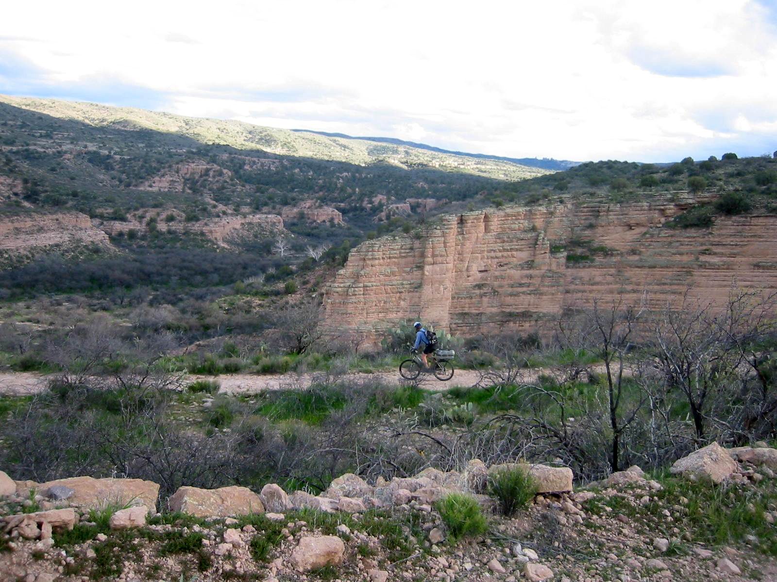
Straight off Copper Creek the road turned nasty. A small boulder pile led to hike-a-bike. It wasn’t looking good, but we rode on. After climbing our guts out we gained a view of Boulder Mountain. We could see our road climbing steeply to a saddle on its east side. If it wasn’t rocky, it almost looked rideable. Of course, it was rocky, so I rode only bits and pieces of it. The rest we walked.
It’s not that steep
At the top of Boulder Saddle we started a frightening descent known as “carpet hill.” It drops 700 feet in 0.75 miles. We had found the rugs of the rug road, but they weren’t helping me in the traction department. Lee rode away from me, showing almost uncharacteristic confidence and downhill skill. I have ridden many a steep and rocky trail in my days, then I rode this one. Peppersauce, Sutherland / Cargodera Canyon, Tia Juana Ridge? These beasts are paved compared to the rug road!

Rug remnants on Carpet Hill
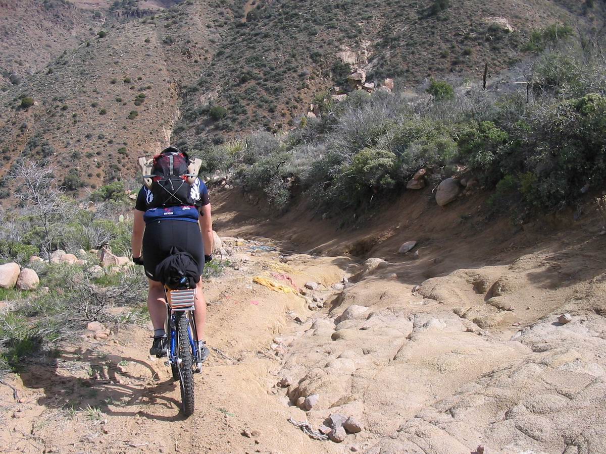
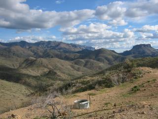
After reeling from the descent we crossed a running creek then were immediately walking up a boulder strewn pitch. Brief lulls in the rockiness led to brave attempts at pedaling, with varying success. Rocks flew, my rear tire slipped, and calories were burning by the minute. It was brilliant. We made slow progress on the 1250 foot climb to Table Mountain saddle — the Galiuro divide. We were entering cliff country and I couldn’t wait to see the other side. We took our last views of the San Pedro valley. They were breath-taking from this height, but I watched lighting crack east of the Rincon Mountains, and another small storm was zooming around near Dudleyville. At the saddle we ran into high winds and a few rain drops. The cliffs of the two table mountains on either side of the pass serve as a funnel for low storms.
Hike-a-bike towards Table Mountain saddle
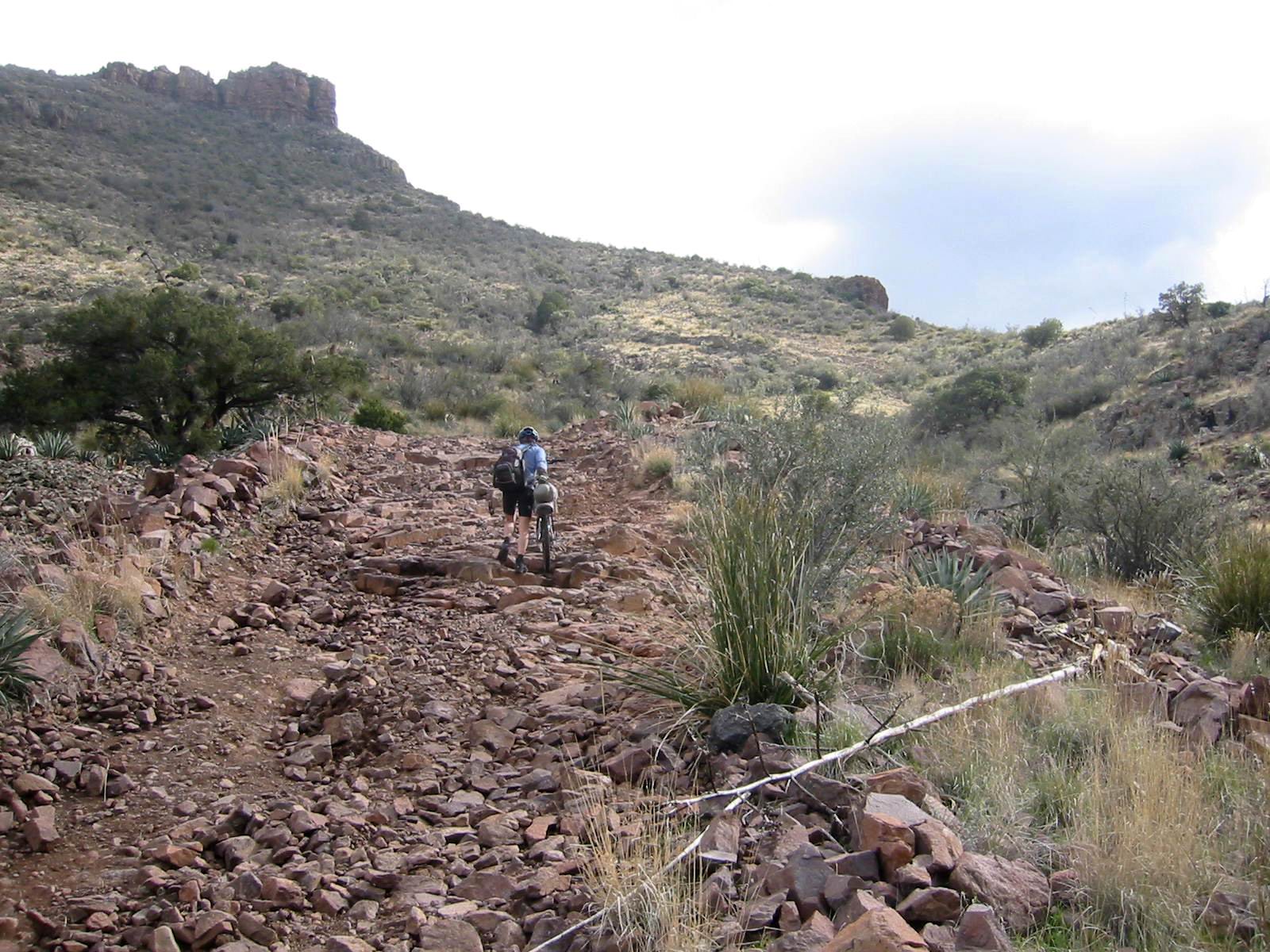
The other side of the Galiuro Mountains was impressive. There were trees, grasses and even water flowing down the road. It’s easy to see how Aravaipa is one of Arizona’s last perennial flowing creeks.
Downhill challenge continued as we dropped on more switchbacking, ridiculously rocky road. Lee once again outclassed me, riding a few sections that I balked at. We splashed through streams, cruised past tempting camp spots in trees, then emerged onto yet another climb. This was the beginning of the rollers.
I could only find tiny 40 foot sections of roller 1 to ride. Roller 2 was no better. Just when we thought the rug road couldn’t get any steeper, rockier or nasty, it did. We walked all of roller 2, a hefty 500 foot climb. Fortunately the corresponding downhills were just barely inside the window of rideability. Actually, they were incredibly challenging and fun, but very tiring. Line selection is key, and the battle to hold your line is constant. At the bottom of roller 2 was Parson’s Grove, a beautiful spot to sit back and chill.
One of the easier sections of the rug road
As I clipped in to give roller 3 a shot I joked to Lee, “here we go, roller 3, no dabs.” “Whatever you say Scott!”
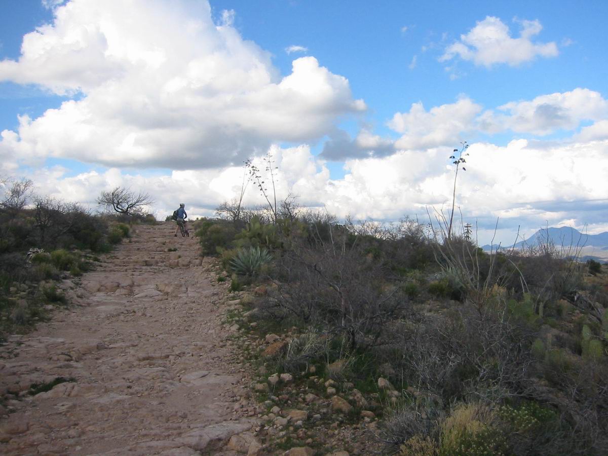
Twenty minutes later I crested roller 3, still clipped in with heart pounding. I also eeked out a clean ascent of roller 4. Things were looking good. Also looking good was the scenery: sheer cliffs, white rock, deep canyons much like Moab or southern Utah. With the scenery also came the incredible riding, Moab style. After roller 4 the rug road follows a narrow ridge that features some of the best mountain biking I’ve ever laid tires on: extended slick rock, ledges, steep ramps and switchbacks. The combination of fantastic scenery and incredible riding was almost too much to believe. But we had paid a high price for it. It had taken over 6 hours of very difficult, tortuous riding to get here.
Moab style riding towards Turkey Creek
Moab style riding towards Turkey Creek
The 1600′ descent ended with a delightfully technical drop into Turkey Creek. Turkey Creek is a side drainage to Aravaipa, but is much the same: dense trees, cliffs on either side and a nice running creek. We coasted down the road, amazed at this place we had worked so hard to reach, heads spinning around, trying to take it all in. Halfway down the canyon there was a sign indicating there was a cliff dwelling. A small trail led to the structure, perfectly placed on a ledge above the canyon. We sat down outside it and contemplating camping in the canyon. It was so peaceful and quiet & we had enough food to make it back the next day (though we both had our doubts about actually making it back). In the end our curiosity got the best of us, and the possibility of a good meal in Klondyke sealed the deal.
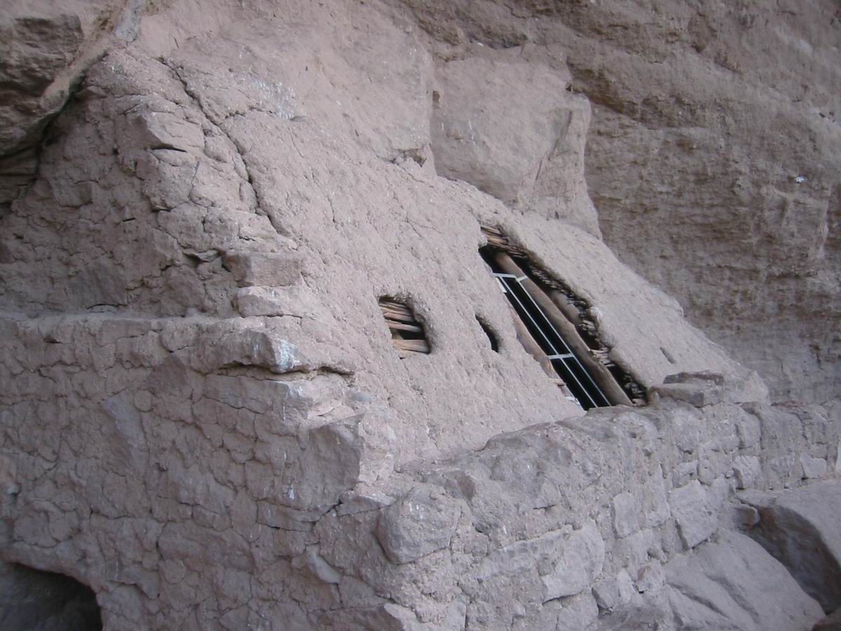
Turkey Creek cliff dwelling
We crossed Turkey Creek a few times, dousing our feet, before finally switching to sandal mode for the two foot deep crossings of Aravaipa Creek. Amazingly, the canyon itself was empty. We still had not seen anyone since early morning in Mammoth. It was getting dark, and riding in sandals and the deep crossings were slow going, but we were more than happy to be where we were, enjoying the surroundings and the perfect evening.
Cliffs in Aravaipa Canyon
Eventually we reached a locked gate — the reason the canyon was completely empty. One of the land owners has decided to lock the road through “her” property even though the county/blm have spent millions maintaining it. It’s the only way to access the east end of the Aravaipa Wilderness. The story (from the locals) is that she is trying to extract a dollar or two from the government, and people are (understandably) angry about it.
We quietly handed our bikes over the gate and were soon rolling back to rolling towards Klondyke. It was not posted at all on the other side, so we were just leaving “her” land.
It was after sunset when we rolled into Klondyke. We approached a few friendly ATV riders, who were amazed that we had ridden the rug road. It seems everyone in town had heard we were coming and was looking for us. We knocked on the door of the store owners. A nice old gentleman opened the door and said, “Bonnie, you better come here, ’cause you’re never going to believe this.” They have never heard of anyone cycling the rug road. Actually, they said no one has ever even cycled to Klondyke on the graded county road.
They were ever so kind to us, opening up their store/restaurant (they close at 5pm) to cook us burgers and fries. The food disappeared quickly into our calorie deprived bodies. We enjoyed interesting conversation with Bonnie and Lee (two Lee’s, now) as we warmed our toes by the stove and dried our wet shoes. They are looking to sell the store but have no desire of leaving the pleasant lifestyle of Klondyke. They offered to let us camp in their yard.
It was a cold and dewy night in Klondyke. As I lay in my sleeping bag, listening to Robert Fripp and Dream Theater while star gazing, my thoughts turned to tomorrow’s task: getting back. My back was sore, shoulders hammered. We had hoped to explore another, possibly easier, route on the way back — a straight shot from Klondyke back to Mammoth through Four Mile Canyon. The prospect was dubious to begin with, but we’ve worked with less & succeeded in the past. But Bonnie and Lee told us that the rancher would not let us through and that the possibility of hike-a-biking around was very low. So we were stuck with reversing the rug road. While I was very excited to climb the slick rock and ledges near Turkey Creek, it was with dread that I looked to the rest of the route — both the dangerous and brutal descents and the long potential hike-a-bikes. The only other option was 150+ miles of dirt and pavement, through either Globe or Wilcox–neither very tempting options.
I woke up with ice on my bag, but the sun quickly energized us, and we were off back up to Aravaipa canyon. A few guys at the private property owner’s house had the gate opened when we approached. We told them we were just passing through to Mammoth, and they let us go without incident.
We once again had the beautiful canyon to ourselves. We switched to sandals, crossed the clear water dozens of times, and thoroughly enjoyed a quiet morning bike ride. I was almost sorry to leave the canyon, but taking deep breaths of life while standing and pedaling slickrock soon convinced me that this was where I belong. The climb was even better than expected.
“Mountain biking just doesn’t get any better than this.”
We transitioned from smooth rock and near infinite traction to loose rock, ruts and impossible traction. The rollers were once again on our horizon. There was some walking involved, but I largely rode everything until the big climb to Table Mountain saddle. It almost seemed too easy (and it definitely is easier in the Klondyke->Mammoth direction). We walked, filtered some water, then reached the saddle, seemingly too soon. Now the real fun began. Dropping to the bottom of carpet hill is one of the most difficult descents I’ve ever attempted. There was a visceral element of fear involved. When I’d get stopped after over-extending my comfort level, I’d look down at the valley we were dropping into, and it didn’t seem possible (or safe) to get there. The side slope was so steep that it just didn’t look possible. Lee maintained his confidence, though he still walked down quite a few sections, dabbed, and re-maneuvered his rig. At the bottom I was dazed, but Lee was already walking up carpet hill. I made a weak attempt at riding that lasted all of thirty seconds.
Descending with(out) fear
They don’t call Lee the king of AZ hike-a-bike for nothing. I could hardly keep up with his blistering pace. I hopped on for a couple more weak attempts, and all were failures until near the very top, where the road finally mellows out — in grade, not in a technical sense. We were now at the top of Boulder Mountain, and the ride was basically over. There was still two hours of difficult descending, and a 500 foot climb out of Copper Creek, but it was easy compared to what we had just been through.
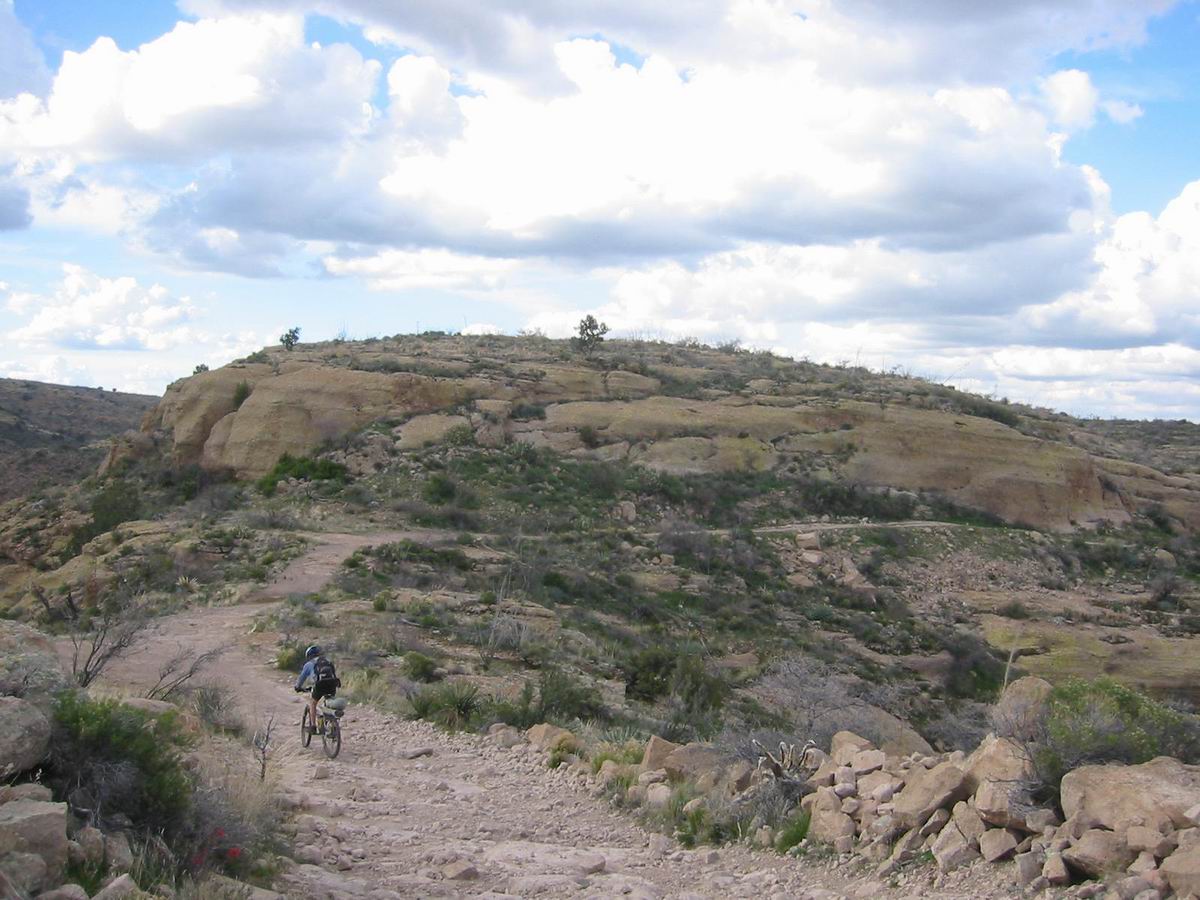
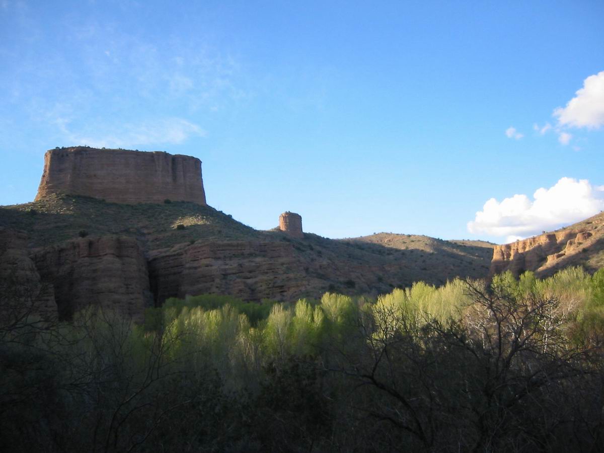
The Galiuro Mountains from near Boulder Mtn
During the descent we saw more deer and a fleet footed wild horse. The downhill on Copper Creek Rd. seemed to never end, as these descents often do. The pickup was a friendly sight. We both agreed we could continue riding, but we were ready for Mexican food in Mammoth and a solid night of sleep.
Map / Photos here.
Stats:
75 miles
13,500 feet of climbing
13 hours moving time
Total time – 9 hours out, 8 hours back

An informative account of this little-known and apparently pretty gnarly 2-track! I’m looking forward to checking out the Rug Road on foot this fall, as an alternate route to the Grand Enchantment Trail through Aravaipa Canyon. Thanks for taking the effort to publish your insight!
SCOTT, THIS IS AMAZING & SO IS THE REST OF YOUR WORK.IVE NEVER MET YOU
BUT & HAVE HEARD MUCH ABOUT YOU & LEE.B. FROM OUR FRIEND BRIAN BARR.
CAN I OBTAIN YOUR GPS-TOPO MAP?
FROM YOUR TOPO FUSION?
Great information! Just completed this road by rental SUV on visit to AZ. I thought I would never make it out with my family. I am surprised you completed it on bike. This was the roughest country I have ever been on. My rental was torn to hell by the time I made it out. Spectacular scenery all the way to Aravaipa Canyon.
Hey guy, a neighbor forwarded the article to me this AM. Haven’t been in touch, have we? It’s a good article, sure depected the situation.
Brett Tucker came through hiking this March & then another gentlemen came through a couple of weeks after him. They were Hiking Brett’s Enchancment Trail.
Take care, Bonnie & Lee
Really enjoyed your story, been over that last year, had a ball.
I’m amazed that you guys rode this on mountain bikes! Very impressive! We ride this route on our offroad motorcycles about twice a year. It’s definitely an epic ride. We too used to stop and have burgers at Bonnie’s store in Klondike and then we would gas up and head home. Last time we were at the Klondike store it was closed and we didn’t know if we had enough gas to get home. Lee came out from his home and fixed us with some gas and we were on our way. My dirtbike only has a two gallon tank, so I can’t take the risk and we now just turn around once we’re out of Aravaipa Canyon.
Great right up!! So at this time, is the road open to motorcycles? Any recent issues with Norma and her locked gate? I’ve been wanting to do this for a while now. Store open?
Doh… I mean write up. 🙂
Thanks for posting the map and all of the info. We are planning an attmept this weekend and since I don’t have a gps (and do have tons of old topos of the area) your map is a great help. Thanks again.
Your story about how the road got it’s name is fairly close but it was not your weekend warrior’s out traversing. It was the Tapia-Salazar family’s that lived in Aravaipa canyon east end and they were working at the mammoth mine that put down the carpet to make it easier to climb or like you said to 4×4 like you said so it was close.
Thank you for the comment, Joseph. Much respect to the Tapia-Salazar family for what is a very robust commute! We love that area and have returned a few times on bikes since this original trip. Nice to hear a bit of history on it.
I’m glad to be one of only a few to traverse this route from Klondike to Mammoth on a bicycle. A packed bicycle. I hadn’t read this article before now but I’m glad that others had fun with all the hike a bike and difficult terrain. Thanks for the great story Scott.