Completing the Grand Loop last month left Chad and I feeling a little empty. We knew there were better loops out there, waiting to be dreamed up, explored and possibly raced. One such route presented itself to us as we drove back from the Grand Loop, through Northern Arizona. The idea – Flagstaff, Sedona, Prescott, Williams, in one fell swoop.
Not even a month later, we saddled up to try it. I called Lee, knowing it was an outside chance, but he signed on instantly. You know you have good friends when an impromptu 4-day bikepacking trip quickly becomes a reality.
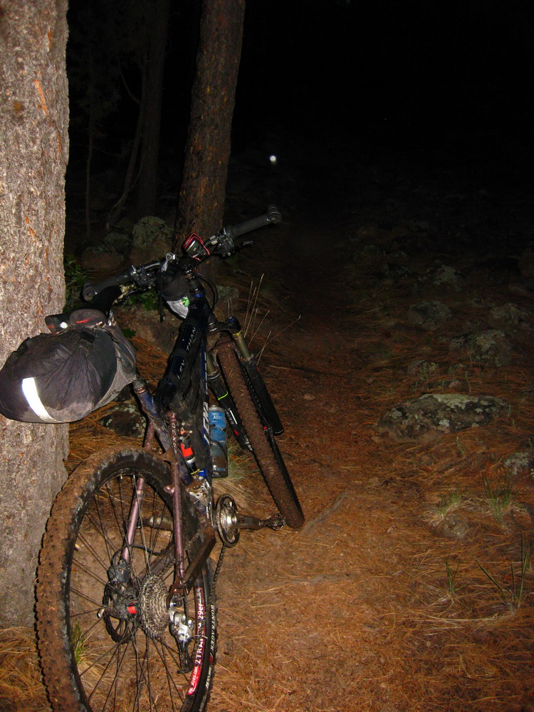
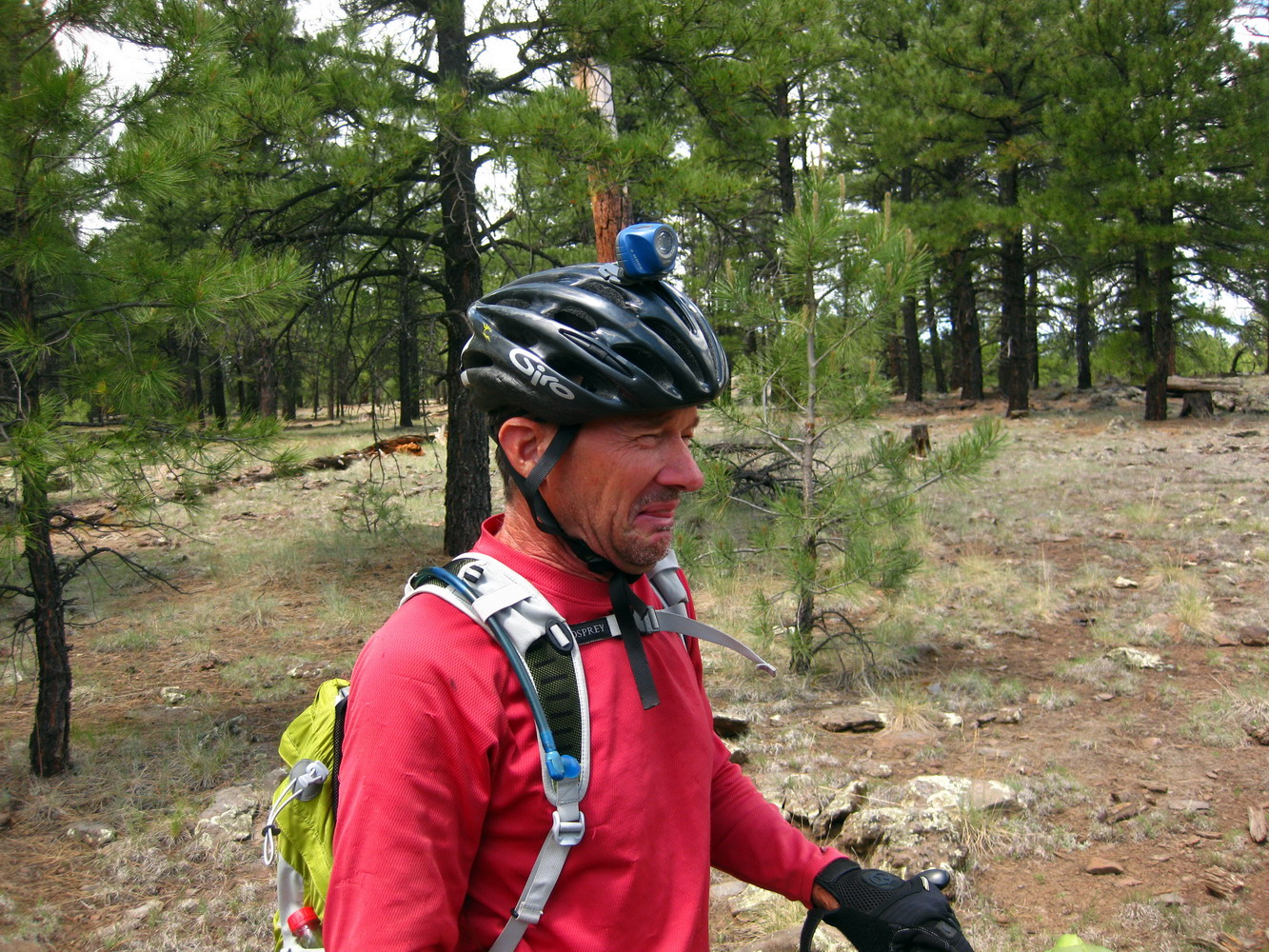
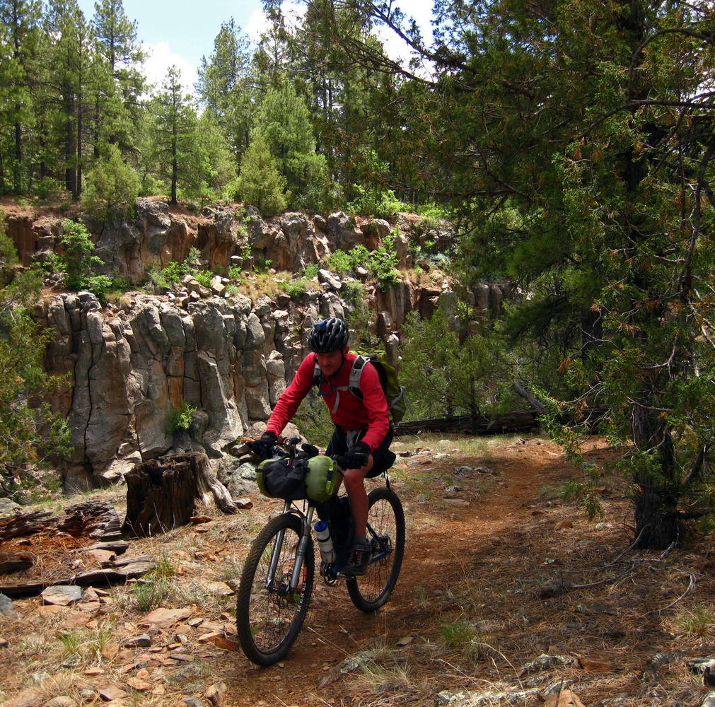
And what better way to start a bikepack than by rolling out from home? Courtesy the new digs in downtown Flag, we staged from here. After some last minute track cutting/merging/simplifying in TopoFusion, we were ready to roll.
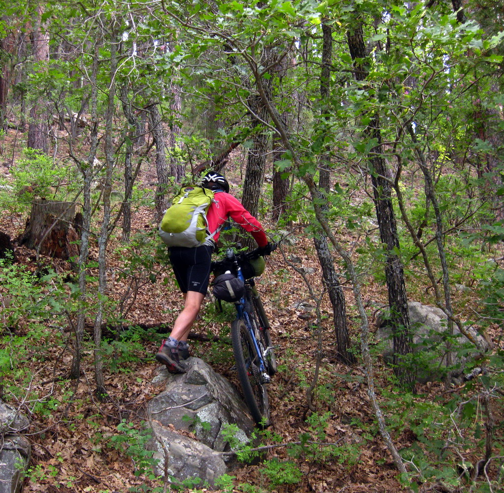
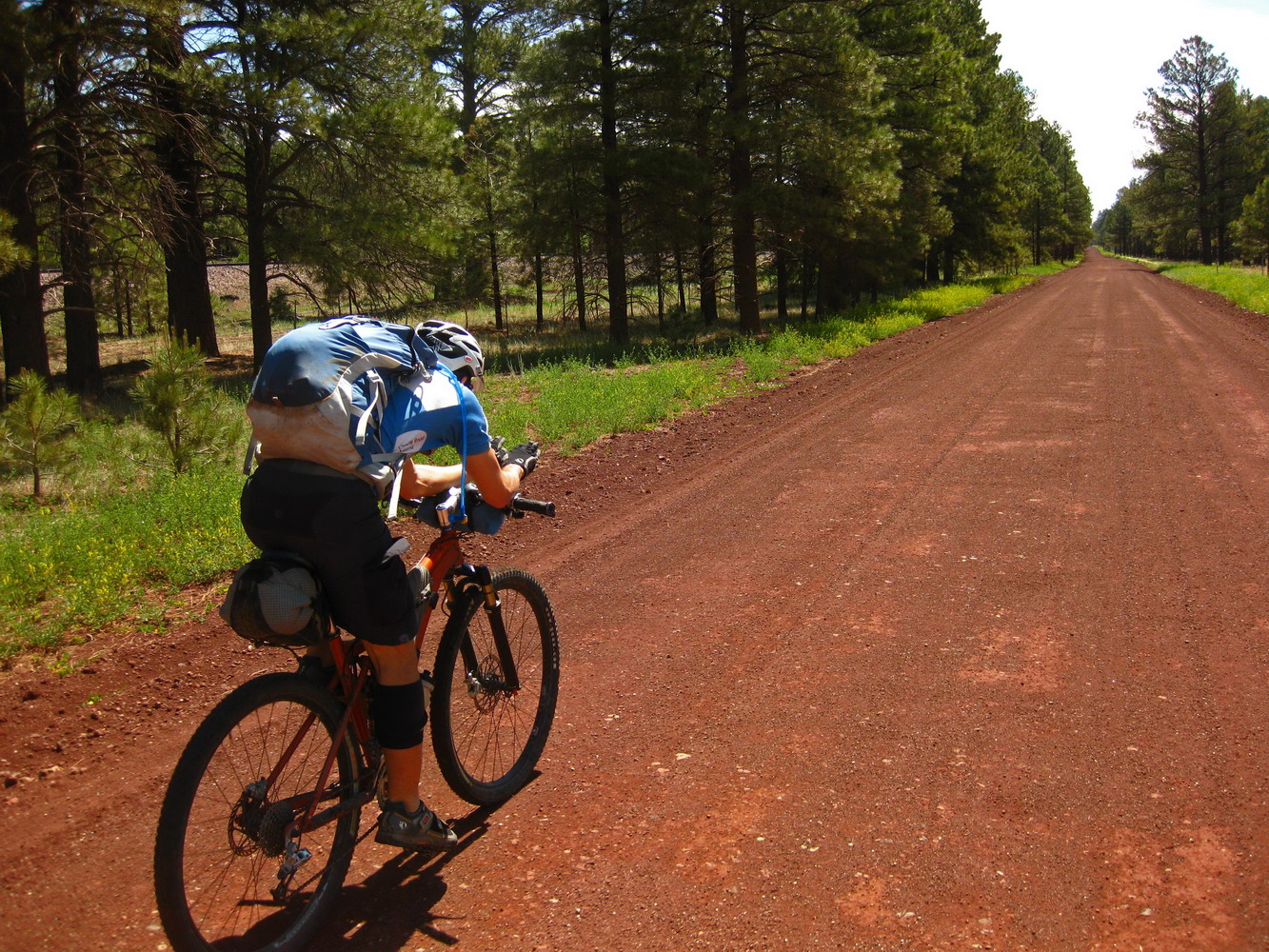
We headed south of town on urban paths, jumping on the AZT. Lee and I missed a few miles of trail here on our 2005 trip, due to inclement weather (mud). And I’ve only ever ridden it in the dark, limping into Flagstaff. So it was great to be riding in daylight and with Lee along, setting out for adventures anew.
It’s a nice ride, and new fences meant horses and/or elk were kept off the normally uber-bumpy stuff on Marshal Mesa. It was in the best shape I’ve seen it in.
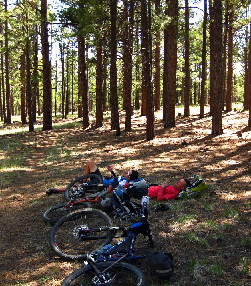
Ah, the life of a bikepacker…
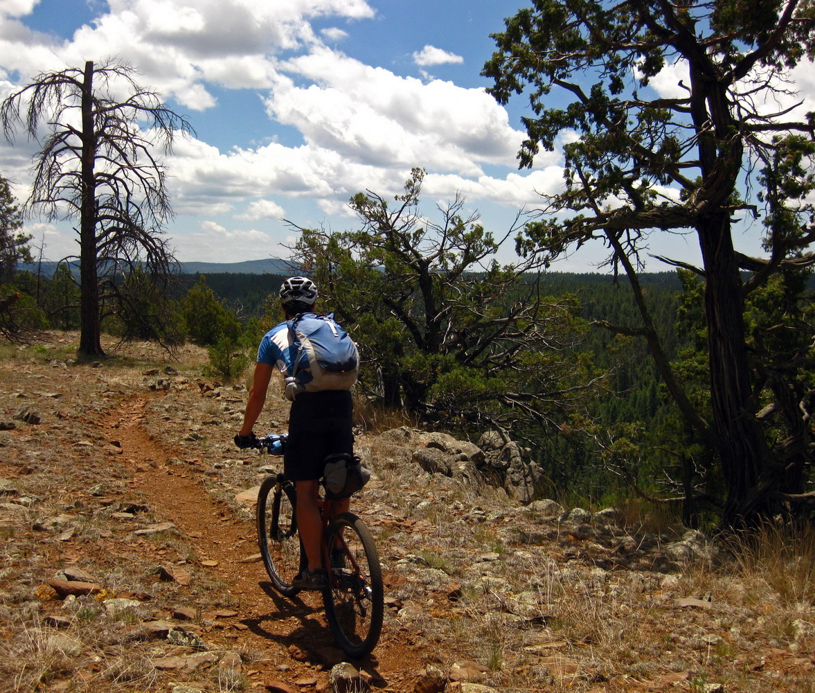
This was the start of some very sweet and new-to-us AZT. Whoever built the contour trail around Mormon Mountain deserves an award.

We filled up on water at the Knights of Columbus campground. Then it was time to bid the AZT farewell after 30 enjoyable miles.
We thought we could improve on Chad’s Coconino Dirty Century route, but bushwhacking isn’t really much of an improvement. So it goes in exploratory riding.
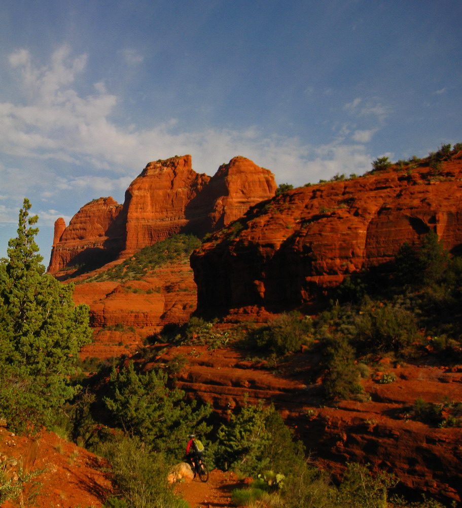
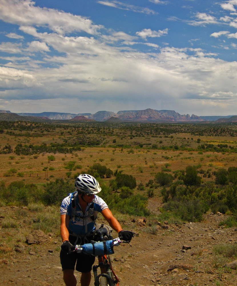
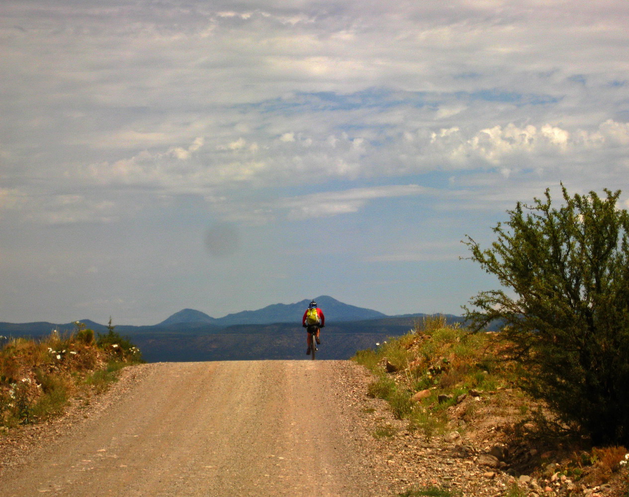
Soon enough we were on Schnebly Hill Rd, destined to bomb off the edge of the world and into Sedona.
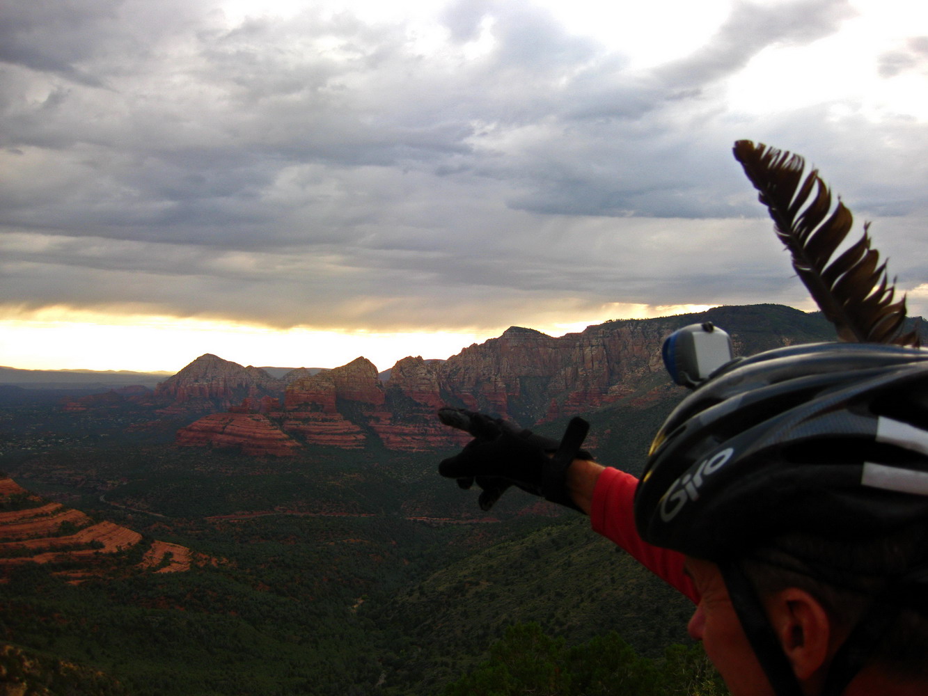
Another feather in Lee’s cap — bikepack Sedona!
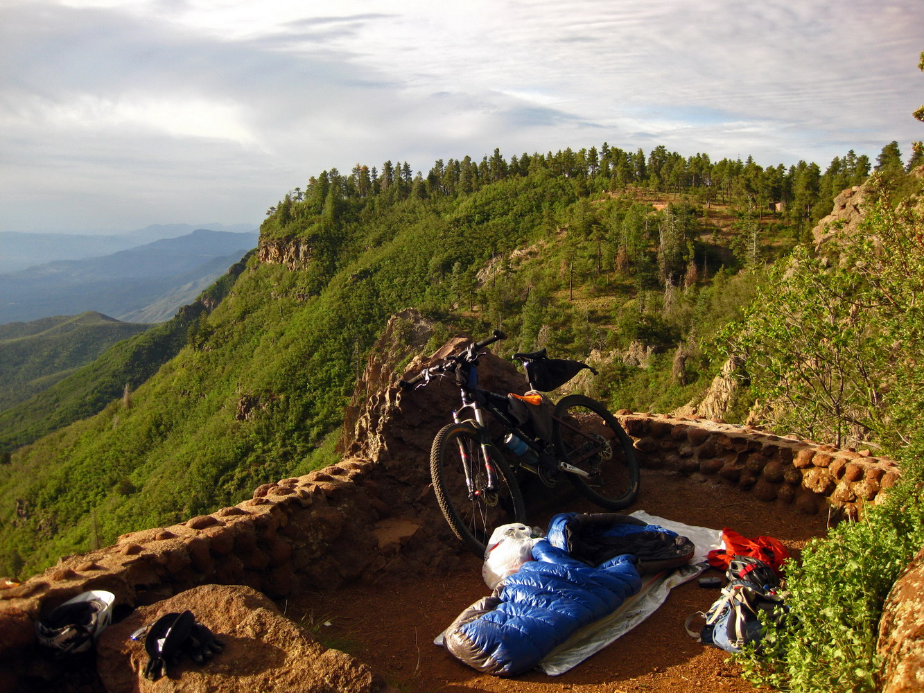
Thanks to Chad’s knowledge of the area we needed no GPS track, and we hooked onto Hot Loop, doing some techy climbing to a prime campsite.
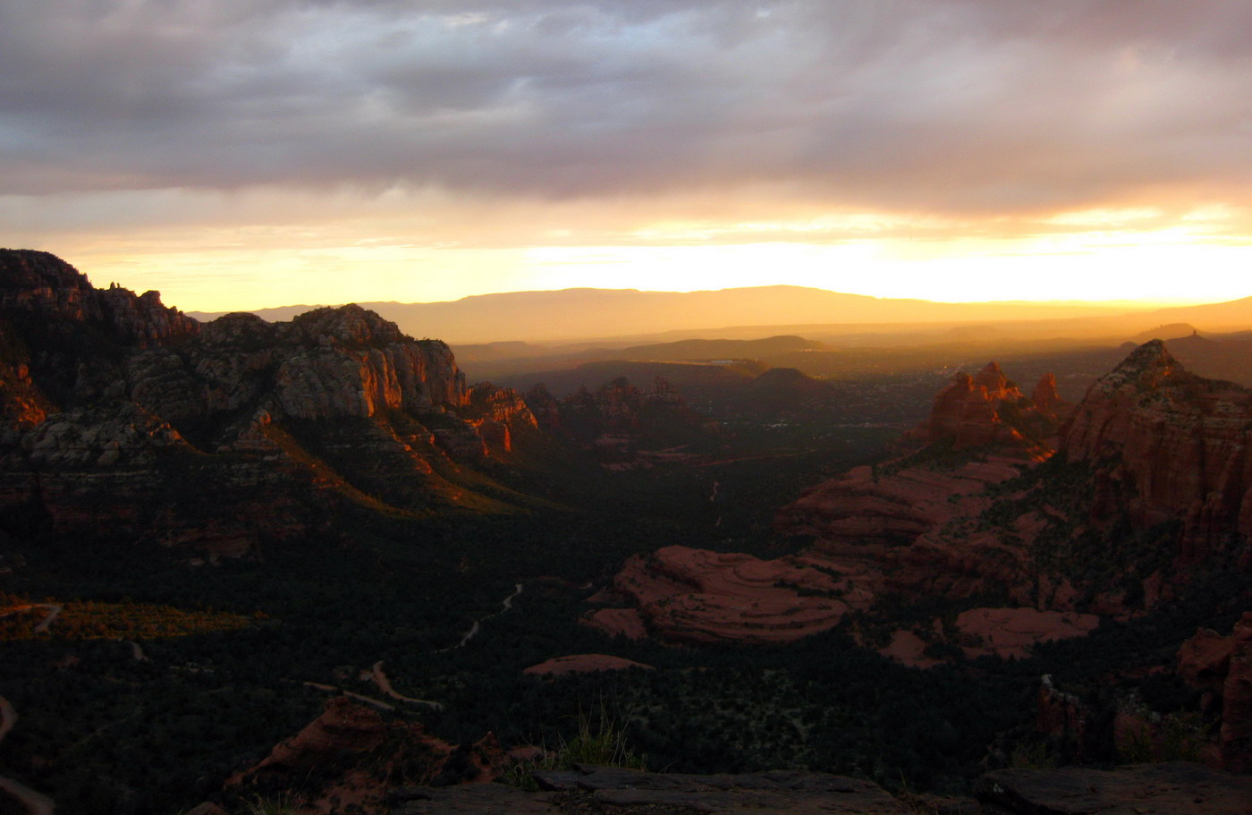
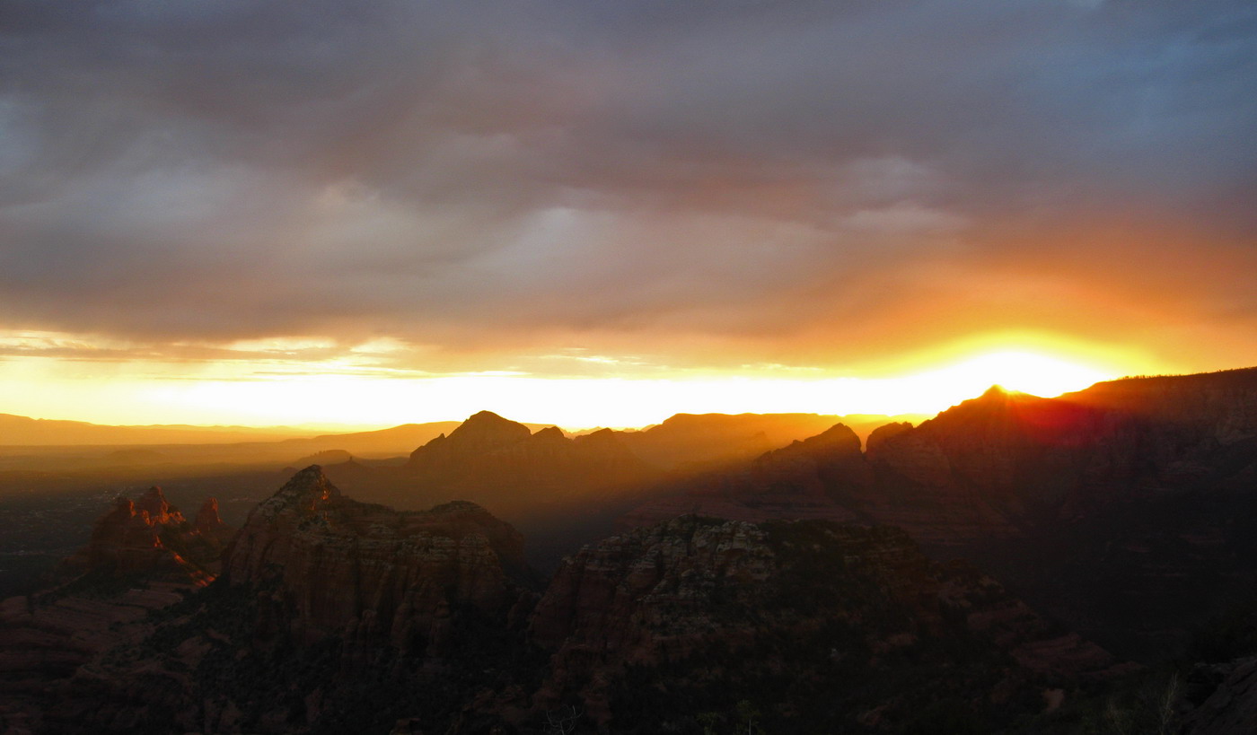
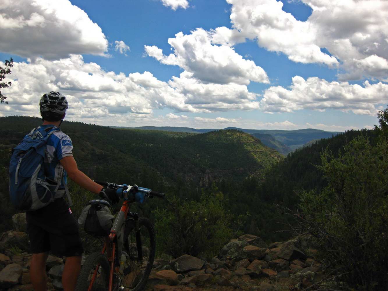
The views from camp were, as they say, pretty OK.
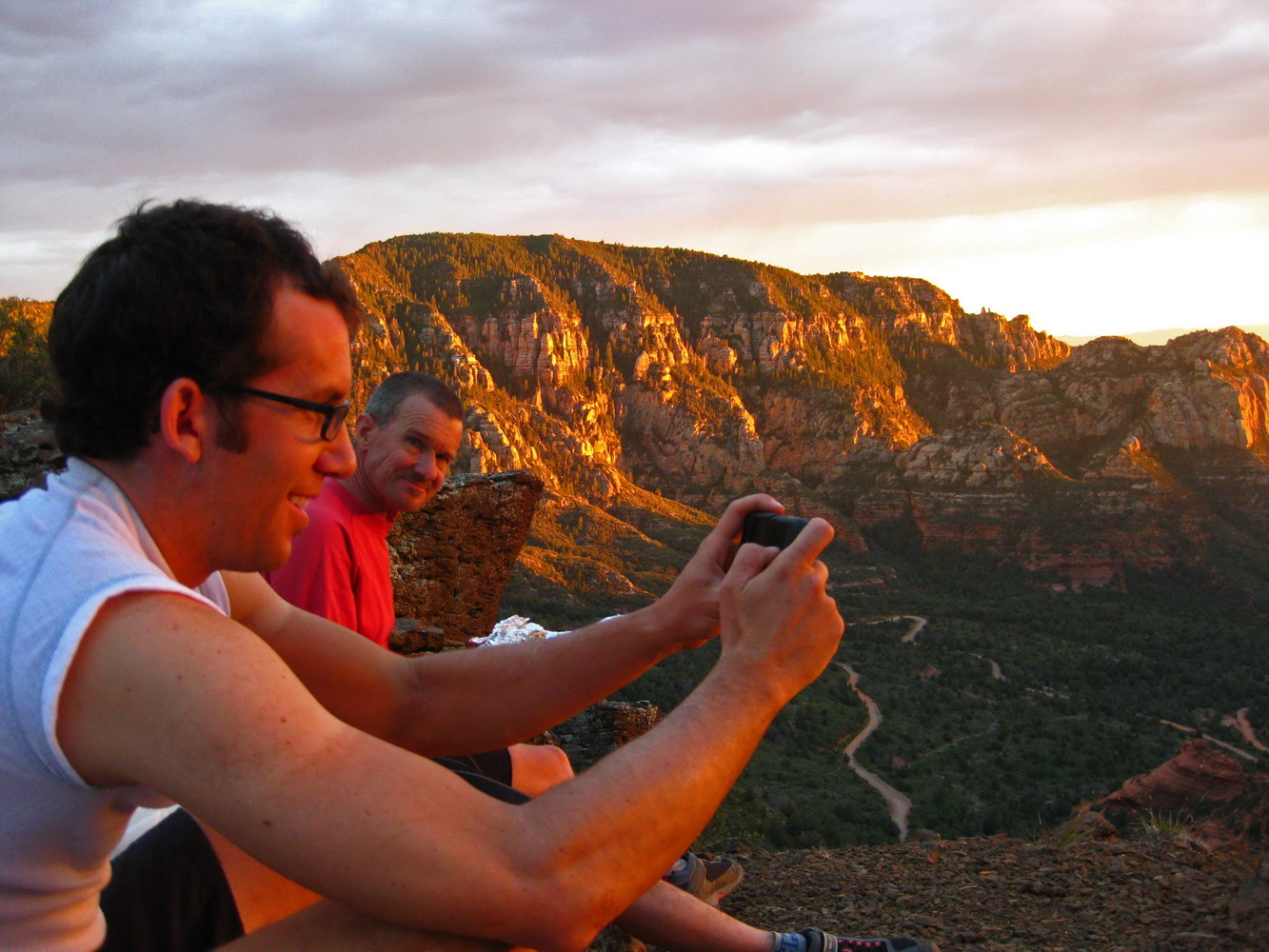
Chad tries (and fails) to capture the beauty on his iPhone. Still kinda cool that he was able to make live facebook updates with pics during the ride.
It was an eventful night, with warm temps, a few bugs and a skunk in camp. The skunk dined on nuts out of Lee’s feedbag, and later walked over to visit me. It was a little tenuous for a while, but he was friendly enough and just looking for a snack.
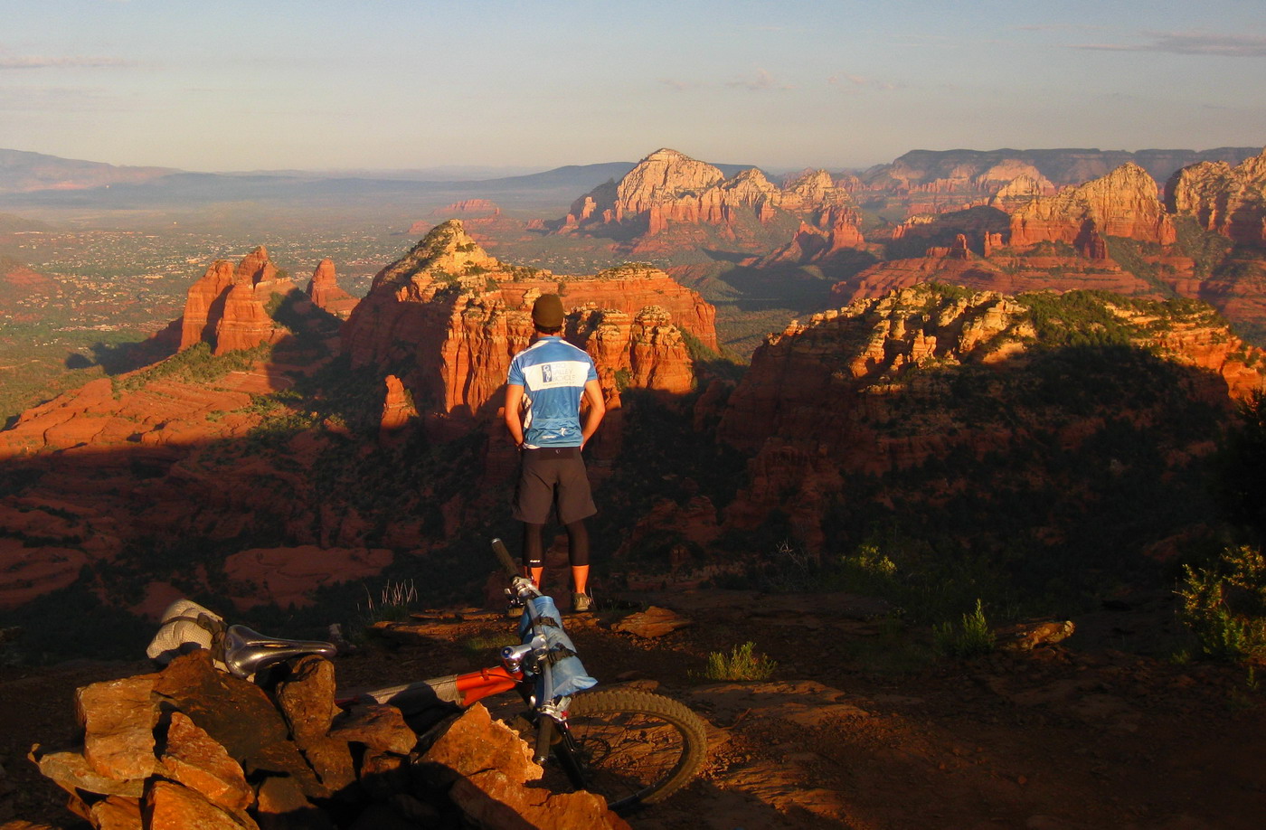
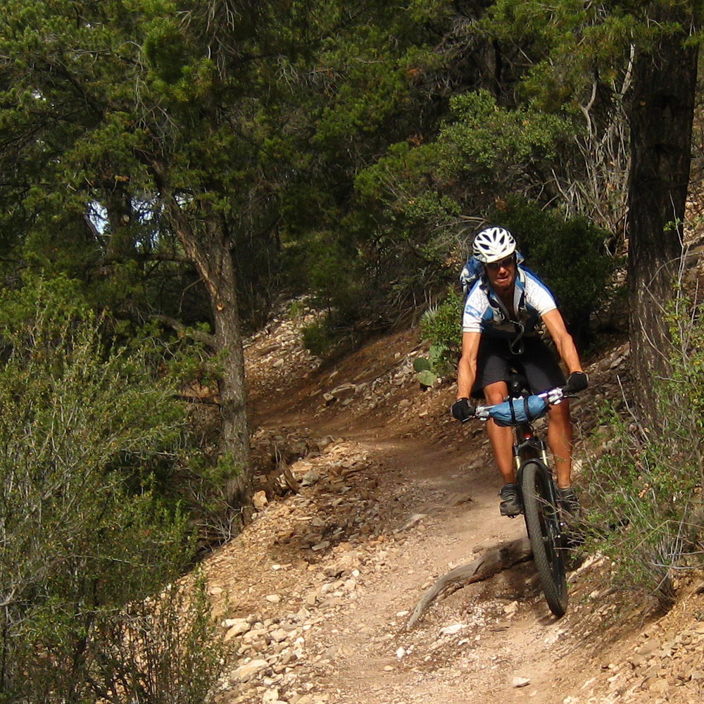
Chad takes in the morning view, before saddling up for some Sedona singletrack.

It was a most excellent descent, into the heat of the morning.
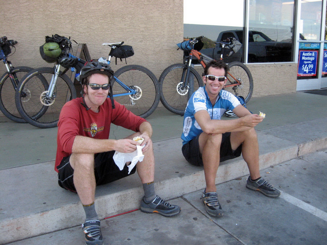
photo by Lee Blackwell
Breakfast burritos at Circle K. We filled up our packs with ice, knowing it was going to be a scorcher of a ride down to Cottonwood (elevation ~3000 feet).
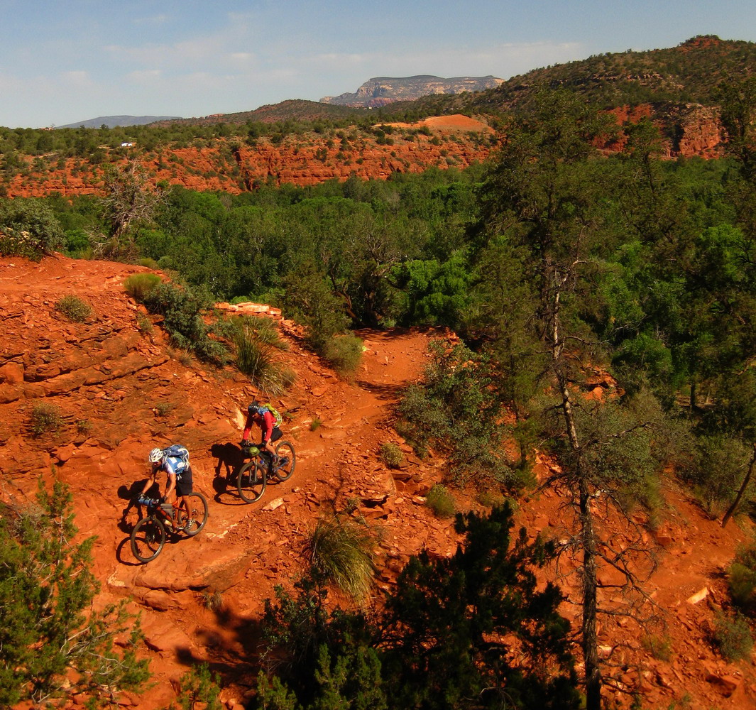
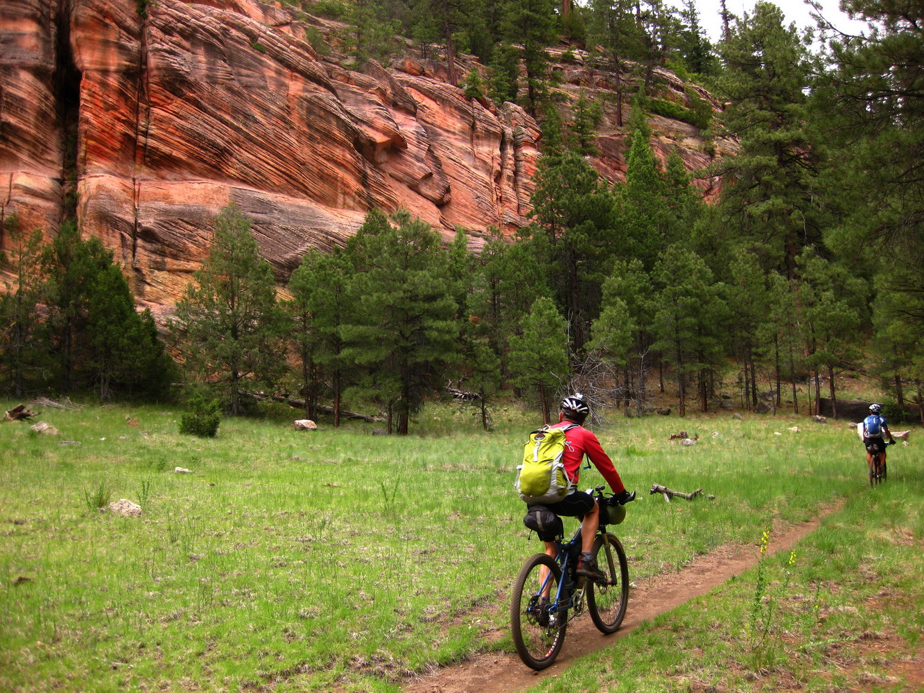
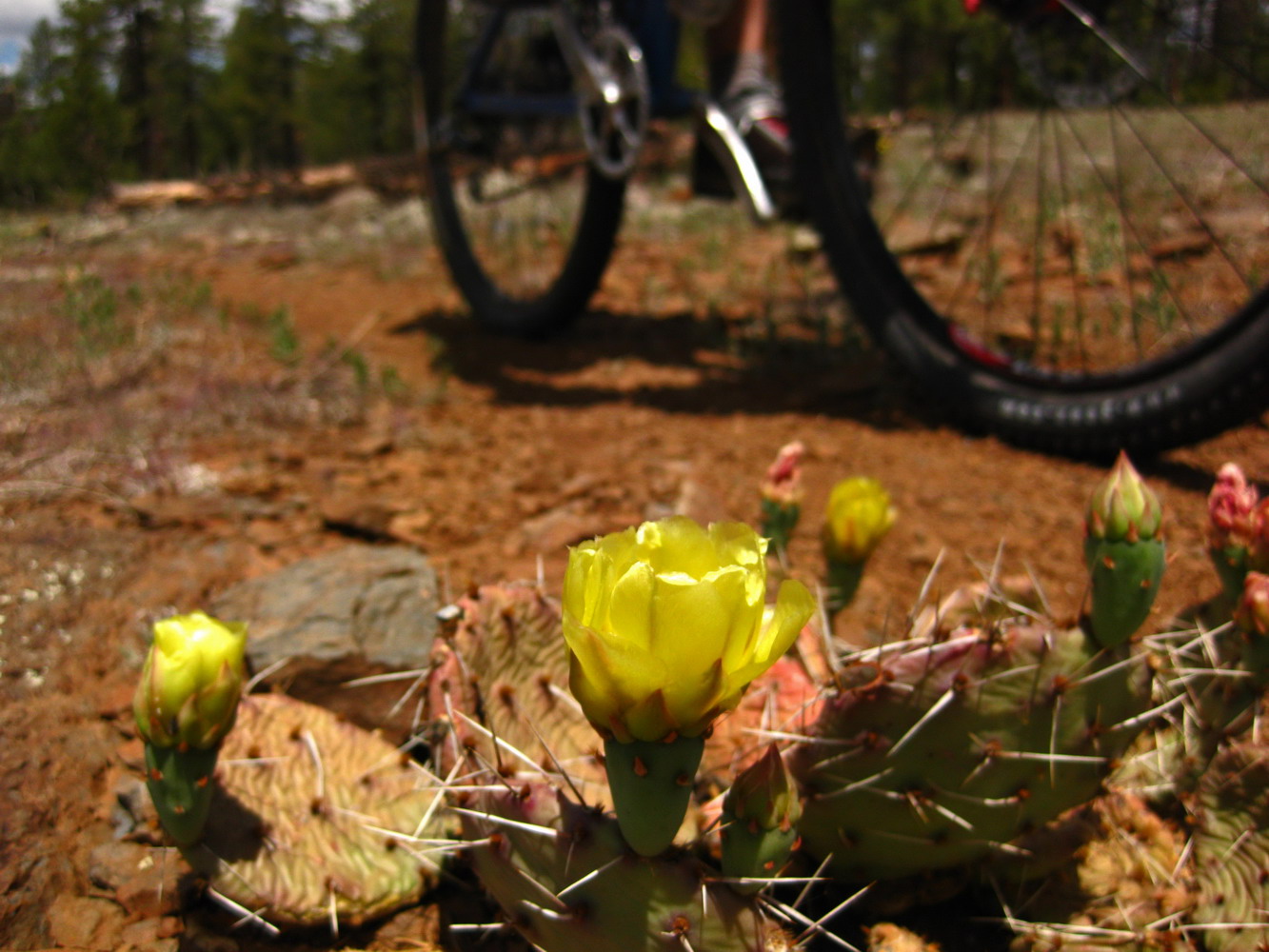
Sedona singletrack is hard to beat. Descending down to Oak Creek was a hoot. Stopping at Buddha Beach for a dip was pretty much mandatory.
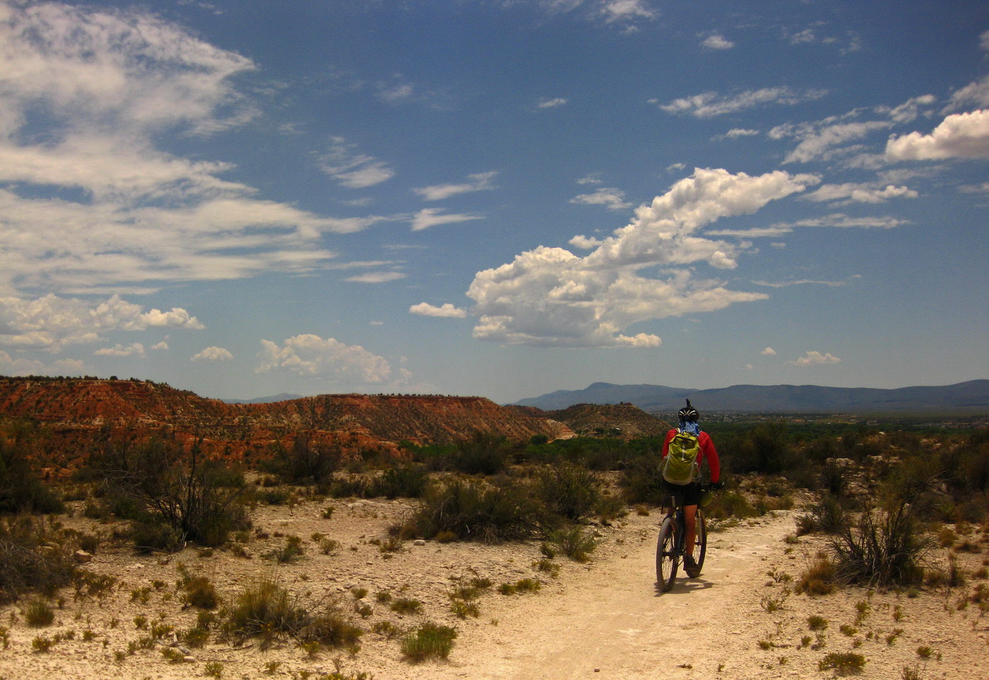
We pedaled some pavement to Red Rock state park, where there was rumored to be a trail leading all the way to Cottonwood.
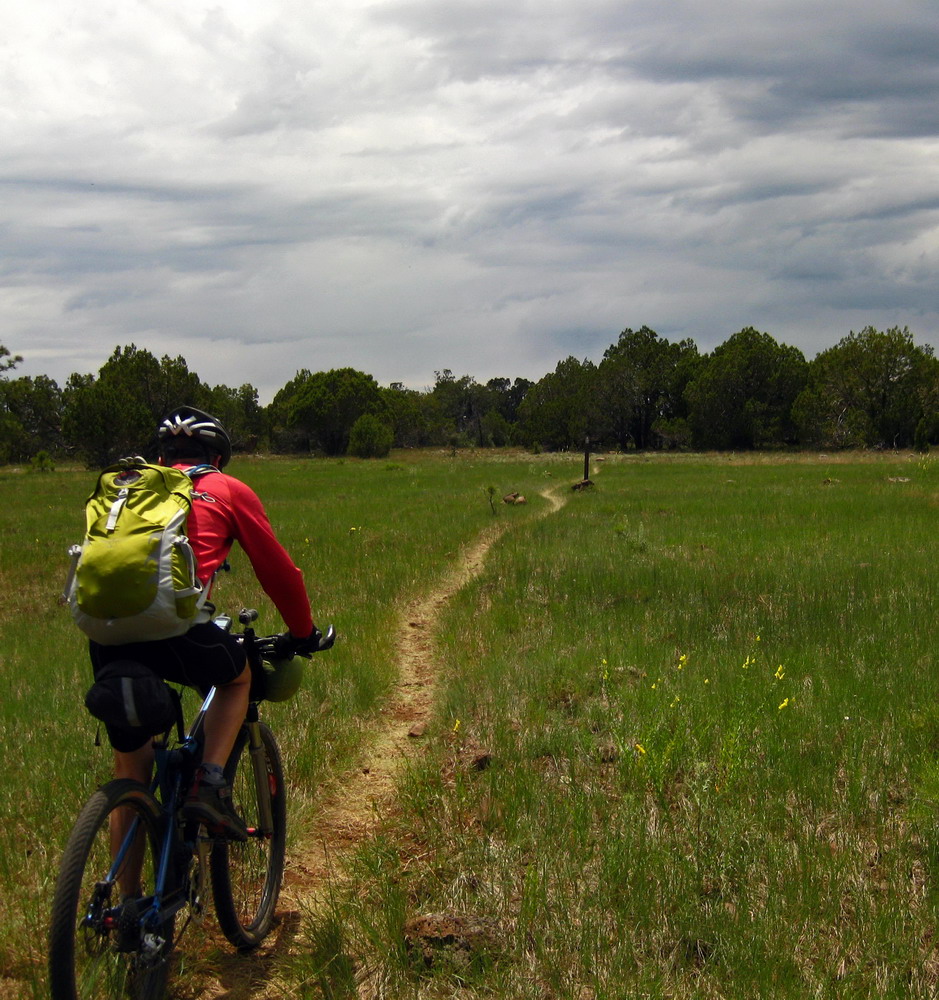
Such rumors were true. A bit of Sedona-esque ST, some fun double track, and then very faint but quite rideable and followable singletrack on the other side of highway 89a. It was pretty cool to be exploring this rarely used trail.
Plus… a bit of hike-a-bike (note Sedona in the far background).
The real treat was the last few miles, which were adorned with IMBA stickers and graced with many a bike tire. That can only mean one thing — sweet riding.

It reminded me of the Lunch Loops in GJ, with drops, side lines and even similar vegetation. It was extremely hot (98 degrees) and sunny, but for some reason I really liked it. I’ve been more cold than warm up here in Flagstaff (that’s not a complaint!), and it felt good to finally not have any doubt that it was too warm.
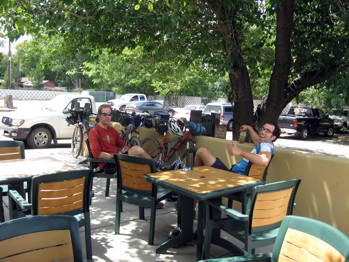
photo by Lee Blackwell
Pulled Pork and burgers were destroyed at “Hog Wild”, as we plotted for the next challenge — climbing. We had dropped some 4000 feet from Flagstaff (seemed like much more!) and now it was time to pay the piper.
On our way out we randomly passed the bike shop. Chad bought a new tire and I tried to hit up the grumpy employee for Mingus Trail info. He didn’t really want to talk.
The whole Mingus area was the biggest unknown of the ride, and it had the potential to be the most difficult. Information was sketchy and consisted mostly of grunts and half sentences from shuttle monkeys on MTBR.
We stalled at Maverick in town until passing clouds became building clouds. It was hot and uncomfortable as we pedaled uphill with 200+ oz of water. But clouds blocked the sun and spat life giving cool water onto us. It was downright comfortable by the time we got to 5000′.
“What if not for these clouds?”
“I’d be back in Cottonwood, at the hospital, with IV’s in my arm right now.”

The climb was STEEP, but just rideable. We contoured briefly before meeting singletrack. It started off well and I thought we were really on to something. But before long it turned super steep, eroded and full of challenging hike-a-bike.
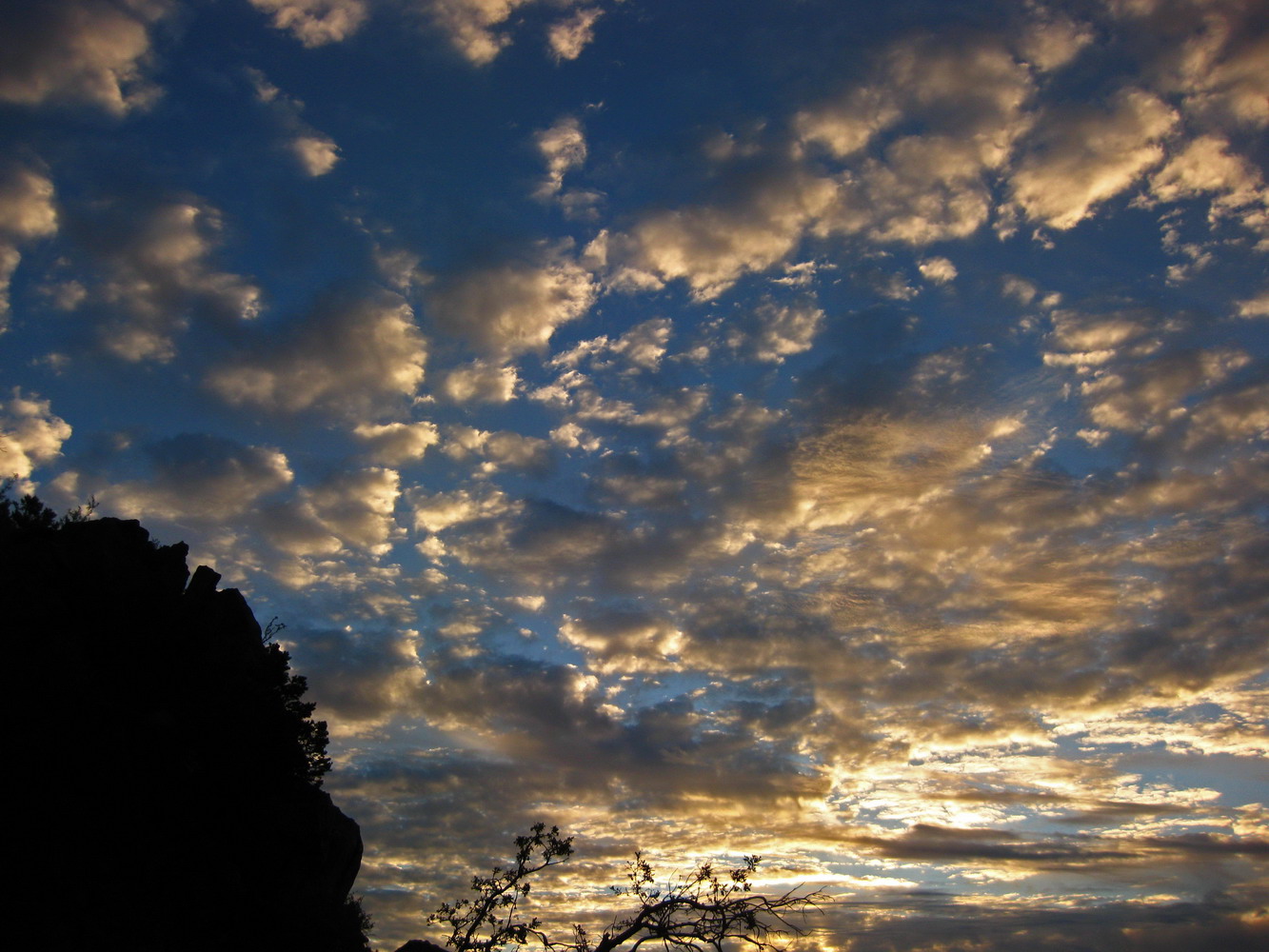
It was a tough spot to be, and the towers did not seem to be getting any closer. Some contouring near the top gave hope, but the summit push required just that — a bunch of pushing. At the top we couldn’t find any obvious water, but we did find a prime camp site:
(Taken the next morning). Another 4000’+ view to wake up to! I fell asleep instantly and only awoke once during the night. Best bikepacking sleep ever. Sunrise view from the bivy bag:
There was no water to be found at the top. The water system was shut off for maintenance. Our map indicated a Yeager Ranger Station at the exit of our singletrack descent, so we figured it was no big deal. We also had plenty that had been hand carried from Cottonwood.

Expectations for the Yeager (#28) trail were not high, given the quality of our climb up the mountain (which was trail #106, the “view point” trail). But it did not disappoint! This trail rocked our world!
Checkout Prescott in the distance in the above pic.
Hit it Chad! Hit it! Umph!! He needs to work on his bikepacking micro hucking skills.
Sweet singletrack brought us to the ‘site’ of the Ranger Station that was no more. Doh. Next reliable source of water was the Verde River, some 40+ miles of unknown territory away. Once again, good thing we had carried so much up the monster Mingus climb.

I spent about 60 seconds drawing this route on TopoFusion, and I did not trust it. There was some pleasant riding, good views and such, but we got into some hassles too. Fence hopping, private property skirting, ah the trials of the exploratory bikepacker.

photo by Chad Brown
A sub-optimal water source is better than nothing. We filled up some bottles “just in case.”
They weren’t needed. The Great Western Trail took us on an old railroad grade around the backside of Mingus and onto Perkinsville Road. Time to drop!
Bill Williams mountain is right above Lee’s head in the above shot. We dropped to 3500′ again, and this time were eying to climb to 9000′.
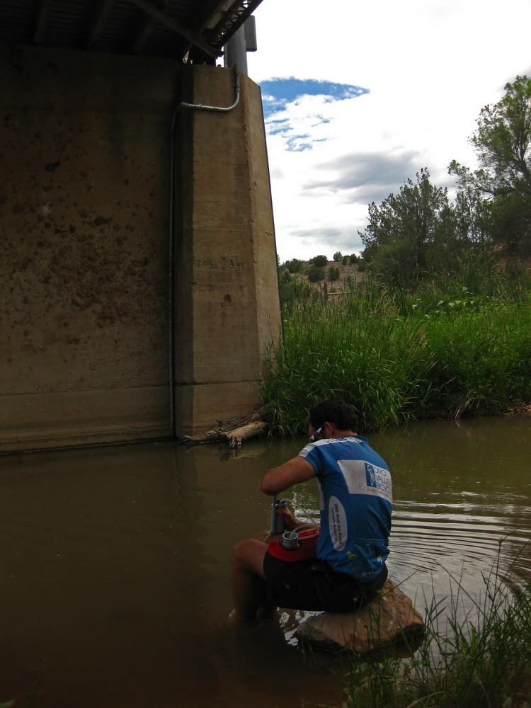
The Verde wasn’t the best tasting water, but you can’t be picky in the desert. We jumped in to cool off, with Lee trying to get his core temperature “just a hair above hypothermia” for the climb ahead. Our timing was perfect — sun while we hid under the bridge, and glorious clouds as soon as we were ready to leave.
The Perkinsville climb was made possible solely by the grace of those clouds. In a way it’s amazing that we were about to complete this ride in June (without hiding every afternoon). Luckily it has not been a typical June, and the clouds and occasional micro drops were our continual saviors.
Lee left both Chad and I in the dust throughout the Perkinsville climb. I laughed as Lee attacked Chad and Chad responded, getting ahead for a while. By the next time I caught a glimpse of them Lee was well ahead and showing no signs of slowing down. Even later on in the climb it was clear that Lee was feeling very strong and that his pace was too much for both of us. I felt good/strong, but not at such speeds. It was really cool to see Lee flying.

photo by Lee Blackwell
Chad, shambilized by Lee’s blistering pace.
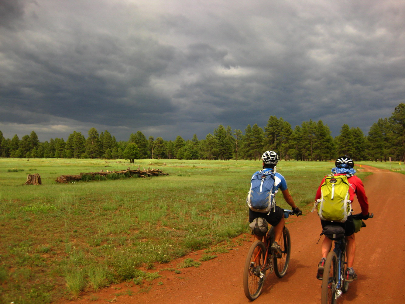
Suddenly we were in the forest, and glad of it. Heat worries were no more, and dark clouds foreshadowed our fate.
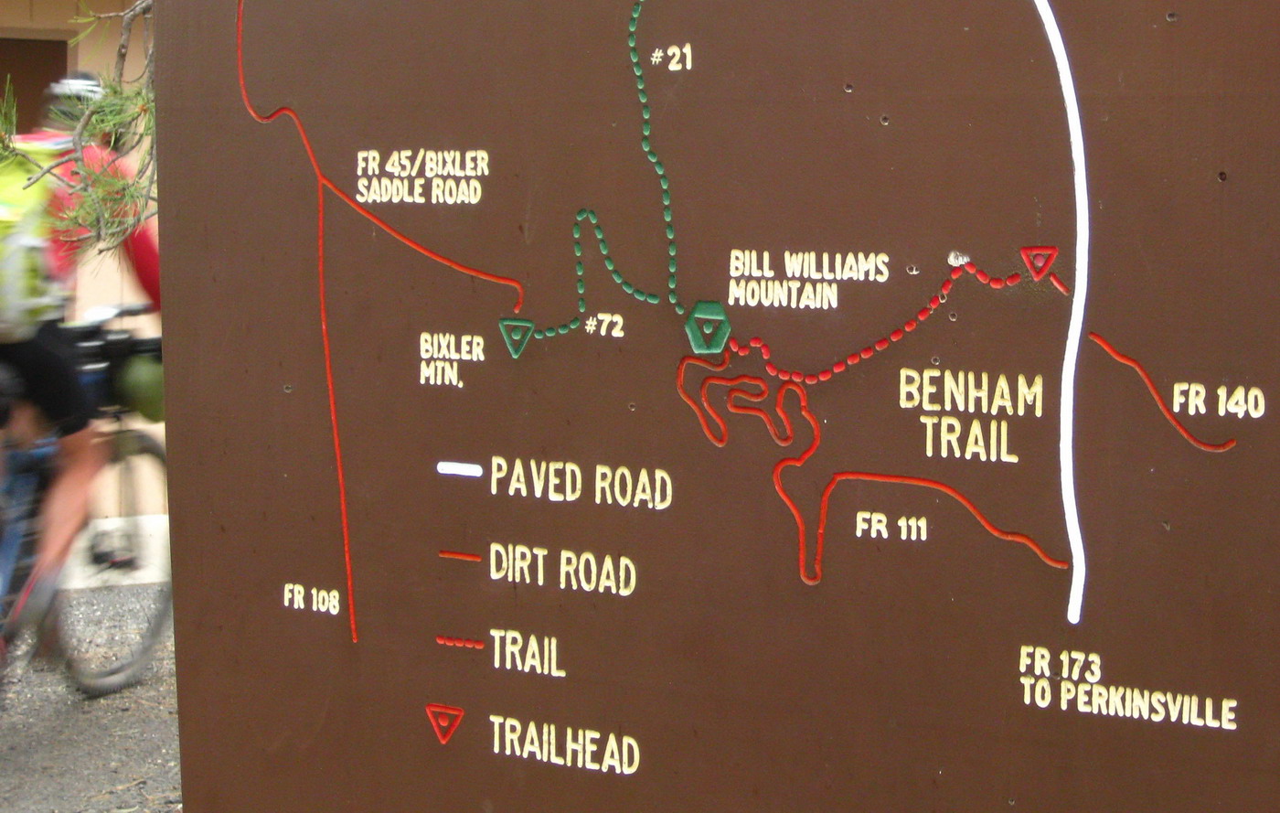
Pleasant forest riding led to a trailhead. We didn’t know what to expect, but designation as a National Recreation Trail is almost always a good sign.


Benham was a bikepacker’s dream — 95% rideable uphill — even the switchbacks!
I took the lead and was in the zone, busting out switchback after switchback in my 20×36 super granny. Chad yelled from below, “look to the left… we’re about to get wet!”
We had planned to sleep at the top, but that looked doubtful with the widespread rain and given the elevation (~9000 feet). We rode deliberately towards the top, hoping to get as far down the trail as we could before the rain really settled in.
We made it over the top before things got too wet. Chad and I took the lead down the holy-crap-this-is-awesome trail! We were flying, and it was hard not to just keep riding, pushing in to town. It’s not that we were riding in a panic, just a small sense of urgency with rain and darkness creeping in. I stopped to wait for Lee, who had been layering up and readying for the descent. While stopped I realized there was nothing to hurry for. It was warm, I was comfortable and the trail wasn’t going to turn to goop or anything. Best to slow down and enjoy it.
What a trail. The rain and dark only made it more fun / challenging.
We rode a soaking mile or two into Williams and ponied up a few bucks for a motel room and delivered pizzas. As the rain continued we were glad to have a roof over head.
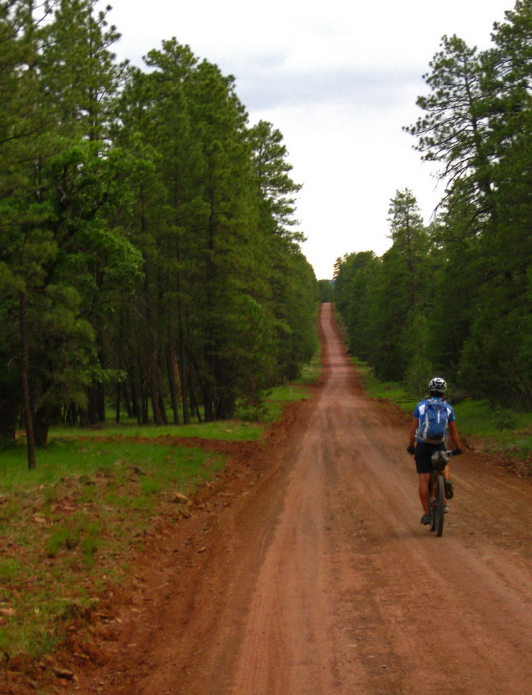
It rained at night and even in the morning. We left town on forest roads where Chad could do his best “Tour Divide” impression. Shout out to our TD buddies!
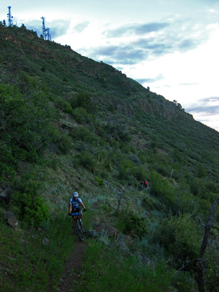
Rejoining the “Pines to Mines” route, we hopped onto singletrack along the rim of Sycamore Canyon Wilderness.
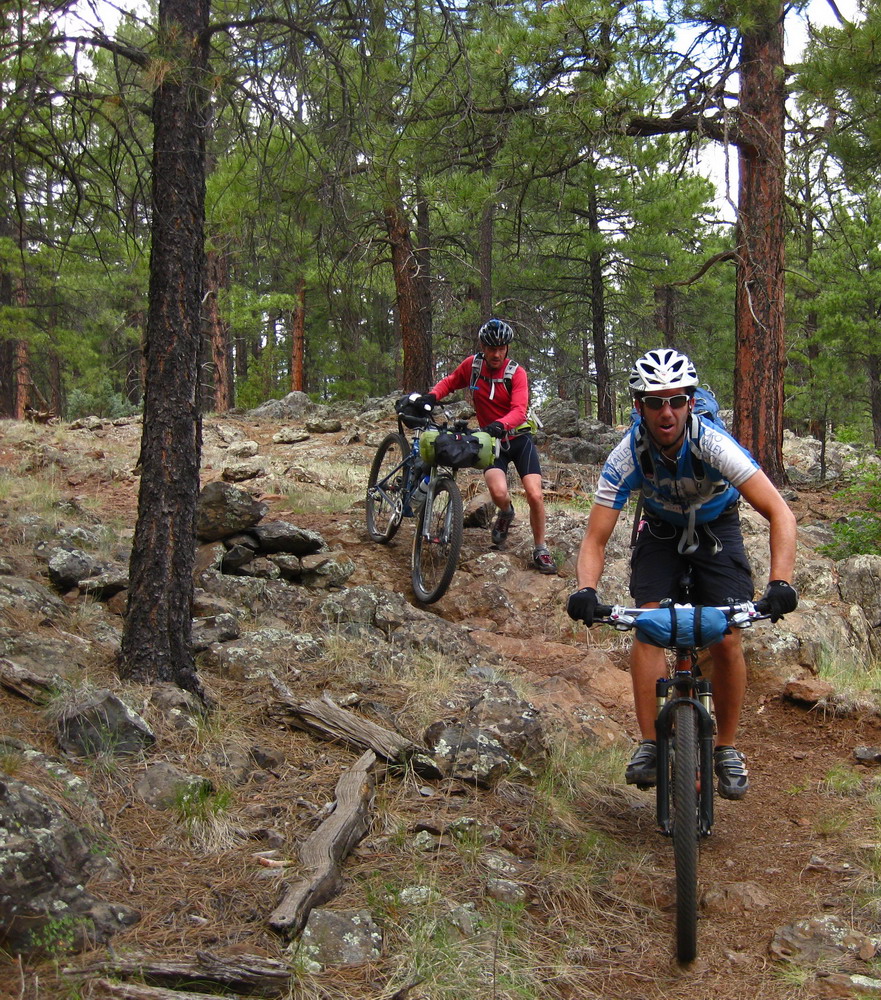
It was surprisingly techy / slow. All good fun.
Lee just can’t take anymore of this darn sweet singletrack.
Classic MC macro shot.
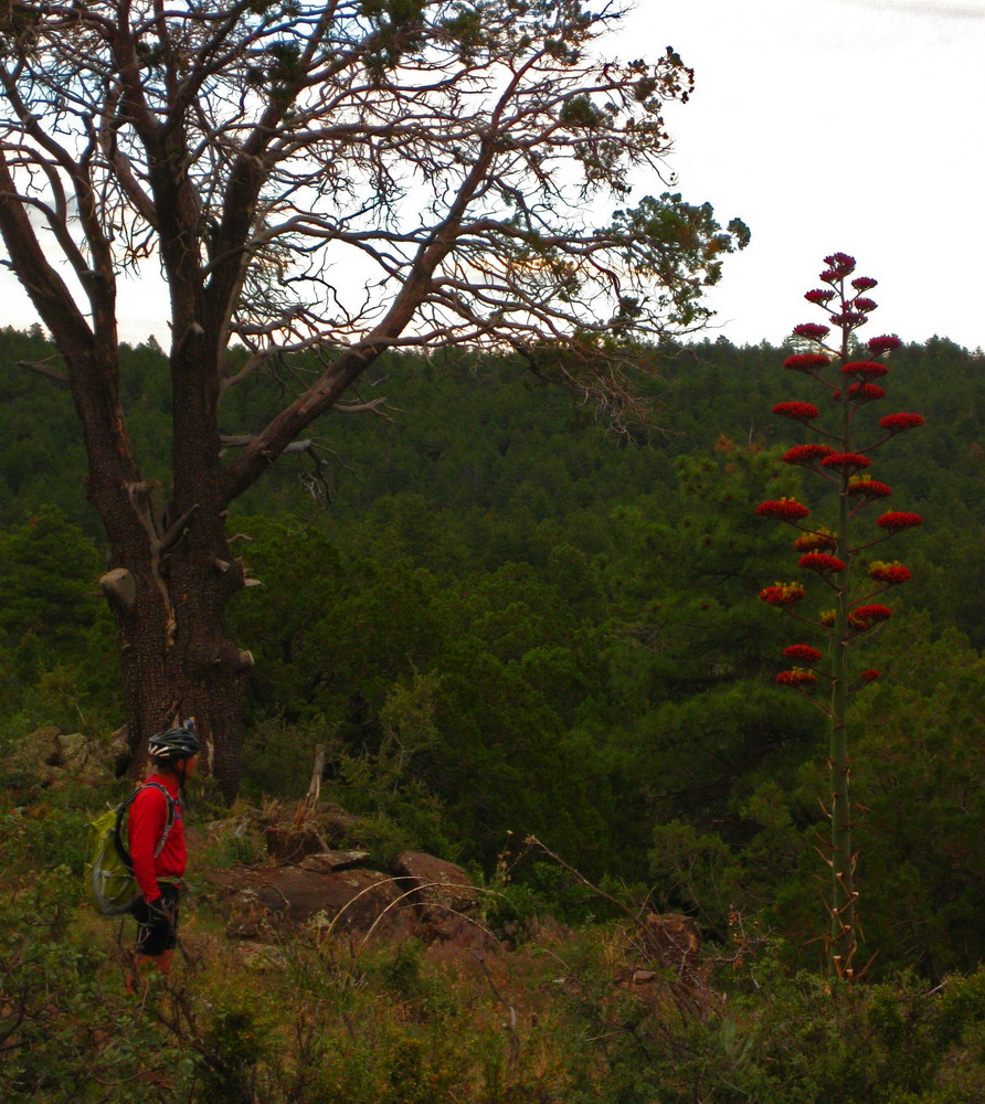
View from our lunch stop along the rim.
A 3X Lenz Leviathan ride. Definitely a choice bike for this ride. Though I would have loved to be on the Behemoth, too…
More Sycamore goodness.

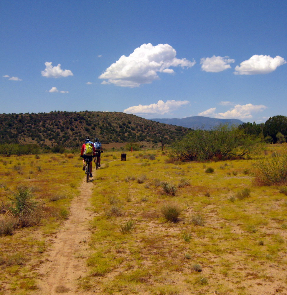
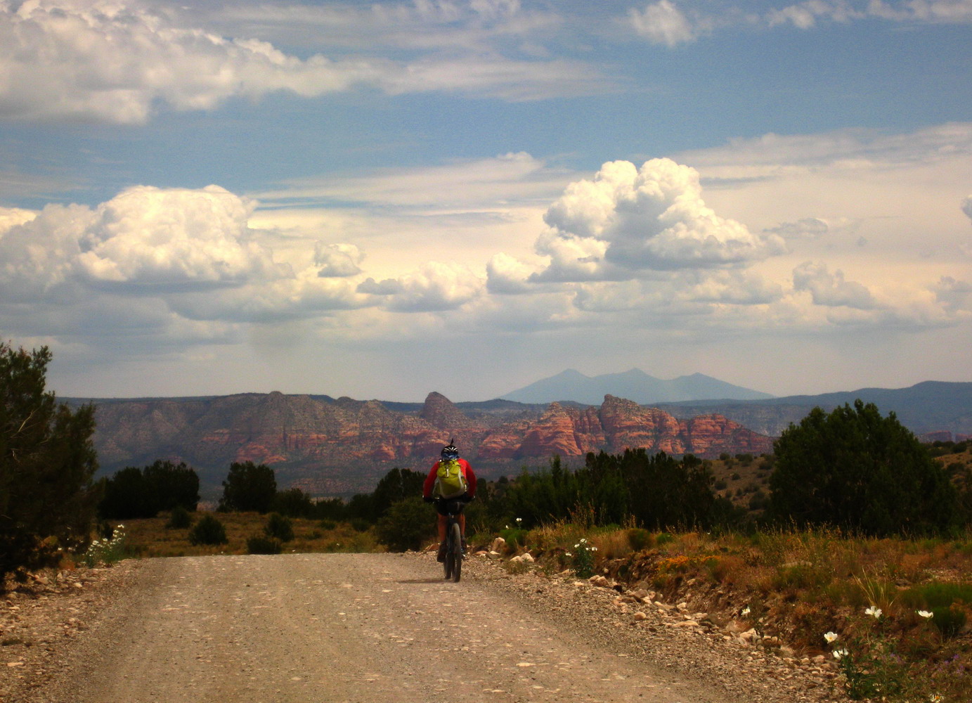
A few hours of pleasant dirt roads took us closer to the San Francisco Peaks
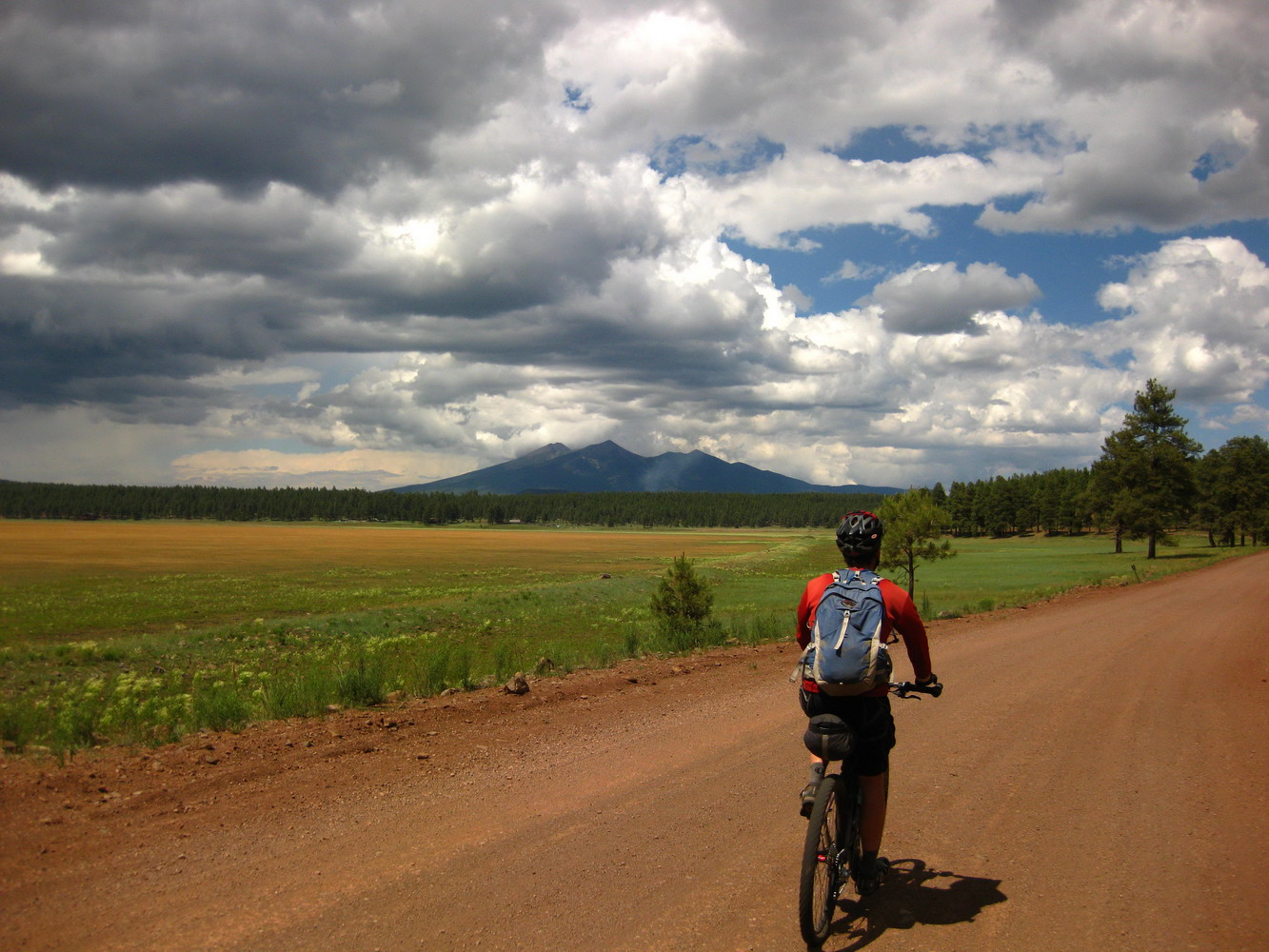
photo by Chad Brown
And finally, back to Flagstaff just as a storm pounded the city — refreshing, as was the trip in general. Linking all this quality singletrack in a not-too-heinous loop was very satisfying. Then there’s the exploration, the discovery and of course the company. Hard to imagine better people to ride with, and the humor and laughs were off the chart.
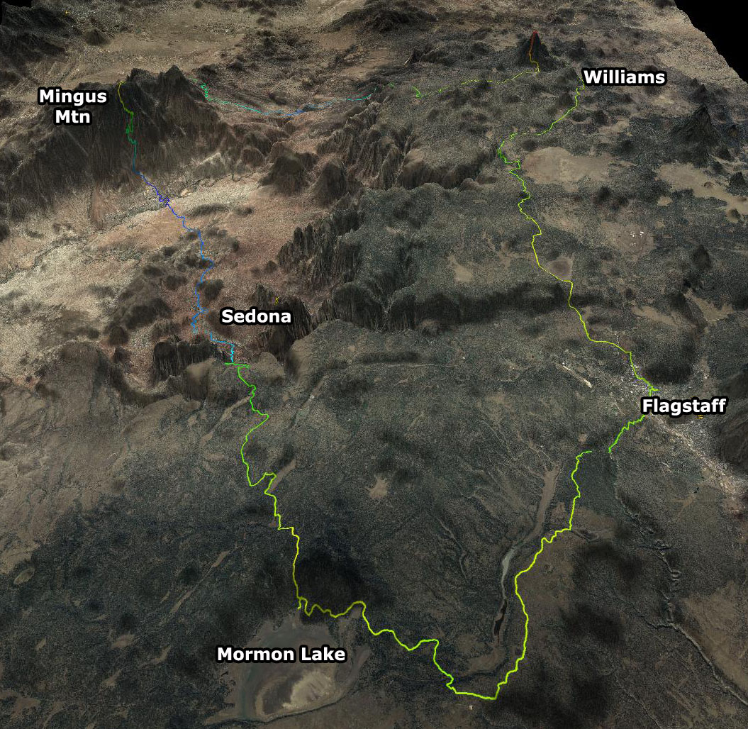
216 miles, 24,000′ elevation gain, 4 days. Look for this loop as a new race this fall!

Damn you guys SUCK! You went out and did this and I still haven’t even read your GL In Reverse story!
Absolutely wonderful looking ride and the pictures are outstanding. Well done!
Ed
Sweeeet loop. Nice to see ya’ll getting out. Jealous.
WOW!!!. None the matter about downhill, freeride, XC riding, etc., etc., this is what mountain biking is about. Thanks so much for the adventure.
Ahhhhhhhhhhhhhhh siiiiiii. Verrrrry nice.
nice!
Thanks for doing the legwork on this. Sweet loop. I need to explore the Perkinsville road route to BW.
Awesome epic, awesome pictures. Too bad you couldn’t find some better company…
(!)
But, uhhm, “Bob”?
Idontgetit.
MC
A distortion of the last three letters in Kaibab. On the GPS basemaps it is labeled the Kaibob National Forest.
Sounded better than CocoMingoBab. But that works too.
Easy solution for what to call this masterpiece: Flag Drop Loop.
http://creativecommons.org/licenses/by-nc-sa/3.0/ 😉
[…] revisited the outstanding Yaeger Trail. Little did we know that back in June we happened to descend perhaps the best trail on the mountain. Nice to know that now, though, and […]
[…] revisited the outstanding Yaeger Trail. Little did we know that back in June we happened to descend perhaps the best trail on the mountain. Nice to know that now, though, and […]
Awesome ride writeup. Man, Chad looked nervous on that root. That doesn’t sound right for an all mens bikepacking trip.
[…] time finally came to race the Coconino Loop, first explored by Chad, Lee and I, last June. There was some work to insure everything went smoothly, including a last minute rescinding of a […]
Spectacular. I’ve been up in NorCal for a couple years now, but was riding in the Mojave around Vegas for a couple years. These photos bring back the desert for sure. I still prefer my new neck of the woods though. Nice job guys.