I was really getting along with summer in Tucson. The high country was open. Morning rides were beautiful. All was well. Then the allergies kicked in, and things went downhill quickly. I operated in dribble mode, with a fuzzy head, for too long before finally bailing for clear mountain air.
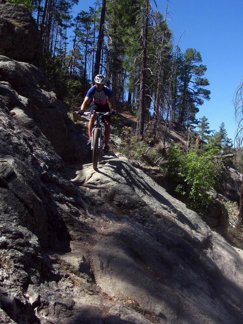
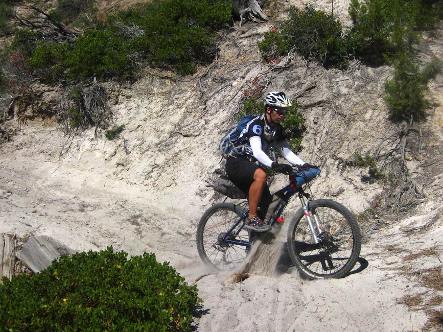
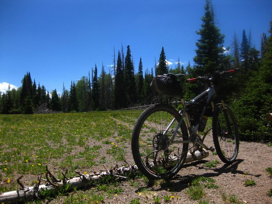
I camped solo on Lemmon and the relief was pretty immediate. Chad joined me for a ride the next day, hitting all the ‘goods’ on top of the mountain, followed by a pizza gorging session at the cookie cabin.

photo by Chad Brown
It was a good thing Chad’s legs were still torched from his record-setting Coconino Loop ride, because though my nose felt better, my head was still heavy and fuzzy. I did a good impression of myself, the mountain biker who can occasionally ride with some composure, but I was not there.
So I left Tucson, heading to Utah’s Dixie, just a few days earlier than planned. Once again the relief, in terms of allergies, was immediate, but something was still off. I had a pretty good ride with my dad on Rim Rock and the ‘slot canyon’ trail, then went over to Dave Harris’ house to do a little Dixie smack talkin’. It was fun to get a glimpse into the mad scientist’s laboratory and brain, but I was totally wiped and woke up feeling like half of myself.
Dixie was off. My parents and I drove caravan style up to Salt Lake City, where my brother and his wife were coming into town to look for jobs. It was good timing as I was able to spend time with most of my family.
I rode with my brothers in the SLC foothills, and it was a little dismal. I was swimming in my head and could barely control the bike whenever exertion was required. That’s pretty much all the time on the challenge climbs off shoreline. Both of them cleaned the “$20” climb with ease, I dabbed.
I’d had enough. Two weeks of being sick (from allergies!) was too much. I went running for the first antibiotics I’ve taken in a decade, prescribed by a doctor in a closet clinic inside a grocery store. He took one look at me and sent me home with a big bottle of pink pills.
They worked (sometimes antibiotics are simply amazing). Suddenly riding the Dixie seemed possible. Chad and I agreed to meet in Cedar City to do a “Dixie Quasi Lite” loop — a combination of the Dixie 311 and the Dixie Lite. Just a hair over 200 miles — perfect for fast touring in ~3 days.
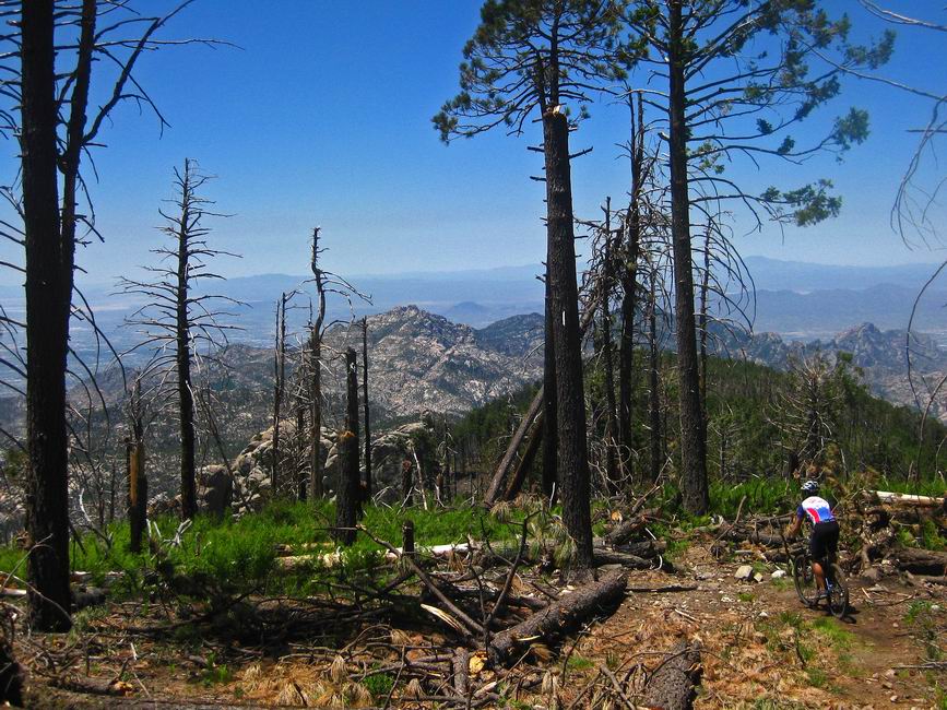
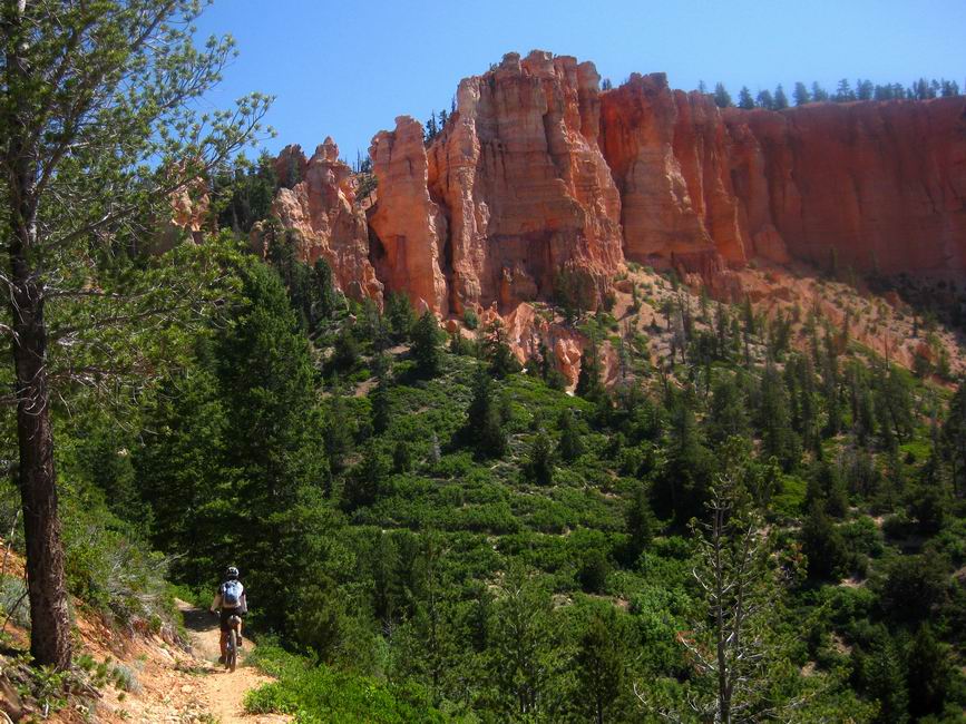
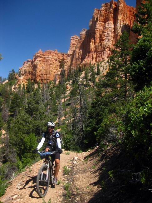
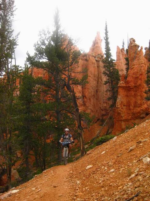
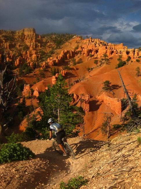
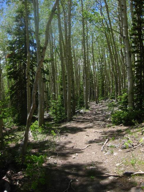
First up was the Virgin River Rim Trail. I had ridden the entire trail about 10 years ago, with my brothers, and I remembered it being relatively hard and long.
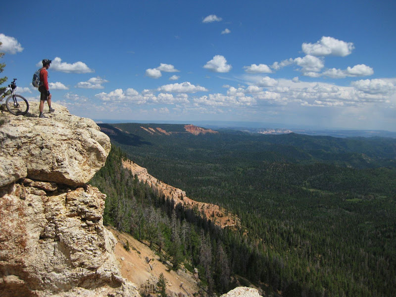
photo by Chad Brown
So much for my memory. It was perfect bikepacking trail…
… for a couple of weaker-than-usual bikepackers. The trail sees a bunch of bike tires, so it’s well ridden in and very fast / flowy. We were riding huge stoke by the time we wrapped up the trail, descending powdery ATV trails and forgotten logging roads down to Highway 89.
I’ve driven 89 many times, en route between SLC and Tucson, and have always daydreamed about bikepacking in this area, maybe hitting up one of the many little stores up for a snickers and gatorade.
And here we were, at Long Junction, bringing the same items up to the register. There wasn’t much time to ponder it, though. The sun was setting and we had seven miles of highway to pedal.
Those miles turned out to be downhill, so we made a lot more progress on the Pole Canyon climb than we expected. Though it had only been a half day (noon start) I started feeling tired and weak as we climbed amidst fancy (and rarely used) summer homes.
Light failed us just as we needed it most. The GPS track became improbable to follow, so we took the left and right lines only to have the GPS tell us we were wrong. We stuck as close to the track as we could, walking through high grasses.
Chad looked down, “uhh, we are walking in a bog.” We soon found something that looked like an old road clearing, sitting down to inspect the area for camping potential. I kept hearing mosquitoes, so we pushed on a bit up the trail. It was amazing how the short break and bit of food brought me back alive.
We camped on the trail, and after a tasty freeze dried meal, I drifted off to sleep, dreaming of orange cliffs and fanciful landscapes.
The next day was filled with exactly what I dreamed of. The going was rarely easy, but the rewards more than outweighed the cost.
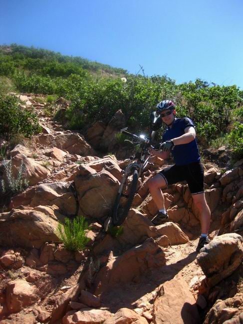
Sand surfing! The only hike-a-bike seemed to be when the trail had turned to dust. The ATV/moto presence in this area is unmistakable. It gets annoying at times, but without them these trails would either not exist or be completely forgotten.
At first we rode on top of the Sunset cliffs, just as we had done the day before on the Virgin River Rim. Then we plummeted off the plateau in a sick combination of dust clouds and burning brakes. I expected the ensuing “re-climb” to be similar to the descent. I expected to walk.
But it contoured nicely, in large part, and the views up into the cliffs and down into valleys unknown were more than enough to make trail surface and grade irrelevant. I couldn’t believe people could negotiate the trail on an ATV, though clearly the wide trail was manufactured for / by them. We didn’t see anyone out on the Grandview trail, so I suppose it is rarely run in some sections.
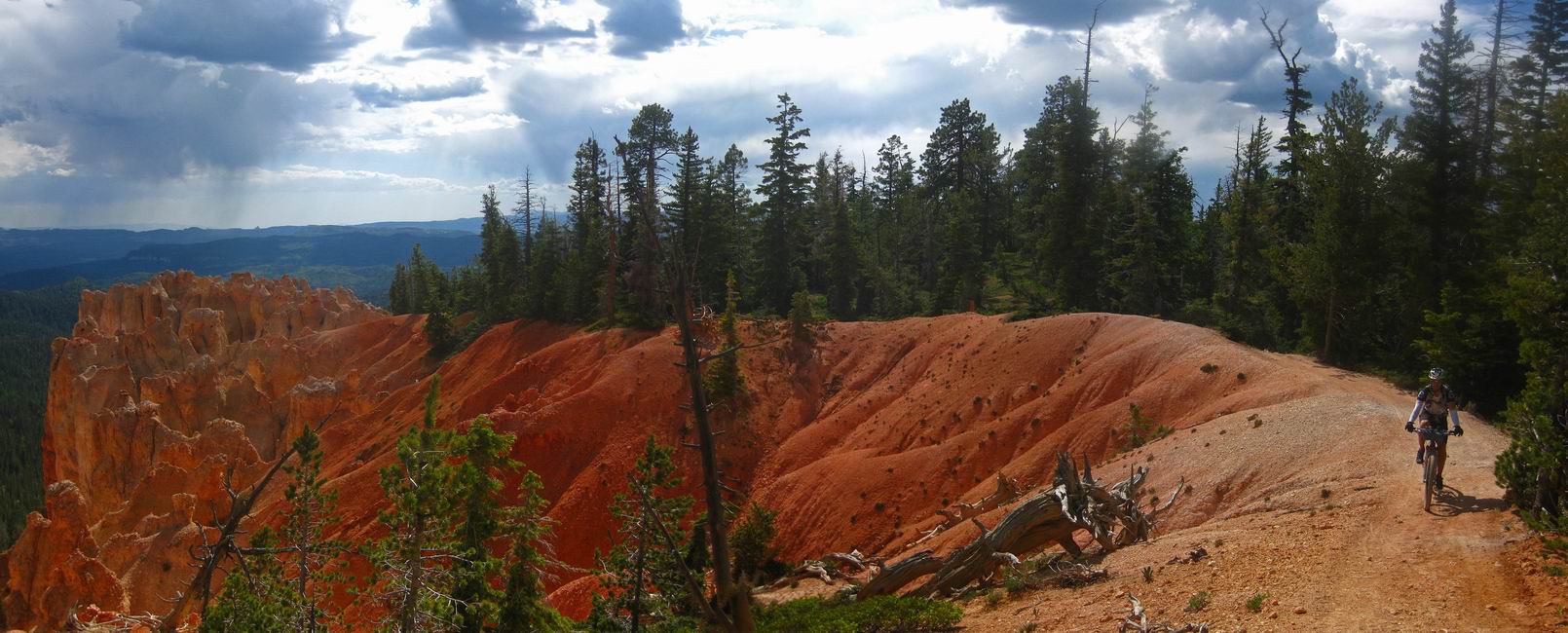
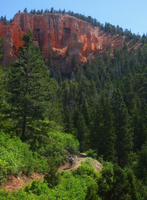
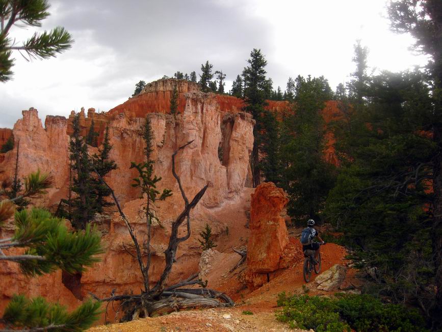
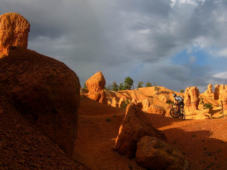
Our GPS line wisely took us away from the Grandview for a nice break on cool forest roads, eventually dropping us off the south side of the plateau again. The reason? Crawford Pass trail. Closed to motos (though clearly poached at times), this trail spent nearly all of its time in the eroded red and orange hoodoos and was a real treat.
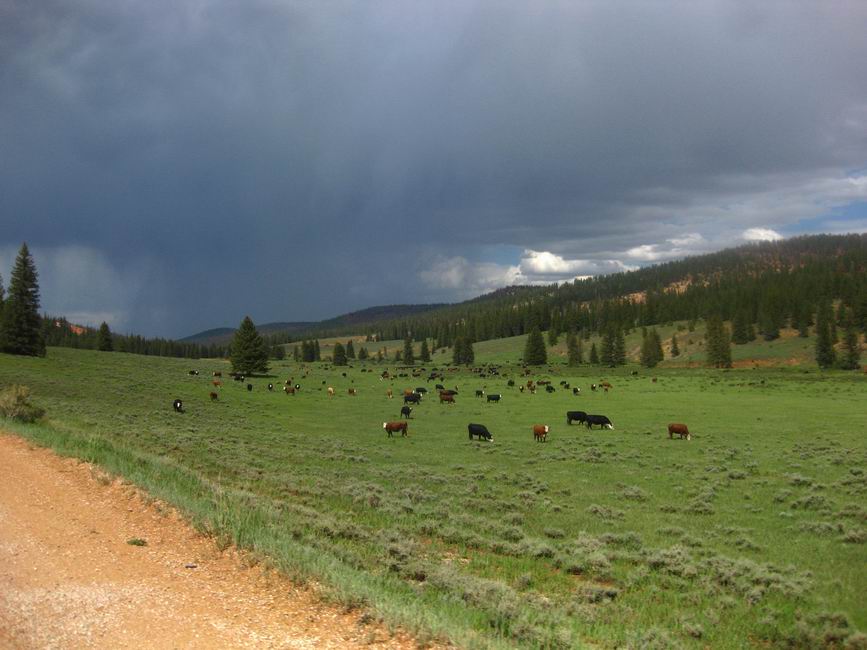
The afternoon storms built as we hit some easy and fast miles. For us they seemed hard and long. I was feeling weak again, and Chad’s Coconino burnt legs were catching up with him. We bailed off the route temporarily to seek shelter from the next wave of storms. I scarfed more pink pills as we waited for the next sucker hole.
The hole lasted long enough for us to wrap up the graded roads and head over to the Chimney trail. I’d ridden this last year as part of one of 2-epic’s other fine events. This time it was a bit more exciting as the next storm gained momentum on top of us.
We stood under the campground’s bathroom shelter as the next storm danced its dance. It was starting to look like Thunder Mountain would live up to its name.
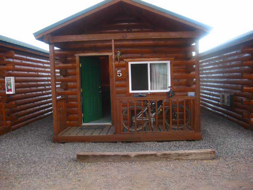
The roads from Chimney to Thunder were a bit of a drag. Conditions were perfect — warm sun would toast us just as clouds rolled in and dropped a little sprinkle, making us temporarily cold. But I was getting tired, and was thinking / hoping that there were actually rooms available near the bottom of Thunder Mtn. I remembered reading that Fred W. went for a room on the Dixie Lite, but hadn’t researched that possibility myself.
Thunder Mtn started out like it did for me on the last 2-epic event — painfully. Maybe one day I’ll ride the trail with fresh legs and a clear head. Wait, when do I ever have fresh legs? For a few days before the AZT 300 each year?!
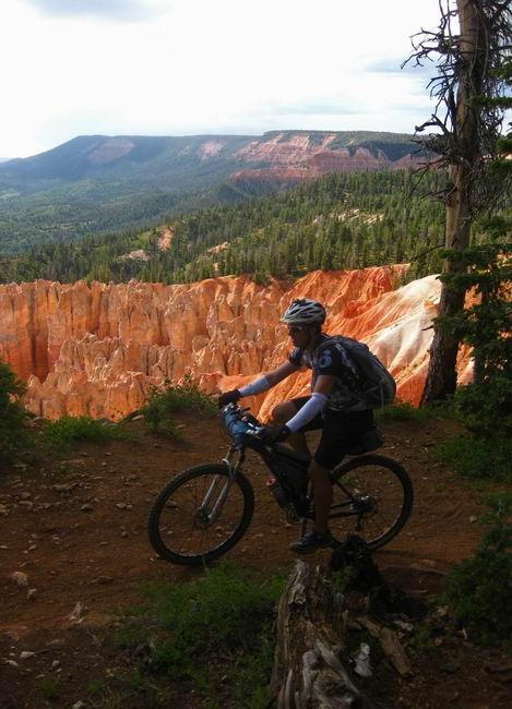
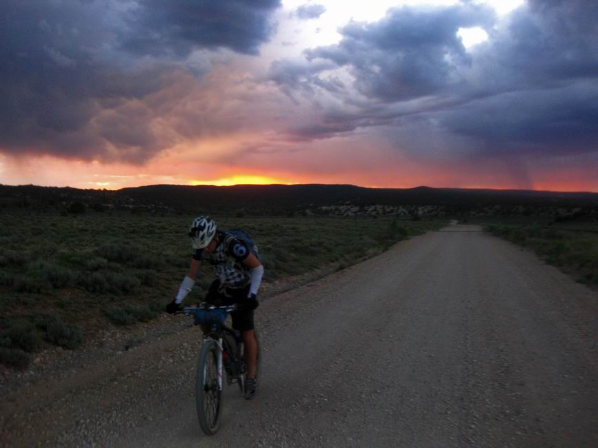
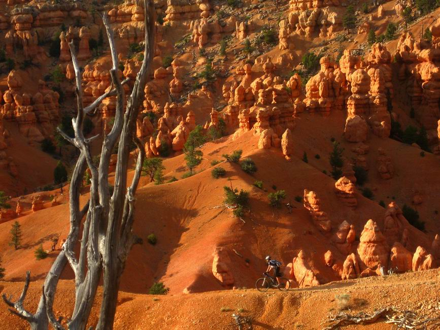
There was no thunder, but the persistent clouds made it look like we were going to get skunked in the photo department.
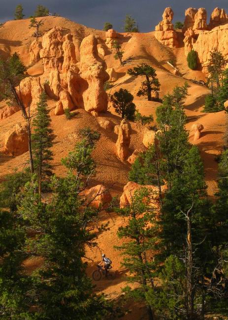
But no! Rays of light blasted the alien landscape, and the cameras came out to play.
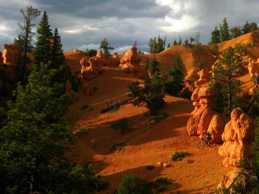
Climbs were now inconsequential. I wished the trail would never end.
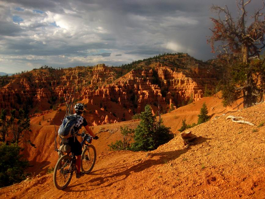
It was the kind of evening you could never plan or orchestrate on your own. A day’s hard riding resulted in us being in the perfect place at the perfect time, with the mental reversal from drudgery to bliss making it all the more sweeter.
A golden hour where time may as well have stood still.
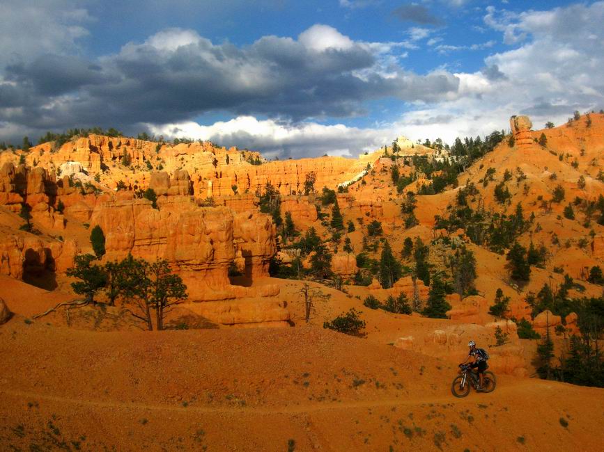
The last mile into Red Canyon is one of the fastest descents I know of.
“We need more trail like that,” says Chad.
We sought food at Harold’s, just a few windswept miles down the road. The only thing you could order was a giant slab of meat, so that’s what we did. I took a page out of Lee’s book and got the Country Fried Steak, something I’ve never ordered before. It hit the spot, and I saved a big chunk of it for breakfast.
“Are you thinking of getting a room?”
“Yeah…. I’m tired.”
The golden hour had worn off and I was pretty trashed. Chad had decided to make tracks for Tucson to tend to his sick girlfriend, and I was wondering if continuing was even a good idea for me. But as they say in bikepack racing, never scratch (drop out) without sleeping on it.
I bought two snickers bars for $1.50 each (!) from the Innkeeper, hoping it would be enough to get me to Panguitch Lake the next day. In the morning, Chad rode with me to the ATV trail turn off where I’d start climbing back into the high country. He went to Hatch to try his luck at hitch-hiking back to the cars.
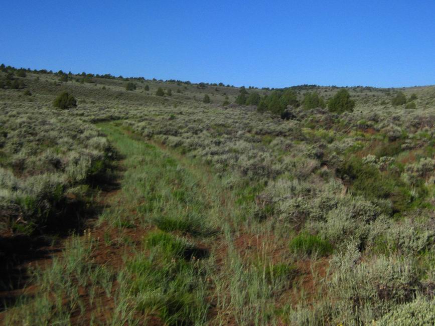
It’s interesting how you can still get lost while following a GPS line. And boy did I ever! The route took me on grassed in 2-tracks, faint ATV trails and bumpy forest roads. I didn’t see a soul. It wasn’t the kind of terrain you’d take a picture of, unremarkable, forgettable. Or is it?
I don’t think anyone gets too excited about this area, but that in itself has value. At least to me. That’s one of my favorite things about bikepacking and the route-finding necessary to create big loops like this. You have to cover “so-so” terrain and see areas more subtle in their beauty. It doesn’t scream out at you like the bright colors of the Sunset Cliffs or the Virgin Rim, perhaps taking a finer eye and different mindset to appreciate it. Blink and you might miss it.
Or so my thoughts went as I pedaled this untouched little gem of a route that the Dixie Lite course follows. I got lost in it, and was disappointed when the GPS turned me onto pavement and I knew that civilization was imminent.
I didn’t really want anything, but I parked my pony outside the Burger Barn. It didn’t open for 20 minutes, so I took a page from Harris’ book (thought not knowing it at the time), pacing around while looking at the menu, and the girl behind the counter decided to open early.
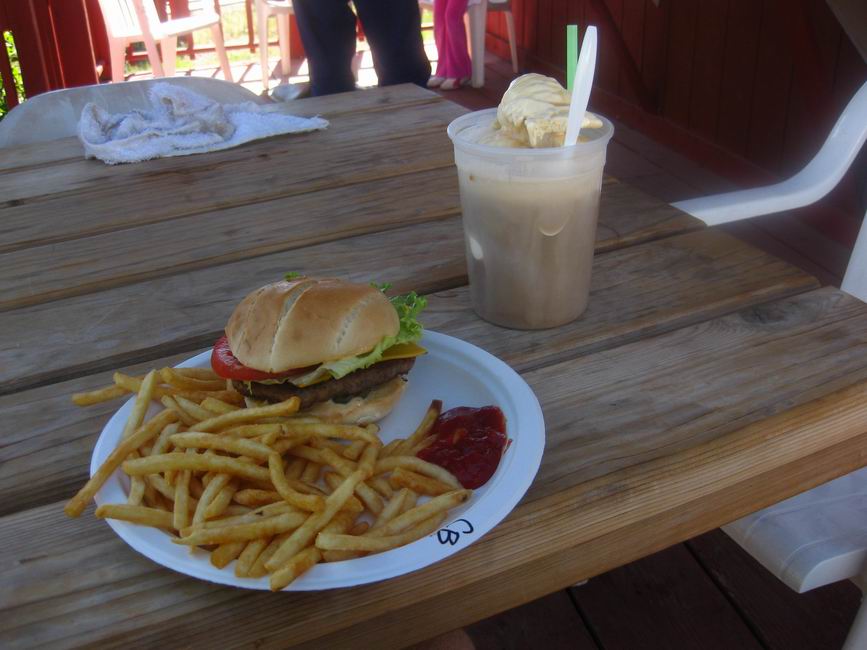
A root beer float that comes out in a bucket! Oh yeah! I thought I’d have to pour most of it into a water bottle, but everything pictured was put away with ease. The burger barn turned out to be a highlight of the trip. I’m still thinking about that burger and the tub root beer float.
As I soft pedaled around Panguitch Lake the wind was ripping into me. The reeds and grasses of the floodplain were dancing wildly. I observed them as I readied myself for my own dance up the 3000′ climb.
They danced the correct moves — tail wind!
I happily burped my way up the climb as it got steeper and more rough. I blew right by the Spruce Trail, climbing several hundred bonus feet before I realized my error.
The Spruce trail was a welcome change — actual non-moto singletrack. That meant it was covered in deadfall, but no biggie — I was excited to be so high up, and getting giddy as the meadows and fir trees started to appear. A relatively easy trail, with technical moments, I was bummed when it ended.
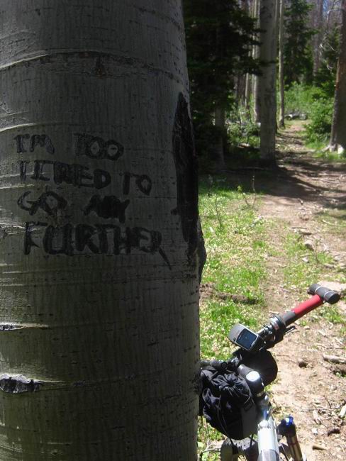
I had to laugh at that carving, though I didn’t agree with the sentiments one bit.
The graded road descent from Sidney Peaks was awesome, for a few minutes. The 10,000 foot wind felt like an arctic blast, thoroughly sucking all warmth out of me. I got worried when I kept losing elevation on the road, thinking there should be some trail since we were so close to Brian Head. My fears were calmed when I saw the “Marathon Trail” waypoint ahead.
Little did I know that the Marathon Trail was simply the same graded road I was on. D’oh! I recognized the road as one I climbed in the Brian Head 100, and resigned myself to ride roads for a while.
It was a little too long, for my taste, but my outlook was colored by vague memories of racing the 100 some nine years ago. The Marathon Trail did go through some lava fields, but all the rock had been graded out or into the road — not a single challenge remained.
I was still inspired by the landscape and oh-so-happy to be at 9000′, enjoying the cool air. It wasn’t until the very end of the Marathon Trail that things finally got interesting again, on a forgotten piece of singletrack. By then I was looking ahead to the return to the Virgin River Rim Trail and the closing of the loop.
It was, as expected, gloriously a mountain bike trail, thru ‘n thru. Momentum is preserved and the ‘good’ lines are all ridden in. I kept it in middle ring and did my best impersonation of a singlespeeder, powering up climbs and smiling as the speed played right into the next descent. On the occasional steeper pitch, I did my best impersonation of myself, spinning away in granny gear, but it was a little weak. I was glad to be finishing up soon. 200 miles and 3 days seemed like a perfect balance.
Thanks again to the route-meister, Dave Harris, for all his hard work on the Dixie 311/Lite. I am definitely looking forward to more.

Those are some eye-popping pics in there, you sure nailed the light in Thunder Mtn. Glad you could find some pink pills to revive enough for a trip up to Dixie.
A bit of history on the Grandview: some of it intertwines with the Paunsaugunt ATV trail. Where the route is both Grandview and Paunsaugunt trails, it is ATV (and sometimes 4WD). Where it is only the Grandview (and for your route that would be most of it) motorized vehicles are not and never have been allowed. It was constructed I think about 13 years ago with some sort of trail machine that created a wide berth. Having ridden all of it that can be ridden, I’d guess MTB was not a primary use in mind when it was constructed – prolly horse/foot was the intent. The Dixie route sticks to the kindest parts of the trail. NE of Crawford pass it gets really shitty and forgotten – there are dense 15′ tall willows for long sections making it a real bear to get through with drivetrain and skin intact, not to mention generally unrideable conditions. In any case, it obviously sees some poaching, but it is rare. I’ve never seen a moto on any part of it.
I love your outlook on the Spruce trail! You should compare notes with those that did the 311, that would be interesting 😉
I always love your posts and photos, but this trip was particularly amazing. Beautiful!
Great photos!
That section between 89 and Panguitch Lake felt like another world. I felt so isolated out there. And more than once wondered if I was on route, despite what my GPS was telling me. Grandview looks awesome. I’m thinking I missed out on that doing the proper Lite route. Maybe next year a Quasi-Lite is in order.
Great stuff Scott. Bummer we did not get to meet. Next time!
Ditto ditto and ditto! Scott, what’s your current camera setup, anyway? How much Lightroom, if any? (hee hee)
LOL. Everyone got the “I’m too tired to go any further” shot.
Good stuff, amazing ride.
Ed
Brett – Camera is a very small Canon 770IS. Cost ~200 bucks a couple years back. The screen is smashed and the lens scratched, so I can’t really tell what I’m getting. I’m surprised these ones came out as good as they did. Oh, and yeah, I adjust levels in Photoshop, and sometimes add sharpness, but that’s about it.