The goal was simple: a bikepacking route from Pagosa Springs to Durango. Quiet, primitive, dirt, singletrack if possible. It would detour us around the Weminuche Wilderness on the CDT, so we can rejoin the trail outside of Silverton.
Looking at the maps makes your brain hurt. There is a huge network of trails, roads and moto trails, but nothing jumps out that “goes.” You can follow a half a dozen possibilities, only to get stuck in the maze, dead-end with nowhere to go.
The biggest issue is the fake Wilderness area called the “Piedra Area.” It is not congressionally designated Wilderness, nor is it Wilderness study, but for some reason it is being managed as such. As a mountain biker trying to put together a thru-route it is hard not to feel like someone was plotting specifically against you. The Piedra area locks out every possible thru-route, forcing you down to US 160 at the Piedra River. And even from there it isn’t clear what to do in order to stay off that highway — private property becomes a big issue.
A number of people tried to help us with the route, but no one had actually done it. They threw out some good ideas, but none that cracked it. I think most people give up at the ‘brain hurt’ stage of mapping it out. But we had to make *something* work. We needed to get to Durango, and we weren’t going to take the highway, and it needed to be legal.
I put the route planning off until the morning we were leaving Pagosa. It just looked that ugly every time I tried to dig into it. Finally I had to come up with something… it was time to ride!
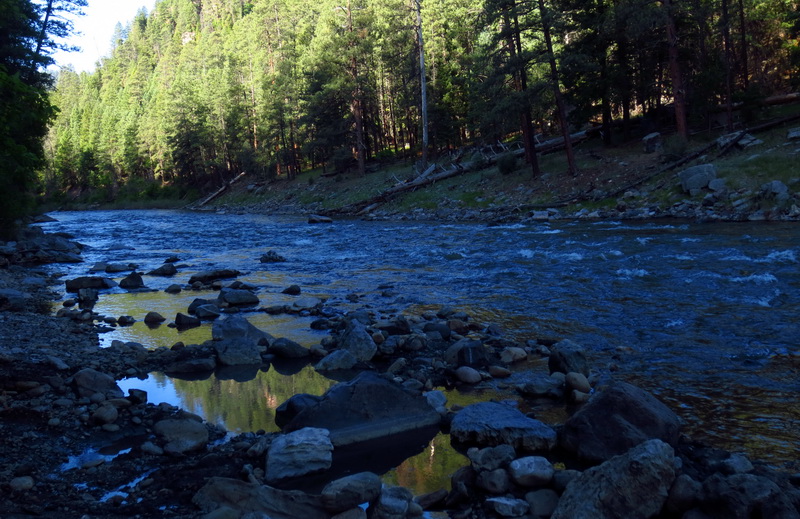
A facebook tip had led to the discovery of a hot springs along the Piedra. Being forced out to the highway and down the river suddenly started to look a little more attractive.
It was a short walk down from our campsite to the spring, where we succeeded in nearly scalding our skin. What a treat to start the day with a hot soak as the river rushed along beside us. Good for muscles sore from dragging bikes down the Dudley mess-of-a-trail the day before.
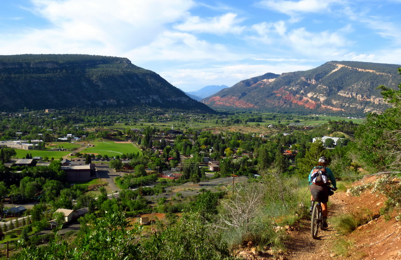
Good riding along the river.
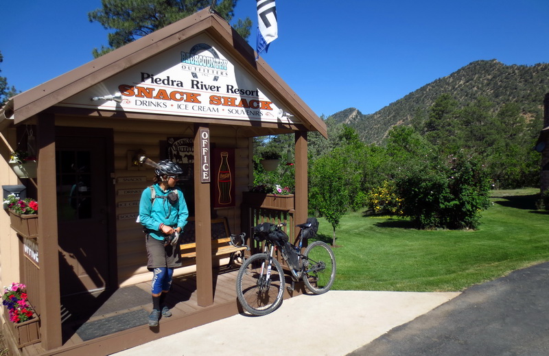
Bonus snack shop! A nice consolation for being pushed onto the highway. Breakfast ice cream!
There’s also a full-on organic farm, market and deli — but it is closed Tuesdays. D’oh!
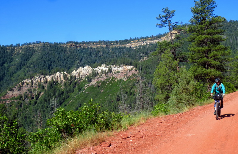
A half mile was more than enough on Highway 160 — it’s a scary one. We turned to climb First Notch Road. Extra climbing, but car-free.
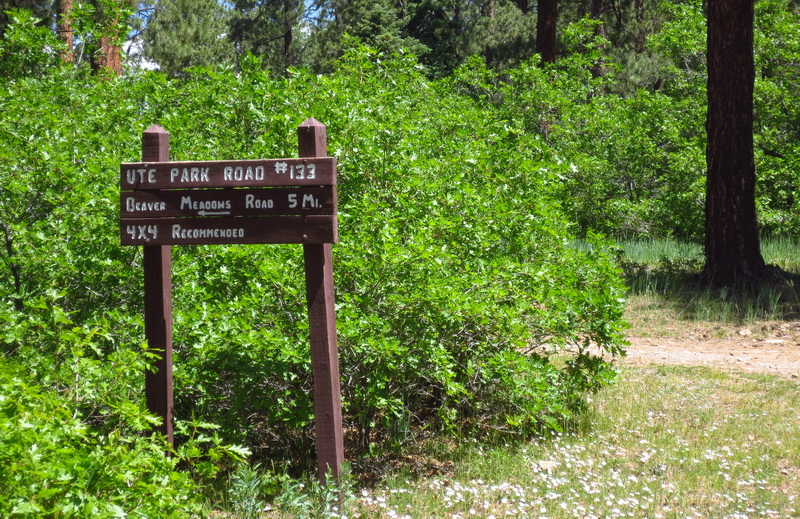
It took us into an area all about motorized recreation. Better than the highway. Ute Park was a pleasant beginner level 4×4 road that took us nicely parallel to the highway.
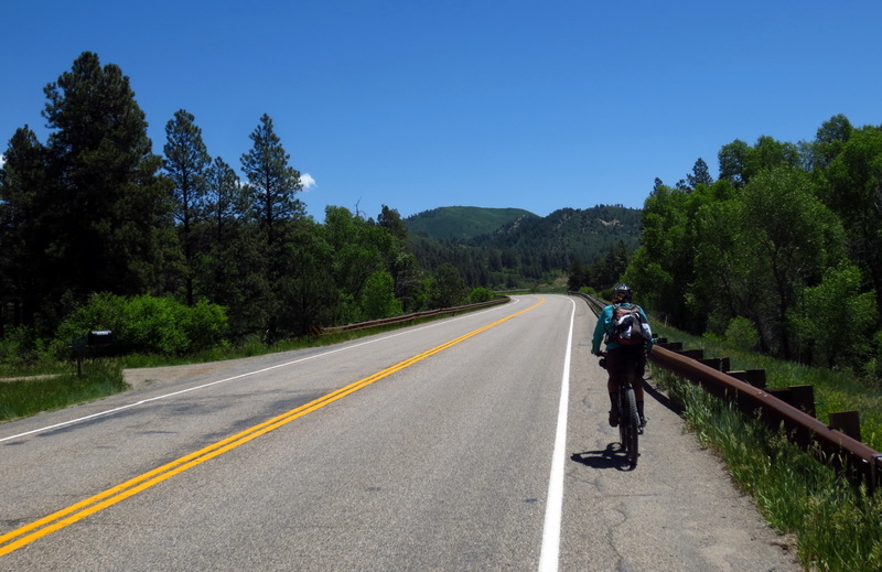
This stretch of busy road brought to you by the Piedra Area. No way around it, we had to ride the pavement for a mile more, going *away* from Durango, but *toward* dirt.

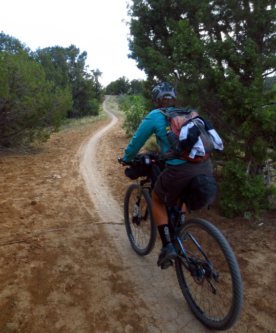
We ended up in a relatively new network of ATV trails and roads, rolling us quite nicely into the outskirts of Bayfield. I was a little skeptical that it was actually going to go through, but it’s actually pretty well signed, and as long as you have map in hand, it all pretty much makes sense.
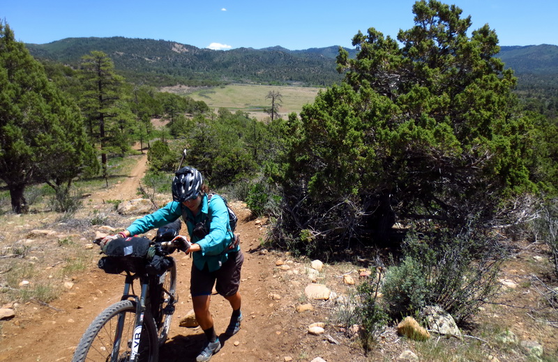
Oops, fall-line on a moto trail…. no way!
We scored lunch at Brenda’s Cafe in town, before pedaling out to battle the wind on county roads.

You tell ’em. Colbert would be proud.
Pretty nice riding, really, all through the farmlands and ranchitos of outer Durango. County roads 503, 228 and such.
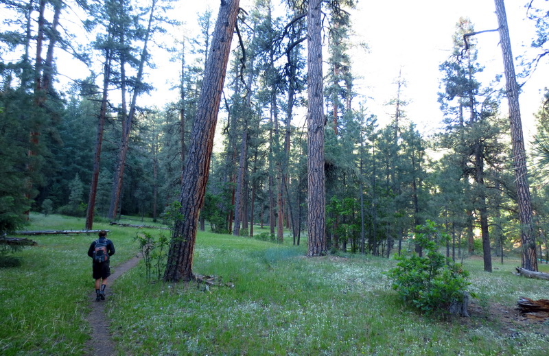
Those led us to the backdoor of Horse Gulch — the most popular trail system in town. It was strange to be riding trails that are heavily beat in (more ridden in than anything we have ridden so far). It was even more strange to be riding trails that we actually know and recognize.
It felt like riding home. We spent a couple months here last summer and loved it. Somehow we lucked into house-sitting the same lovely house we stayed at last summer. Perfect timing since we need to let the snow melt out and get some work done before continuing with CDTbike.
Several people have asked for a GPX file on our Pagosa -> Durango route. This one works and is 100% legal — just a tad on the convoluted side, and definitely anything but direct!
http://topofusion.com/GPX/Pagosa2Durango-dirt.gpx
The only thing missing is some way to not ride HWY 160 in Pagosa itself. Climbing up that hill out of town is no fun with huge trucks gassing it beside you. I don’t see anything obvious to skip it, but maybe a Pagosa local can help… surely people ride to Turkey Creek from town?
Pretty happy with how it all worked out. It was fun exploration, and it should be easy for anyone to skip the Dudley Trail instead taking the West Monument Road from the backside of Devil Mountain.
Extremely happy with how everything has worked out so far — we have had such good luck and are having the time of our lives out on the trail! Looking forward to having a homebase for a short while, getting some recovery, day rides and general Durango fun in before setting off with the next leg of the trip. Thanks for following along!

Yeah, the Piedra special management area definitely gets in the way of east-west travel, but in the great scheme of things I’m glad it’s there.
It is great that the Piedra area connects with the Weminuche, making for a very large primitive and roadless area. Knowing how little used some of the trails *outside* the Piedra are (Dudley!), I can only imagine what some of the trails are like inside it.
It seems like bike access on one or two trails wouldn’t disturb the character of the area. Since it isn’t Wilderness, perhaps there is a little bit of hope for a reasonable thru-route.
Joe — I caught a stick in a spoke and broke it just after your question about breaking spokes!
Looking up into all those steep, thickly forested plateaus in the Piedra gives me a knot in my stomach it is so impenetrable. So sorry to jinx you on the spoke. Did you bring spare spokes and the necessary tools? Is there some kind of emergency repair you performed? When I tour (much less ambitious than yours) if I bring the tools I never need them, but if I leave them home, sure enough I break a spoke.
Scott – This probably won’t make you feel any better about the problem it causes in finding a Pagosa to Durango route, but the Piedra actually is a Congressionally designated area, not just something the locals dreamed up. It was designated in Sec. 9 of the 1993 Colorado Wilderness Act. The unusual designation, calling it an “area” instead of “wilderness” relates to Colorado Water Law and disputes between the State of Colorado and the federal government over whether wilderness designation implies any federal reserved water rights. The old “whisky is for drinking, water is for fighting” thing.
The 1993 bill treated two other areas the same way – Roubideau and Tabeguache on the Uncompahgre National Forest and BLM Uncompahgre Field Office. Those are farther west than you will encounter on a CDT route. They are also much smaller and easier to get around. Colorado Wilderness Areas had consisted of the highest country, above water diversions so it hadn’t been an issue in earlier wilderness bills. Those three all had water diversions above them so there was a fear that designating them wilderness could lead to the Forest Service asserting water rights that could take water away from current water right holders. So Congress didn’t call it wilderness but, basically, said mange it like it is wilderness. The language in the Act does state no motorized or mechanized travel.
I’ve walked a route from the end of the Mosca Road (FSR 631) through the northern part of the Piedra Area to the road on the east side of Vallecito Reservoir. That probably would have been a good biking route if the designation hadn’t prohibited it. There was a push for a snowmobile trail connecting Pagosa Springs and Vallecito when the Act was passed. That’s the source of the language giving the Secretary of Agriculture (which oversees the Forest Service) the option of allowing snowmobiles to use basically the route I mention walking. I don’t think anyone was talking about long distance bike routes on Forest Service trails or roads at that time even though Durango was one of the most prominent mountain biking locations.
That might play out differently if it was happening now. The Forest Service identified an area that included a big chunk of the Colorado Trail as having high potential for wilderness in its Forest Plan revision. There was a lot of local concern for protecting the area but also for leaving the CT open to bikes. The Hermosa Creek Watershed Protection Act that is working its way though Congress very slowly now includes some wilderness but the boundaries were adjusted to not include the CT, the Hermosa Trail, and the main connectors.
I wish I had a good route suggestion but I don’t. Going south of Highway 160, travel restrictions on the Southern Ute Indian Reservation, Navajo Reservoir, and the lack of east-west trails through the HD Mountains all cause problems. I’m sure the discussion will cause some of us to go out and look harder.
Good luck on your trip. Thurman
Fascinating history Thurman. I did not know that about the upstream water issues.