Well, we finally got a touch of bad luck. It really has been incredible how well things have gone, and for so long. To think that we are over 60 days riding (plus 2 weeks off in Durango) and thus far it has been such smooth sailing. Great weather, pretty favorable winds, excellent mechanical luck, and happy/healthy bodies.
The magnitude of this trip is beginning to really hit me. It’s so much longer and so much bigger than anything either of us has done before. So much more unknown. Trails like the AZT or CT are incredibly, terribly short compared to the CDT. The Divide (GDMBR) is very short and so straightforward compared to this.
Eventually a few things were bound to not go ideally for us.
We set up camp on the shoulder of the Sierra Madre Mountains, just off the divide, and asked each other, ‘should we set up the tarp?’ It looked pretty clear. Some big clouds were far in the distance, but we thought the chance of anything moving in to be minimal.
I got a nudge a little after dozing off. ‘It’s starting to rain, we need to set up the tarp.’
I suppose it would have been nice to have a tent this night. Out of the bugs and already protected from the rain. It was a pain to get up, reorganize and tie the tarp to trees. Luckily we had ample time between light sprinkles that woke Eszter up, and actual rain. It came down pretty good for a few minutes, but mostly we just hear thumbles and rumbles.
It wasn’t a great night of sleep, and neither was the previous night, which started very late after the late night hot springs soak. So when we were up and moving, the fog was thick. Thick mental fog and thick physical fog. The first few miles of graded road were slow. My immediate reaction was, “I really don’t feel like pedaling a bike today.”
A couple of miles into the day, my GPS continued to refuse to boot up. Uh oh. I knew that I’ve been asking a lot of it, with a myriad of track options, waypoints, custom POI CDT points, basemaps and collecting a detailed track. I’ve had it refused to boot up a couple times, but restarting always solved it. This time, no dice.
I finally stopped and asked Eszter for her GPS — our backup that she has been carrying the whole time, but that we haven’t yet needed. She booted it up but noticed that the map screen was blank. Uh oh.
Double GPS failure? Really? How could that be?
Well, it was. We still had my phone as a last ditch backup, complete with maps and (luckily) GPX tracks that I had emailed myself and loaded into the Gaia app. Two problems: 1) it has limited battery life and we have no way to recharge it. 2) you have to stop, pull out the phone, take off a glove, hit the PIN unlock and then squint to see it in the sun.
It was going to make the day challenging to navigate. I’m so spoiled by having a GPS with tracks and basemaps on the handlebars, where quick glancing yields confirmation and an understanding of the terrain or the turns ahead.
It was like flying blind. More like thru-hiking. Oh well. I got frustrated with it for a while, and it definitely affected my mood. I’m responsible for navigation, after all.
It wasn’t too hard to follow the forest roads and highway to Battle Pass. It still made me nervous, though.
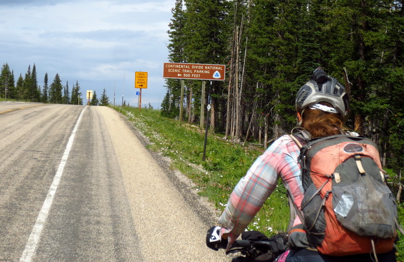
Climbing Battle Pass to rejoin the CDT the wind kicked up to gale force levels. At the pass it was hard to walk around, talk to each other, or do anything, really. We hit in the wind shade of the outhouse, where I tried to revive our GPS units. My phone told me how to do a master reset of the eTrex line. Resetting Eszter’s did not solve the problem — same blank map but otherwise functional unit. OK, well maybe resetting mine will get it going.
It did. I went to the map screen and …. WHAT?! Same exact issue as Eszter’s — blank map screen but otherwise functional. I was about ready to chuck one of them off the divide — Atlantic or Pacific, I didn’t care where the remnants would eventually end up!
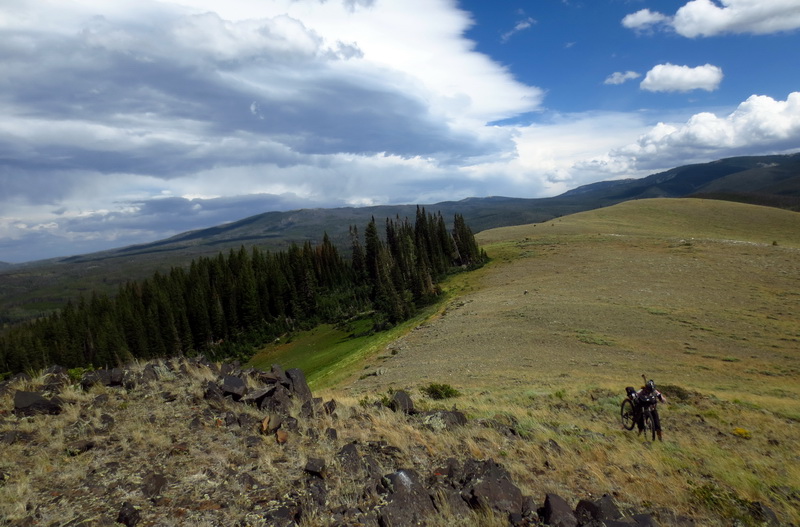
We’d wasted enough time on the GPS units, it was time to accept it and continue on the trail with the tools we had. The following miles of CDT were almost always right on the divide, a mix of singletrack, ATV trail and old roads. First we climbed to 11,000′ Bridger Peak — named for Jim Bridger who had searched these mountains for beavers. Beaver pelts were all the rage in the fashion world in the 1840’s, so there was much money to be made if you could hunt them.
The peak isn’t the only thing named after him in this area, and it wasn’t our only big climb to a peak along the divide. At some point I got tired of the mental fog from lack of sleep and the GPS frustration. I took half a caffeine pill and it immediately cleared the fog. Never had such a small amount of caffeine make so much of a difference. I was back to loving climbing steeply, and just so mentally happy with person, place and time.
Somewhere at the top we saw what we think is a badger with a striped face and marmot looking body. It was so terribly slow and uncoordinated running away from us. I don’t think I’ve ever seen one before.
We carefully made our way along the divide, stopping often to check the phone. This section is very poorly marked. One key turn from road to singletrack would be very easy to miss if you weren’t paying attention. Luckily Ley’s made mentions that you should look for it heading northbound, so we did.
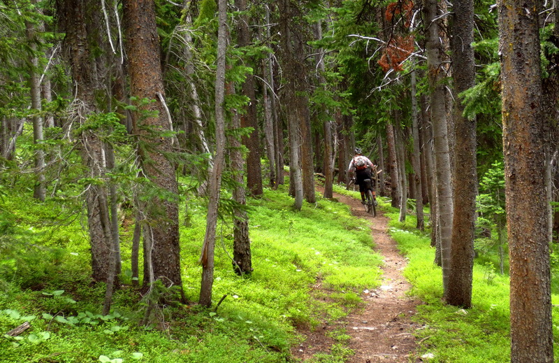
That turn brought us onto yet another hidden gem of the CDT — the Jack Creek trail. It totally surprised us, giving us over 1000 feet of descending on well contoured, beautifully forested trail. Wow. Just wow. It also had a couple creeks to fill up at — those are becoming increasingly rare.
What a treat. It’s surrounded on both sides by tough adventure riding, but when you’re in it, it’s as good as singletrack gets on a bike.


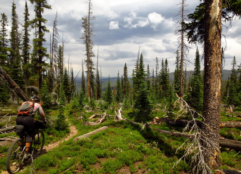
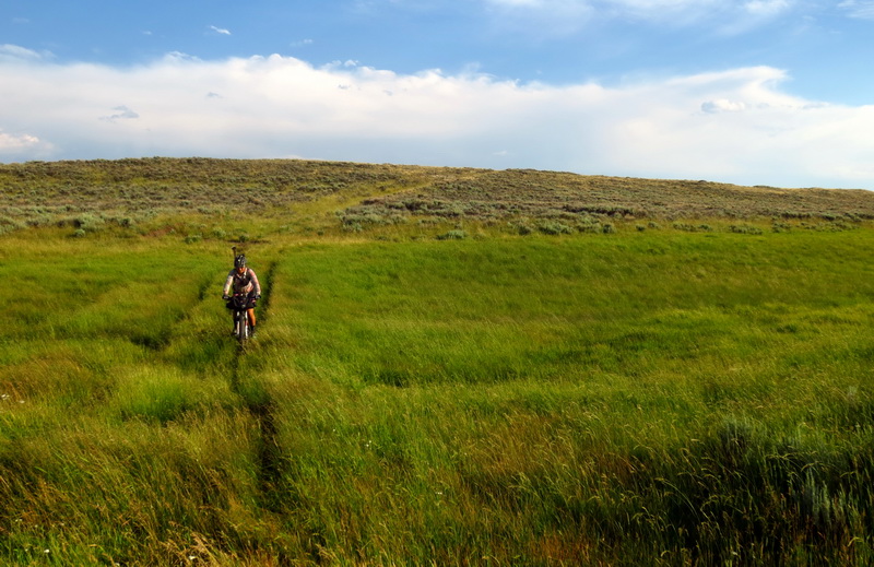
After the bliss, the trail continues as non-existent in the meadows and good trail that is fairly well covered with deadfall in the trees. Really, really cool riding, but very slow going. I enjoyed it on so many levels, but as with many sections on this trail, near the end you are ready for it to end.

We were ready to drop off and head into the desert. Time for some roads and faster miles! We dropped onto the divide route, a huge dirt behemoth of a road that is under construction for many miles. A wind farm is going in out there, so the road is being massively improved.
Well, the road crews chose a bad place to make a few piles of dirt. They completely obscure both the CDT carsonite and the faint 2 track that the trail follows. We missed it. My over a mile. Worst missed turn yet of the trip. That’s a pretty good track record, I would say, considering some of the stories we have heard from hikers.
So we pushed backwards into the wind and back on the CDT. It was a welcome change — a tiny and sandy 2-track heading out into the heart of the desert. Yes. This is what we came for.

A few bends and hills brought us to a fence-line with a trail of sorts along it, down to the North Fork of Savery Creek. The creek bed was an oasis. Beautiful running clear water, out here? We sat in the green grass, drank up and made dinner. The only issue was that we discovered the burrito we had been carrying had molded. Gah! Food stores were already low and we had many miles to go. It was very tempting to give in and camp right there, but we wanted to get going early in the morning and new it would be cold/wet down in the deep canyon.
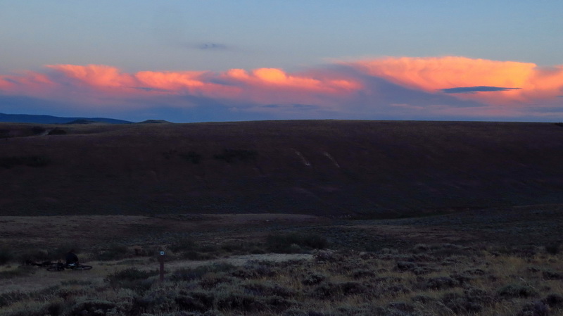
So we emerged from the oasis as the sky lit afire to the west, climbing the canyon rim. A suitably flat spot was found. We were grateful that the wind had subsided somewhat, giving us the chance at a good night’s sleep. We needed it.
What a beautiful night. To the south we could see distant lightning. Light clouds floated over us, obscuring the stars at times. A nearly new moon was never seen. We both were awake early with grumbling stomachs. The race for Rawlins was on.
It’s funny how our perceptions of mileage on this trip have changed. We were only ~50 miles out of Rawlins, but on the CDT that could mean two days riding. We have learned not to take things for granted.

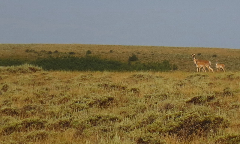
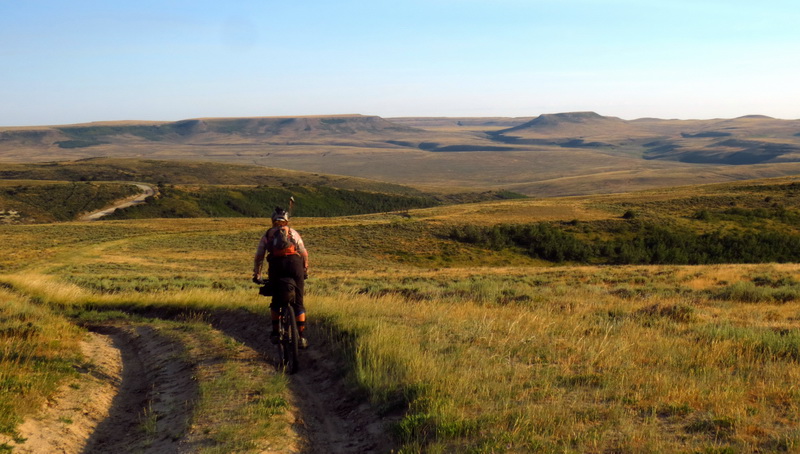
The morning started slowly on beautiful 2-tracks. The sun flirted with morning clouds. The antelope bounded. The deer pranced and jumped fences. The phone came out many times, trying to decipher unmarked turns and ranch gates we didn’t know if we should go through or not.
We were averaging just over 5 mph for the first hour or two. It was going to be a long day and a late push into Rawlins at this pace and with stops. We held out some hope of better road surfaces, but as yet they had not materialized.
As the morning went on the wind picked up. Bless-the-skies it was favorable! Out of the west and south. We got our westward travel done early, before it got too strong.
Eventually we found ourselves paralleling Muddy Creek and going over Bridger Pass on very hardpack and very remote roads. We didn’t see anyone out there — just cows, antelope, deer and a couple snakes! A moto and a couple trucks came by only as we got close to 71.
The wind was at our backs nearly the entire time, blasting us into Rawlins. Average speed picked up to 8, 9 and 10 mph. Yeehaw. Riding open roads with a ripping tail wind is a pure pleasure like no other.
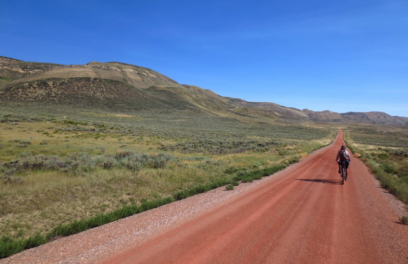
It was a lovely route. Definitely longer than going straight up 71, but we avoided all of the construction and saw no traffic. We also saw no foot prints. It seems like many of the hikers just walk the main road (divide route) to save miles. Can’t blame them since it’s a long roadwalk.
In fact, as soon as we turned onto 71, we saw three hikers we hadn’t met before. The ‘fellowship’ of Gar, Christian and … the other guy’s trail name escapes me. They were looking pretty beat down, and racing to town to catch the 3pm closing of the all-you-can-eat Thai buffet.
Ooh, that mention motivated us. We had planned to take the dirt parallel to 71 that is the CDT, but our first opportunity to cut back over to it was signed private. The next backtracked too much with the wind as it was, we could see a hike-bike over the ridge over to Coal Creek. With the wind at our backs, limited food in our packs and a nearly dead phone to navigate by, it was an easy choice. Into town!
The Thai food was absolutely divide. We destroyed a few plates, eating until we couldn’t breathe. Who knew there was good food in Rawlins? We found ourselves a cheap room with an owner than knew about the race and instantly gave us a little discount.
Forecast was for west winds on Saturday, so it was a no brainer to take a zero day. The deep desert of the Great Basin is next and the route goes mostly west from here. Sunday is calling for a reversal and east winds. That’s an opportunity we can’t pass up on, and though we aren’t counting on it, there is hope for a favorable crossing. I can’t wait to get out there. It’s such a beautiful and desolate stretch, and the CDT looks to route us on much smaller and primitive roads — with more water too.

Leave a Reply