
Trail Networks
Note - The details of the network algorithm are published in the 2004 JCDL conference proceedings. The paper is also available from TopoFusion and is entitled Digital Trail Libraries (5 MB, pdf format).If you are serious about GPS mapping you probably have amassed a large collection of GPS tracks covering your favorite areas. Managing and viewing a large number of tracks can be a big problem. Current commercial mapping products are typically slowed to a crawl when displaying large numbers of tracks. TopoFusion was designed for efficiency and is able to display many tracks.
Even with a fast display speed, there is still the problem of organizing and managing the tracks. Typically you end up with dozens of tracks, each of which cover a unique trail or two but ultimately end up duplicating ground covered by other tracks. It is often difficult to remember which tracks cover which specific trails. TopoFusion offers a powerful method of managing track data. It enables users to produce trail networks. A network of trails consists of individual trail segments that link between trail intersections. In a network, each trail covered by any track is only represented once.
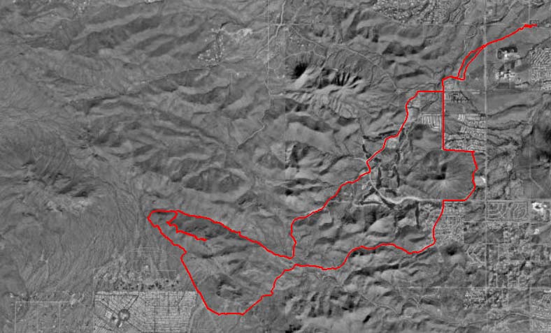
For example, here are three GPS tracks from different trips in the same area:
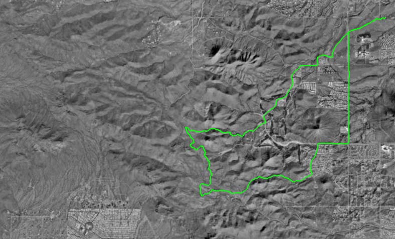

Overlaying the tracks yeilds:

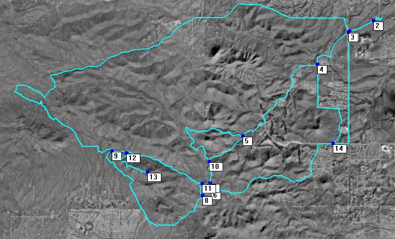
Producing a network in TopoFusion gives:
The advantages of this approach are twofold:
First, instead of dealing with dozens of files with significant overlap, a single file (the trail network) is produced that contains one trail segment for each trail segment covered by the combination of all tracks.
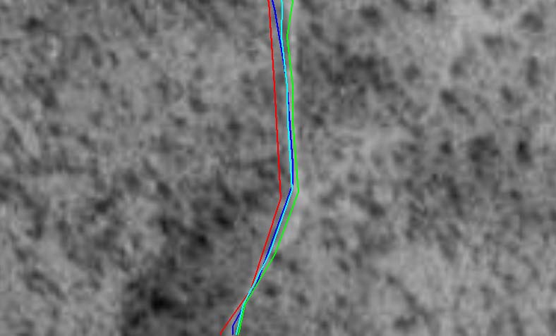
Second, where duplicate data is available, the tracks are averaged together, producing a more accurate representation of the trail. The more data collected on a trail, the better the representation. View detail image showing track averaging (average is in cyan).
At last, recreational GPS track data can enjoy the accuracy of differential GPS and other more advanced (and expensive) techniques!
With a network produced, additional features become available:
- Trail intersections are marked and can be used as accurate waypoints.
- Routes that were not represented by the any of the original data can be created, mapped and measured. Trail segments can be combined together to create a new route--possibly one you've never taken before.
- Measurements on the trail segments will be more accurate due to the track averaging.
- Trail segments between intersection points can be elevation profiled individually.
NOTE - For information about trail network databases see Discussion on Public Participation Online Trail Databases.