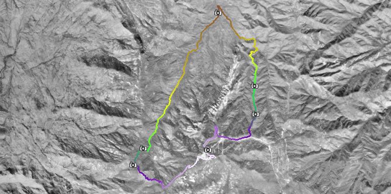
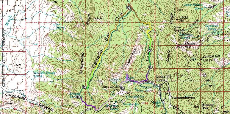
| Description: | We knew we were in trouble when we rounded the corner at Windy Point and saw snow below 7000 feet. But snow in Tucson is a good thing, right?
We pressed on and slid our way up the access road to the top of Mt. Lemmon. Unfortunately a few brave hikers had trampled the meadow trail making it a bumpy and icy mess. A few crashes later and we were at the Sutherland trail junction--the point of no return. Forest service employees logged out the trail last fall, but the recent storms had brought down plenty of new trees in their place.
The trail dried up and turned beautiful just in time for the 30+ creek crossings of the CDO. The designer of this trail had something wrong with him/her. It's by no means a mountain bike trail, but is an incredibly beautiful area.
Soon we reached the junction with Red Ridge; from here it is all guts and glory back to the highway. This climb has brought us to our knees when dry--how about with snow??? It was a slaughterfest, but the trail was surprisingly ridable in the snow. We reached the highway 45 minutes past dusk (we had lights). |