Eugene, OR.
We crammed an incredible amount of visiting and catching up into a short few days. We stayed up late, ate good food and generally had a blast with Alan and Misty.
It didn’t leave a lot of time to plan the singletrack tour. A late night chat with Scott Taylor yielded a few insights, but we ended up spending more time talking about the Cream Puff than routes.
Still, our bikes arrived by DHL, safe and sound. The plan was to leave the next day.
I made some sense of the mess of GPS tracks, with the help of TopoFusion’s network feature, and uploaded as much as I could. I was apprehensive about leaving so under-researched. I’ve learned to throw caution to the wind (a little bit) in this regard, but this was a trip with Paula and I really didn’t want things to get out of hand.
The unknowns and obstacles were fresh in my mind as we made final preparations. My experience on this route consisted of racing the CCP and driving to Oakridge. I’d never carried a tent, stove or dealt with poison oak on a bikepacking trip. This was Paula’s first singletrack tour and though she blazed through the divide in 2004, this was mountain biking. I also knew that she can’t survive mosquitoes very long.
And I didn’t have a good idea of where we were going. It’s hard to research 400 miles worth of trail, and this was a route I was inventing rather than following (e.g. AZT, CT, GDMBR).
Paula had even less of an idea of what she was getting into. But her attitude and determination was impressive. She always had a positive answer to any concern. If it had been up to me, we would have waited a day.
But we were pretty much ready, and gear-wise prepared for just about anything. With a stack of maps and the freedom to go anywhere and do anything what can go wrong?
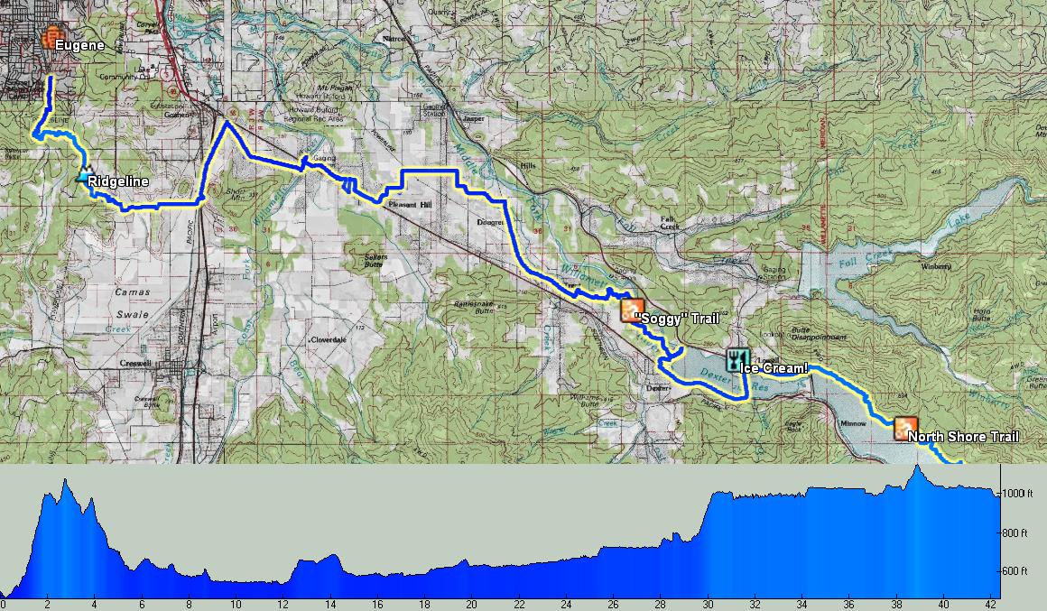
We left my brother’s house and pedaled along Amazon Creek, heading for our first trail. It’s a classic that I’ve ridden many times–Ridgeline. The only local Eugene ride, it’s short but good. Fun switchbacks under heavy shade, but halfway up Paula’s rear tire went flat.
I had intended to swap her AZ-pierced slime tubes for regular ones, but she insisted she wanted some flat protection. A fresh slime tube would have been better than one full of thorns!
A couple pump and go sessions were fruitless. We changed it at the Fox Hollow trailhead, and feeling the 14 ounce heft of the dead tube, we stashed it under a rock (I retrieved it after the trip).
Contouring and dodging trees I heard exclamations of joy behind me. We were already having more fun in the first 5 miles than we did in the first 500 on the divide.
“I’m glad you like it, ’cause I think there’s going to many a mile like that on this trip…”
At Dillard road we turned right, blasting downhill towards the freeway. What followed was a piece-meal of paved roads paralleling highway 58, with a few sections on it. We rode past farms, xmas tree plots and the Willamette River. I made a few on-the-ground route decisions to stay off the highway, including one on a dirt road that brought us right into someone’s yard. Doh!
Pleasant riding, but just as the pave was getting old we spied a sign, “Elijah Bristow State Park.”
I’d never heard of it, and no one had mentioned it. The brochure suggested we could skip the next few miles of pavement in favor of “trail.” The only problem was that the map itself described the trails as “soggy” and had a warning about them. Not exactly a good sign, given that no cyclists seemed to know about it or ride it.
What did we have to lose? We cruised down the first bit of singletrack into the trees. After a few consultations of the map we found our way to the soggy trail. There was a tiny little bog that required a dismount and a hop to cross, but otherwise it was an awesome break from the road, and took us right where we wanted to go.
I spied the “Dexter Dam” on the GPS, and a lower traffic road on the other side of the reservoir / river. I could tell the dirt road we were on carried high traffic, so I figured there might be a way across.
I forgot about the popularity of a little past time called fishin’. There was no way across (unless you can climb barb wire), so we backtracked and reluctantly joined the highway for one last stretch.
A white covered bridge brought us to the town of Lowell, where we consumed our first of many treats featuring ice cream sandwiched between two cookies. A little more road brought us to the top of the next reservoir, which we’d follow for the rest of the day.
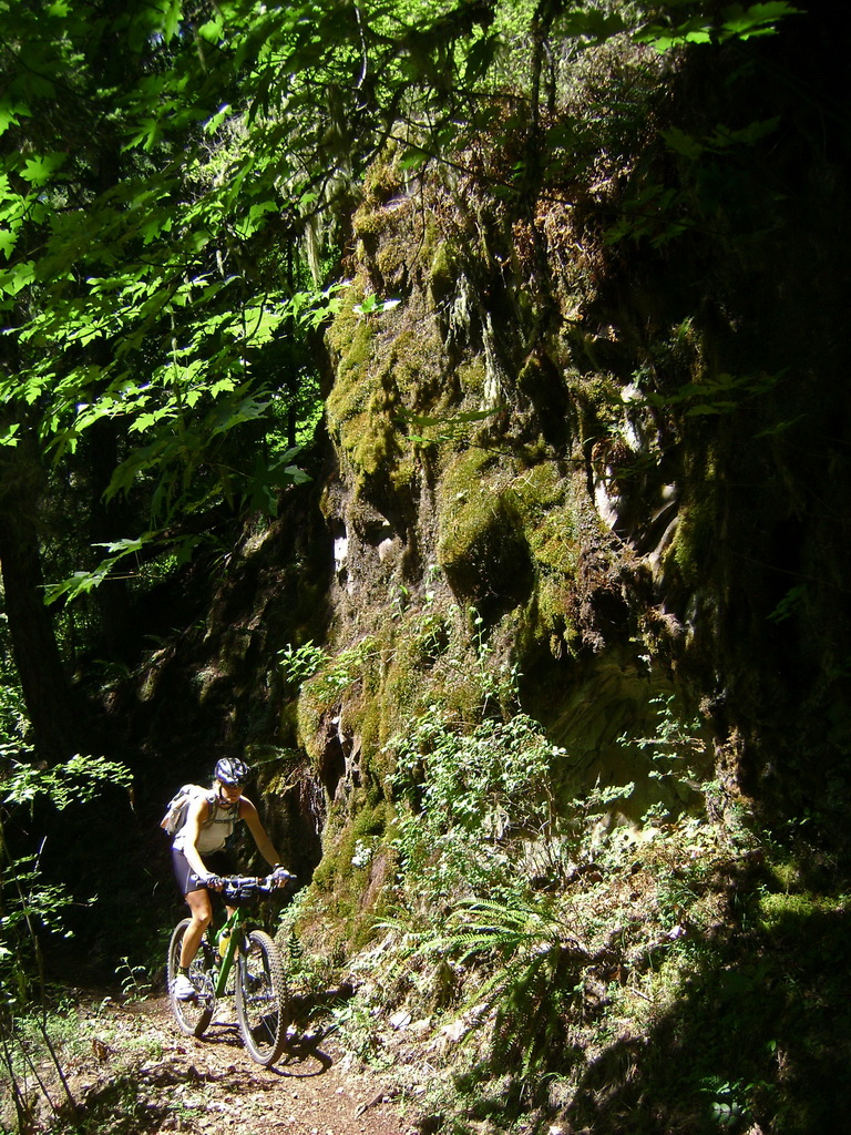
The North Shore trail held some very fun riding, but also pretty thick overgrowth and plenty of spider webs. I was torn between the fun I was having and the poison oak paranoia running rampant in my head. (We would later learn that this is one of the worst trails for poison oak)
Leaves of three, let them be! I brushed so many different kinds of plants that had 3 leaves that I stopped paying attention. I worried more about blackberry — a deep cut could spell doom in poison oak country.
When we hit the campground we jumped in the lake with Technu in hand. We both agreed we’d have enough oak paranoia for one day, so we decided to take the road (turns out the trail ends here anyway). We queried the camp host about free spots to camp down the road, and he clued us into a gravel pile we could camp behind about 4 miles away. Too many bugs and loud campers at the pay-to-camp site.
Two kids on BMX bikes met us going the other way on the road.
“There’s nothing fun that way, turn around!” they said.
“There will be, eventually…” was my reply.
The gravel site worked well except that we couldn’t get our tent stakes into the ground, and our tent is not free standing. We improvised a few rocks and used our bikes as tie downs. First usage of the stove worked well, though my fuel consumption guesses were not even close. We also forgot to bring a utensil of any kind, so we stirred our tasty dehydrated burrito mix with the end of a toothbrush and ate with our fingers. There are worse things to forget.
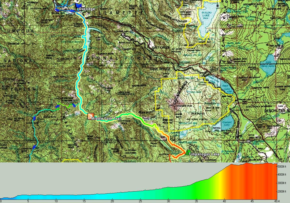
Day 1 – 43 miles
We were testing new Big Agnes sleep pads. I dare say this first night was the best camp sleep we’ve ever had, including car camping. Thermarests are off the case, for good! We slept several hours past sunrise, and awoke refreshed.
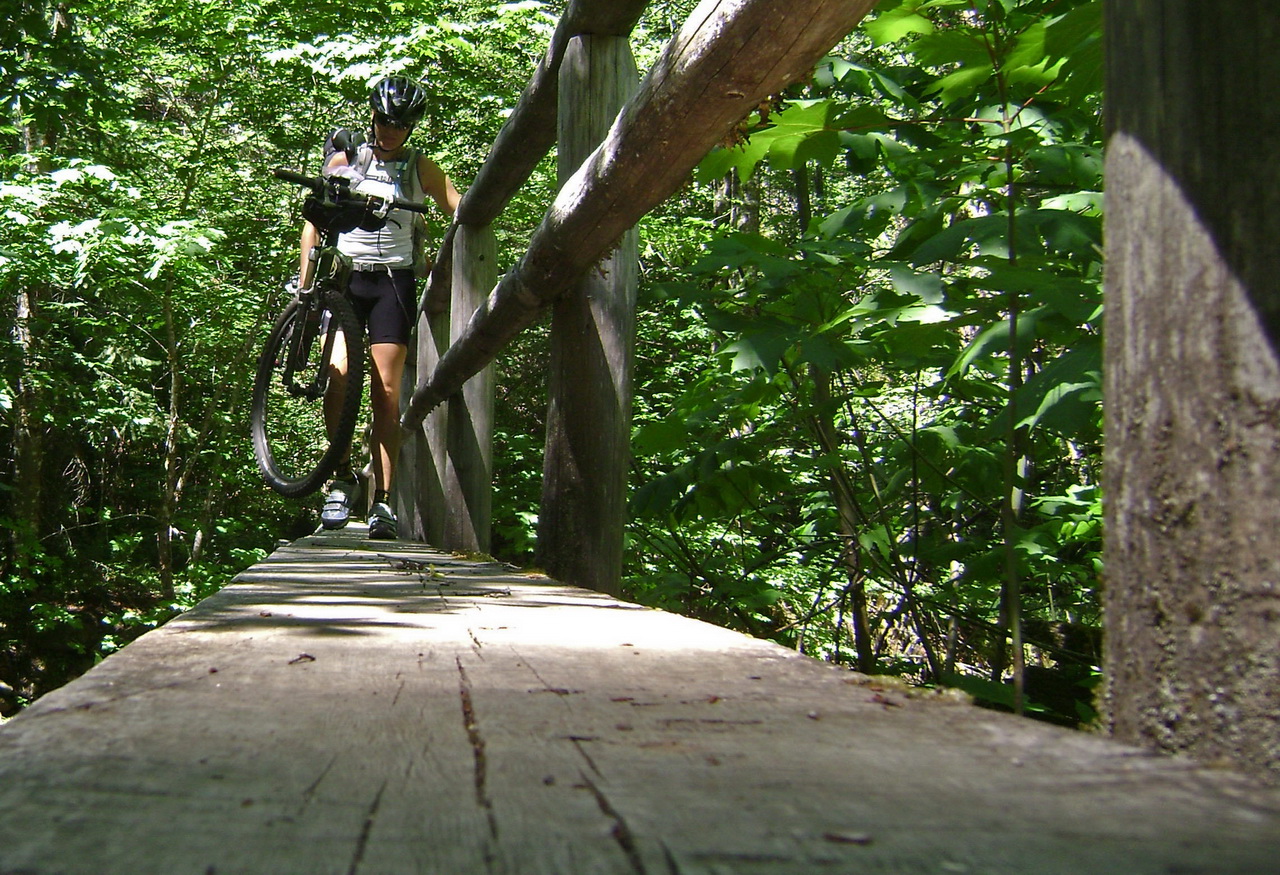
I made some oatmeal, then we were off to climb School Gulch to join the “Eugene to Crest” trail. The first thousand feet were on a two track (closed to vehicles by a washout). Singletrack on Winberry Divide was a bit of a rude awakening. We pushed our bikes here more than any other day of the trip.

And really it wasn’t that much. Just too steep, but easy going as far as bike pushing goes. Still both Paula and I had matches to burn, so we weren’t going to walk if we didn’t have to.
We bumped into Scott Taylor and friend, post-riding the Cream Puff course (which we were now riding backwards). It was fun to see them and chat a bit, and it also meant they had cleared the spider webs on the trail ahead!
We were pleasantly surprised to find the singletrack on Tire Mountain to be much more rideable. This was good, because we had another 2000 feet to climb, all on singletrack.
For crispy Arizonians, the deep forests of Oregon are like a different planet. We’d keep stopping to admire some crazy plant, something foreign like a banana slug (above), or the ever present moss and lichen.

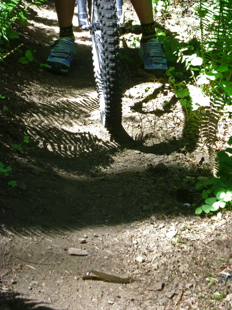
Where there’s no trees there are views, but the trail turns into micro-track. Paula was still getting used to the loaded bike and the narrow trail had her head a bit.
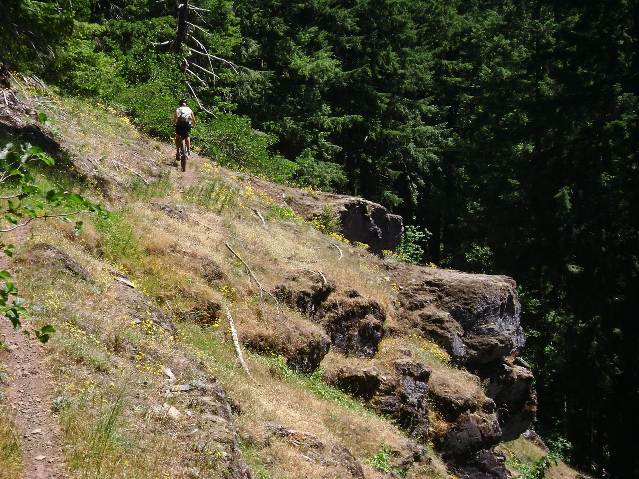
Eventually it was time to head down, with 3000 feet of hard earned elevation to descend on the “crown jewel” of Oakridge singletrack – the Alpine Trail.
It’s a blast, just a little too steep for good flow, but maybe my standards are too high. I had neglected to ship the adapter to add air to Paula’s fork (to compensate for the extra gear she was carrying), so on the steep downhills she was riding in a compromised position. This made the downhill sketchier than it needed to be, but she handled it well.
I had some flashbacks of the CCP, and maybe that colored my experience (I suffered badly on the third descent of Alpine during the race). Not complaining at all — I’d ride it again in a heartbeat, but it just doesn’t live up to the “crown jewel” hype.
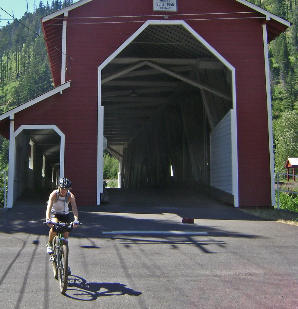
We crossed the classic red covered bridge in Westfir, headed for FOOD in Oakridge. It was late in the afternoon and hot. We’d only covered 30 miles, but a tough 30. Paula was focused on hitting 40 miles, so her mind was fixed on continuing on.
As we pedaled a few easy miles into town I subtly hinted that it would be a good idea to stop and get a room. There’s no reason to kill it and be tired for the rest of the trip. After the hints failed I finally had to argue convincingly, which worked. She admitted it didn’t make sense, but she’s just used to full bore effort. This is supposed to be a vacation, remember! We’d just done a ride that many wouldn’t even consider doing, unloaded! We shouldn’t feel bad about not riding until the sun goes down!
There was a free concert in town, so as we made our way down the main drag every motel was full. The second to last motel offered to let us call the last one to save us the ride. They had one room left, and in the time it took to ride over there someone came looking for a room. Good thing we called!
I rode Paula’s bike to the shop, where Mackenzie and the crew of Willamette Mtn Mercantile were kind enough to open up a new Marzocchi adapter so I could add air to her fork. I took care of a few other things on her bike and got some more trail beta before heading back to relax in the room.
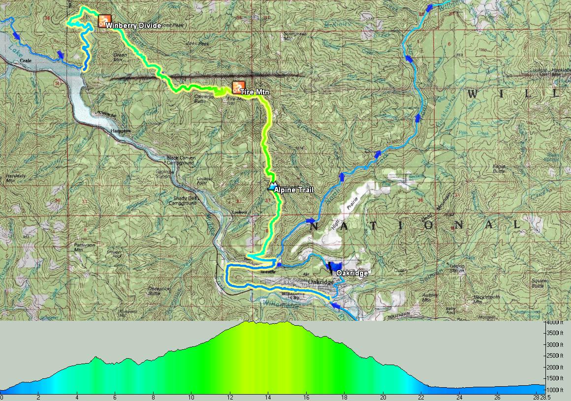
Day 2, 30 miles but 6000’+ climbing.
We were worried about traffic and heat on the 12 mile paved ride out to the Middle Fork Trail. So we foolishly got an early start. Traffic was nil, and heat wasn’t an issue all day (they have these things in Oregon called trees–it’s a novel concept).
The lack of signage on the Middle Fork Trail was a little frustrating. Since the road parallels it, my GPS track couldn’t really tell me where the trail starts. Peeking into Sand Prairie campground yielded no trail signs, but I decided to take a spin around camp anyway. Sure enough, the trail starts at the far end, and we were good to go.
There are a couple tricky spots right off the bat, and Paula fumbled around a bit. She was tired from yesterday’s effort (remember, she’s not a cyclist!) and the road ride out had been pretty tortuous for her. She told me later that she was mostly frustrated because she knew she should be enjoying the trail, since it was right at her level, but she wasn’t.
I had been incorrectly using my Epic Designs seat bag, and was having problems with it rubbing and catching when I hit big bumps or jumps. So I stopped to fiddle with it, quickly realizing the problem, but not before deciding to adjust the angle of my saddle.
Big mistake. The saddle bolts are ones you really need to get tight or you’ll find yourself with a bouncing saddle. Right as I was about to crank down on the seat I thought, “Let’s see, this is our only 5mm allen wrench, hmmm…”
A second later it snapped. Shit.
The seat was fairly secure, but we were now missing the most useful tool a cyclist can carry. I figured we’d run into more cyclists on this trail (it was the weekend) and perhaps I could trade multi-tools with them or buy a 5mm wrench.
A minute later I saw two riders, but by some twist of fate, they weren’t on the same trail as us! I wasn’t about to yell through the forest at someone enjoying their ride, and I figured we’d see more.
A few miles in we got into the thick of the trail — some very nice sections. Paula found her groove and even commented, “why would someone shuttle this? I’d rather ride up than down! Look how much coasting you get to do on the way up.”
She was right, it was a nice way to travel. We saw two more cyclists, but neither of them carried any tools (!). Mainly I wanted to borrow a 5mm to crank down some more on the seat.
We kept rolling, enjoying a pleasant day along the rolling river. I could get used to this. As we slowly gained elevation the sudden and simultaneous appearance of downed trees and mosquitoes had us questioning whether we wanted to stay on the trail. But we kept going on past Indigo Springs. Eventually we passed a connector trail leading back to the road and thought for a second about taking it. Paula said we should stick with the trail, so we rolled on.
Two more downed trees forced us to slow down and allowed the bugs to catch up. “This is no good.” Paula doesn’t like mosquitoes, because they really like her.
We turned around and headed back to the deserted road. I didn’t know which road to take now, so I suggested a nap in a bug free area. I studied maps while Paula got a little rest. It was a gamble — one road was the major travel route and was more likely to be clear of snow and trees. But it went by Timpanogas Lake, famed for its thick mosquitoes. The other was more unknown and climbed higher.
I chose the higher “grade” road, thinking it would be an easier climb.
It wasn’t. It was paved for a while, but so steep that we quickly realized that the mosquitoes could keep up with us. Paula started hammering to get away from her current swarm. We called these burst efforts “mosquito intervals” or “mosquito-leks”, finally settling on “fart-mosquitoes” (fartlek is a running interval term). We made quick work of the climb this way, but dug deep into energy stores.
Now above 5000 feet the road signs pointed us higher, but I spied a lesser contouring road on the GPS. It panned out and saved a few hundred feet of climbing (which sounds like nothing right now, sitting in my comfortable home, but out there, at the time, it meant everything).
As we rejoined the major road, snow appeared and the bugs grew thick. We were at the turnoff for Timponagos lake when Paula said, “I’m done, we need to stop for the night.”
Oh boy! If I can just get the tent set up, we should be OK. I thought there’d be a water pump at the lake, so we rolled into the developed campground. Paula did circles around the campground while I fumbled around with the tent. Every time I’d bend over I’d get swarmed so bad that I could hardly see what I was doing.
I pulled the plug on this idea. Even getting a mile from the lake would be worth it. I packed back up and noted that the pump was shut off. As we passed the Middle Fork trail I told Paula to continue while I pumped water from the river. Swarmed again.
I had hoped we’d make it to Lemolo Lake, on the other side of the divide, where we’d be lower and hopefully out of the bugs. I hadn’t planned on getting shut down by the fart-mosquito intervals and steepness of the road.
But we found a small spot to pitch the tent, again with Paula riding up and back on the road while I got things setup. She made a mad dash for the tent while I suited up in full rain gear to cook dinner.
It was alright, and pretty amazing to see the swarm constantly near the mesh door of the tent, just waiting for Paula to get out. By morning she was counting big bites and the total was somewhere near 30. In contrast and despite spending a lot more time stationary and outside the tent, I struggled to find 2 or 3 bites on me.
Day 3 – 50 miles, 7000′ climbing
Good camp sleep followed by a reluctance to face the bugs again meant a late start. We made a plan for how to pack things up as quickly as possible, with the tent being the last thing to take down as Paula headed off down the road.
I told her to circle at any intersections since I wouldn’t know which way to go until I got there. I found her about a couple miles later, but I was overheating big time (does it ever get cold here?!) in my rain gear, so I stopped to pull it off. I was amazed to find no bugs at this slightly breezy spot.
I’m not really sure why this stop took so long, but it took longer than I anticipated. The result was that I fell a little further behind Paula.
Not a good thing — she wasn’t there at the next intersection and I had a moment’s panic. I looked at the less traveled road and was pretty sure I couldn’t see a tire track. I figured I’d see her track soon on the main road.
But as I rolled down, I didn’t see it. Damn this gravel road! For the previous 2 miles I could always see it, but now it was invisible. I thought she might have been riding back and forth on the secondary road and might have just missed me. So I turned around.
This time I made sure no tires went that way, and yelled her name. She must have taken the main road. I pedaled with haste back down the road.
I ran into her going the other way, and she had cracked. She had told me earlier that she could handle about 30 bites before she went berserk, and she was now going berserk! Crying and hysteric, she couldn’t understand what had taken me so long, and eventually said “I just want to go home! Get me out of here!”
She had stopped to take her jacket off and had been swarmed. That combined with me not being there and having to backtrack or worry she’d gone the wrong way sent her over the edge.
She calmed down once I was there, though, and we kept rolling over the divide into the Umpqua drainage. I had a pretty good idea that there was a lodge at Lemolo Lake, and hoped we could stay there, taking an easy day and sleeping out of the bugs.
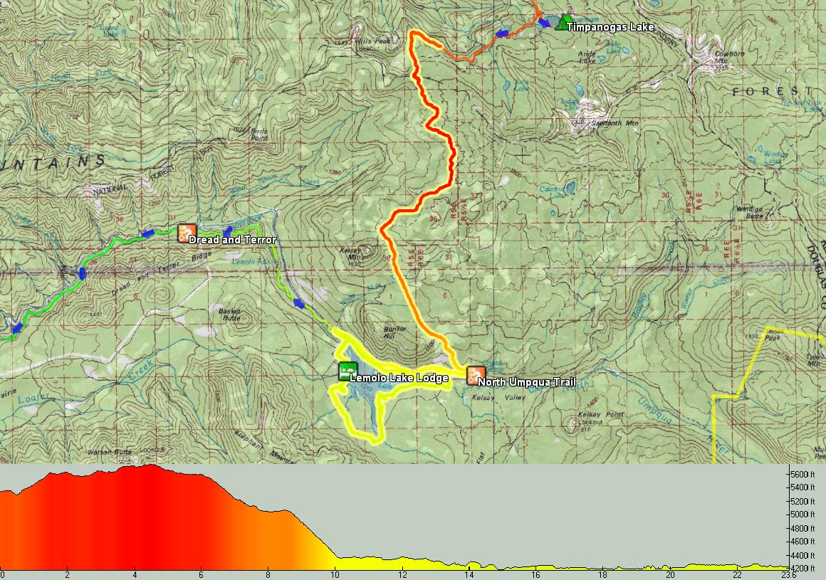
In the pre-trip scramble I’d somehow forgotten to upload my set of waypoints that included the location of Lemolo Lake’s lodge/store. I had a guess as to which side of the lake it was on, but was hoping for signs to confirm my memory.
First we had a few confusing intersections to navigate, and stopping to pull out the maps and inspect the GPS for elevation contours wasn’t really an option. Going downhill at the present junction doesn’t necessarily yield the path of least resistance, but in this case a hasty decision to give us coasting did pay off. After descending a while I spied a singletrack on the right side of the road. It was the North Umpqua Trail! Sweet!
I didn’t try to talk Paula into it, happy to b-line it to the lodge. But she wanted to roll singletrack rather than road, so we hit it.
Good thing. It was easy, contouring, and very, very fun. The bugs decreased as we cruised down the valley. But soon we were passing the Lake (visible only on the GPS, not from the woods of the trail). And we’d passed no connecting trails to drop us back to the road.
There was no telling when the next access point would be (impossible to tell from the map), so we picked up our bikes and bushwacked a short distance down to the road. A road sign told us that the lodge was only a mile away. Woohoo!
We walked into the lodge like zombies and ordered the biggest breakfast we could dream of. Quentin cooked us the best bacon I’ve ever had and some pretty mean french toast on homemade bread. We got their “overflow” room and proceeded to nap the rest of the afternoon away.
We then took “chomper”, the resident lodge dog, for a walk along the lake, ate another meal and began the search for my lost gloves. I had planned to ride the 8 mile singletrack loop around the lake in the evening, but when I suited up I realized I didn’t have my gloves.
I inquired at the lodge and was happy to hear from the hostess, “yeah, I saw them by the tree and put them….right….here….”.
But they weren’t there. “That’s weird, someone must have taken them.”
One of the other employees overheard and offered to set me up with his walmart “work” gloves which were very close to what I ride with anyway. Super nice guy, he went and grabbed them so I could go spin around the lake.
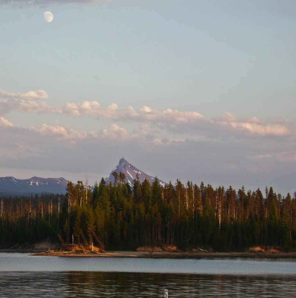
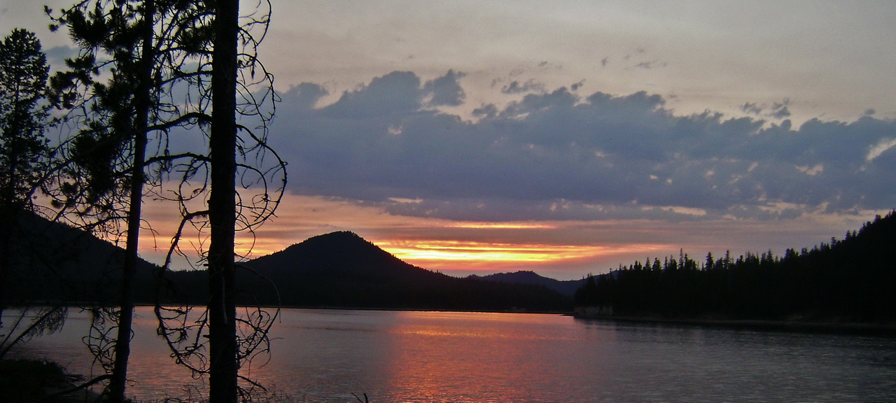
They were awesome, all camo’d out. I wish I’d taken a picture of them. But I was focused more on the views from the lake and the nice sunset.
There were some fun sections on this generally flat trail, but the downed trees were trouble — mosquitoes would swarm, forcing another mosquito interval session.
A great evening, and a fun chance to ride footloose and fancy free without camping gear. We had such an awesome stay at Lemolo — a great family run place with everything the touring cyclist needs to relax and recover. Scott (the dad) even took a grinder to my shattered 5mm allen, thus resurrecting it.
Boy, this is getting long. Next installment it’s on to the epic Umpqua Trail and a totally awesome day for Paula, a complete reversal from mosquito hell.

Awesome ride!! Shaddy tree and mosquitoes or Cactus and scorpions…. hrmmm. 🙂
georgeous pics too… thanks for sharing!
[…] Paula could make it. She’s done some pretty epic stuff on a bike (like, perhaps this, or this). But I’ve always been there, taking care of the wrenching, flat changing, navigation, […]
[…] think Paula could make it. She’s done some pretty epic stuff on a bike (like, perhaps this, or this). But I’ve always been there, taking care of the wrenching, flat changing, navigation, unexpected […]
Neat stuff: will come back soon:)