At last the snows did come to the mountains. It piled up in a slushy mess, up high and on the roads down low. We were lucky to get out safely when we could.
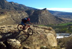
The destination? Fruita / Grand Junction – the desert.
Eszter and two Bec(k)s were bikepacking the Kokopelli Trail …. [Continue reading]
The view from my ‘office’ was superb. Gold aspens, blue sky. Trails from the door. Easy access to the alpine. A cozy place to stay.
Why leave such paradise? Why jump back in the van and sleep in a tent for two weeks, working from campsites and libraries, constantly on the lookout for …. [Continue reading]
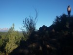
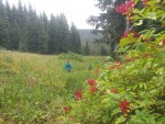
bird nerd!
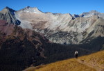
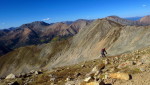
Our addiction to high places and to places where trees cannot grow, continues.
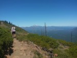
run! the storms are building!
Sometimes that just means getting in the car, driving up high, and walking for a few hours. (We were also hoping to catch a couple of CDT hikers and ‘perform’ some …. [Continue reading]

I’ve been meaning to write this code for a while. It would dig through the trackleaders archive, and do a little counting. The results are a little staggering, at least to me.
That’s a lot of tracking, a lot of adventure covered. 6 million miles!
It started back in 2008 or 2009. …. [Continue reading]
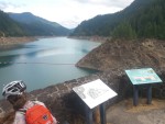
We set up camp in the shadow of Mt. Shavano, and just outside of Salida. We needed a tiny bit of recovery after the 14ers and such, and Salida is the perfect place. We have friends to visit, there’s a friendly bike shop, a hot spring / rec center, and even my favorite …. [Continue reading]
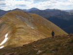
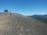
descending off Huron — dream riding
I didn’t think it was going to happen. If you’d asked me a week ago whether I’d be riding down Huron Peak, after having summitted, I would have put the likelihood somewhere close to zero. Yet there I was, late on a Saturday afternoon, sun shining bright …. [Continue reading]
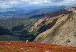
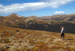
I feel so lucky to be able to experience prime alpine season here in Colorado. The monsoonal flow has settled down, days are still warm, and snow is a non-issue. It’s time to get high!
With this comes an appreciation for the freedom and opportunity we have, being mobile and able to live …. [Continue reading]
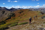
Look! Proof that we occasionally hit the trail early.
I was overly excited and awoke at an uncivilized hour. It’s not every day you have a new peak to climb, accessible by bike/foot right from ‘home.’ Alpine(ish) starts are a good idea when heading above treeline in Colorado, too.
did you know …. [Continue reading]
Let’s continue on with the second half of the photo reel. Part one left us at Oakridge, roughly halfway through the loop.
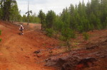
big tree went boom
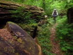
The route hits some deep wooded singletrack, a very pleasant 98 degree ‘warm’ spring, and some roads, leaving town.
Paved roads aren’t the first choice …. [Continue reading]
The Hot Sisters Route came together we’re putting the route on the fast track to being published. There will much more info to come, but for now we have a page coming together over at bikepacking.net:
Hot Sisters Hot Spring Route
The route is ready to go — email me if you’d like GPX …. [Continue reading]
Eszter and I spent a few days scouting an alternate route for an exciting new bikepacking route that just came to life this month. It’s a five or six hundred mile backcountry loop highlighting singletrack, hot springs and mountain climbs (on foot) all through the central Cascades in Oregon.
Despite the fact that bikepacking and …. [Continue reading]
Done. A little more than three weeks, which is pretty much what we guesstimated. It all came together supremely well.
We got up lazily from camp at Devil’s Lake. I love camping in the same spot for multiple nights. A few miles climbing on the pavement back to the Metolius Windigo trail took us through …. [Continue reading]
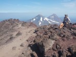
It wasn’t an alpine start, but I did wake up earlier than normal, excited about the day ahead. We were camped at the trailhead for the South Sisters Climbing Trail. 6 miles and 5000′ up was the top of the volcano, one we have been looking at, and riding around, for the last 3 weeks. …. [Continue reading]
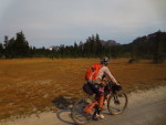
A few hours ago we pretty much completed the loop, reaching the top of the Mrazek trail, which is a heavily ridden and mostly downhill ride into Bend. We could have been done in a few short and easy hours.
But, we are not done! We have our biggest climb yet, and the centerpiece (literally) …. [Continue reading]
Coming into Sisters today, we both independently realized that the route had somehow ended up almost entirely singletrack for the last day or so. We hadn’t really planned on any from the end of McKenzie all the way to Sisters. Yet, that’s the way it played out, as we coasted at 10mph on smooth trail …. [Continue reading]
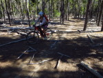
Today was almost entirely either sand, or singletrack. That wasn’t the way we thought it was going to go, but it was an interesting day. Making it up as you go has a way of keeping things interesting.
We started out on smooth singletrack along Clear Creek, heading to breakfast. Then more good trail to …. [Continue reading]
Today was another fantastic day on the bike. We got to ride the McKenzie River Trail. It’s a real gem, and in many people’s opinion, *the* gem in Oregon or maybe, anywhere.
I wouldn’t go quite that far, but it sure works itself well into a bikepacking loop. The lower half is lovely green circle …. [Continue reading]
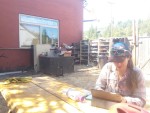
Are you a camper, or are you a glamper? Bare bones, or do you carry the luxuries? There are many styles of camping, and bikepacking almost always falls far from the glamping side.
You have to keep things light or you can’t ride trail, and it’s just not fun. Services are often few and far …. [Continue reading]
What a nice night. We woke refreshed and ready to climb the rest of our bonus climb. The road down to the Aufderhide (FR19) was kind of interesting, with some views of sharp rock fins and a 2-track type of feel. I’d say it was a win, though someone wanting to save some leg strength …. [Continue reading]
Alrighty, we finally left the town vortex of Oakridge. The more time we spent there, the more it grew on us. It was a nice couple of days, for sure.
But we were anxious to get back on the hot sisters loop, too. The main thing keeping us around was the fact that trackleaders has …. [Continue reading]
|
About
 Scott Scott
Digital Nomad, nowhere, USA
Lifelong mountain biker, trail mapper and programmer. Sometimes bikepacker, sometimes runner, sometimes packrafter. I love to ride my bike, get out, and explore this beautiful planet we find ourselves on.
I live in a 20 foot GeoPro Trailer, traveling about the west.
Main author of TopoFusion GPS Software, co-founder of Trackleaders.com.
More...


Paint by Bike
Your life is amazing, too
Wasatch 100 by bike
CDT report card
Altitude Binge, Mountain Biking 14ers
A mountain biker's dilemma
Mountain Bike Quantum Physics
Lemmon Epic Tradition
Summer Vacation?
Moments End
Bachelor Bikepacking
An average week in Arizona
Techy Tacos Prime
Watcher of the Skies
|